🥾 Physical: ★★★☆☆
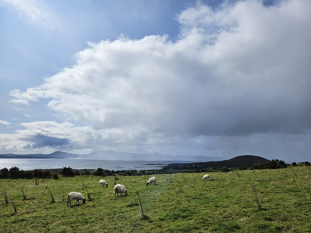
- ✅Views of Killarney National Park and the Lakes of Killarney
- ✅Black Valley and Muckross House crossing
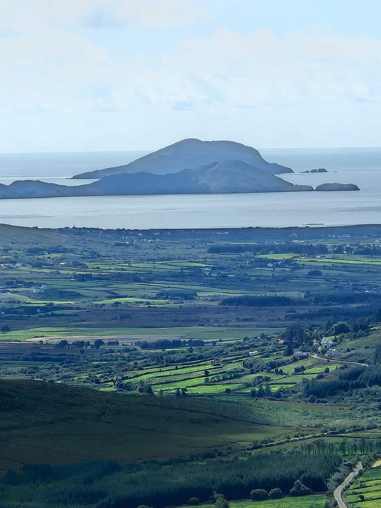
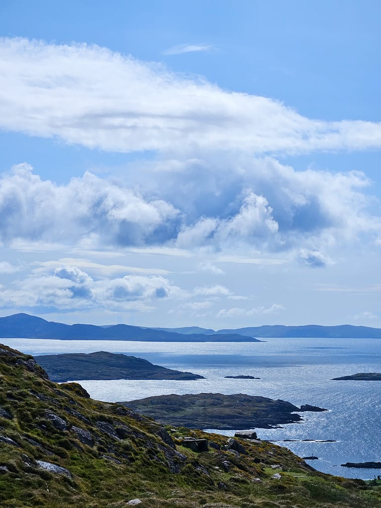
- ✅Panorama of the Ring of Kerry on the Atlantic coast
Before we start
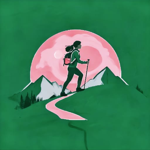
I don't actually remember exactly how it all started, but the idea of being alone in nature has always been a dream of mine. Perhaps it was etched into my mind by the film "Into the Wild," which I saw when I first became interested in nature sports, or perhaps it was already there somewhere.
But that dream never came true. There was always something missing. Sometimes it was my time, sometimes my budget, sometimes my physical fitness. "Not now," I said over and over, "I need to get stronger, gain experience." Years passed like this.
Then came the summer of 2023. I needed to make a plan for my company's 10-day vacation block. That's when I realized: My old excuses were no longer valid. I was short on time or money. All that remained was one thing: take the first step.
But that was the hardest part. Part of me believed beyond a shadow of a doubt that I could do it, while the other part gnawed at me, "What if I'm not who you think I am?" What if I'm not as strong as I thought? What if this is just a romantic fantasy? There was only one way to find the answer: try. To silence my inner voice, I took the first step into the unknown. And to eliminate the possibility of turning back, I bought my plane tickets.
When deciding on a route
For years, the idea of doing my first solo hike, the Camino de Santiago, which begins in France and ends in Spain, had always been in the back of my mind. However, recent safety issues along the route, the fact that it takes longer than 40 days to complete, the excessive use of towns and secondary roads, and the limited time spent in nature, along with my current lack of a Schengen visa, have all discouraged me from pursuing this plan.
When deciding on a route, I had six key criteria. First, safety. Then, the route needed to fill my time and be challenging enough, yet balanced for my first solo attempt. Furthermore, since I was going in August, the weather needed to be pleasant and not too oppressive. Furthermore, because I had limited preparation time, it needed to be somewhere I already had a visa for or was visa-free. Finally, I wanted it to be somewhere I was seeing for the first time—so I could explore something new, both physically and mentally.
Considering all these criteria, I decided to focus on Ireland because I already had a UK visa and had never been there before. When I started researching long-distance walking routes, I discovered that Ireland had many more long-distance walking trails than I had anticipated. Because Ireland is located in the north, August temperatures were ideal for long-distance walking.
So, I've been dreaming of it for years. the idea of going out alone I decided to take a completely different route, on the fairytale-like Kerry road in Ireland.
Kerry Road
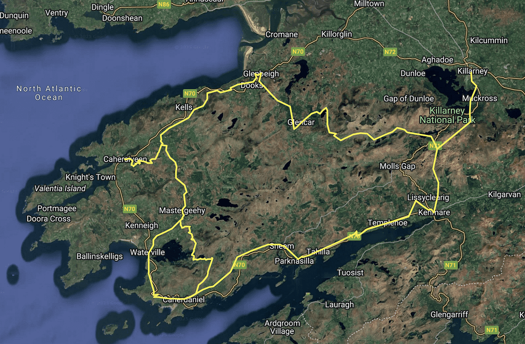
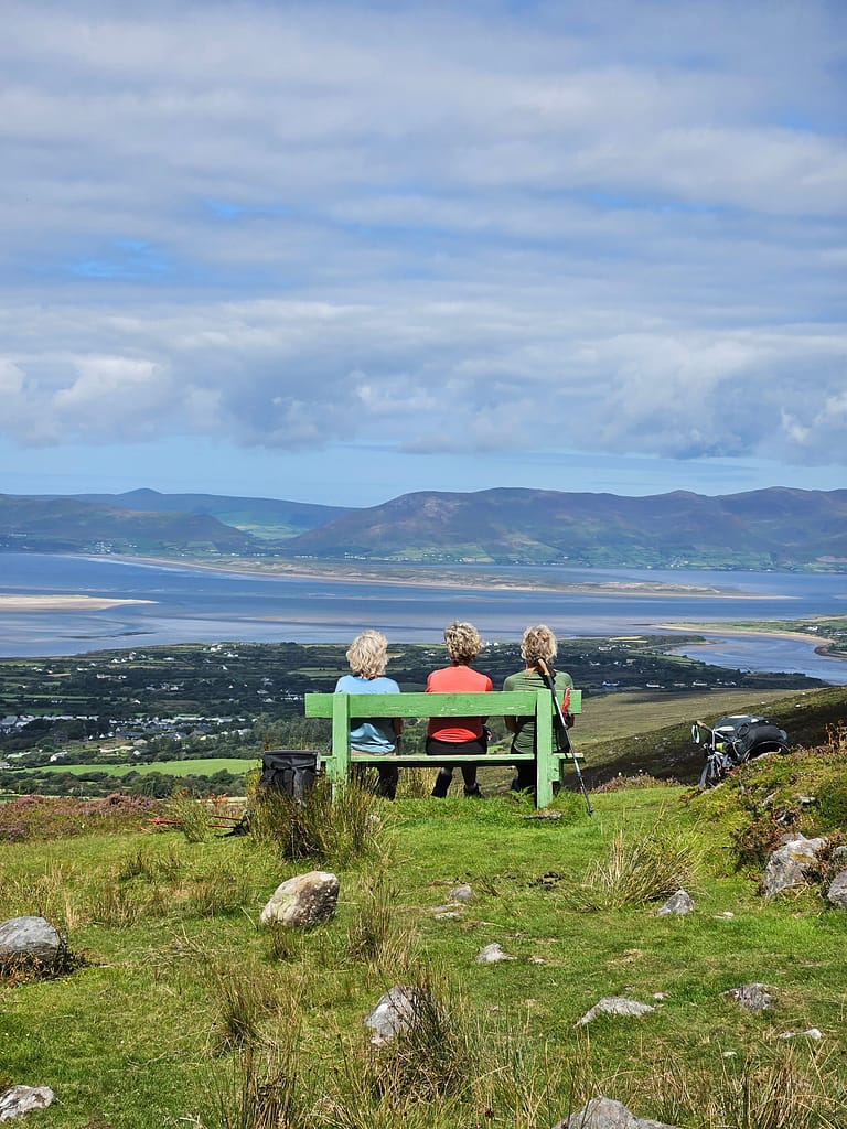
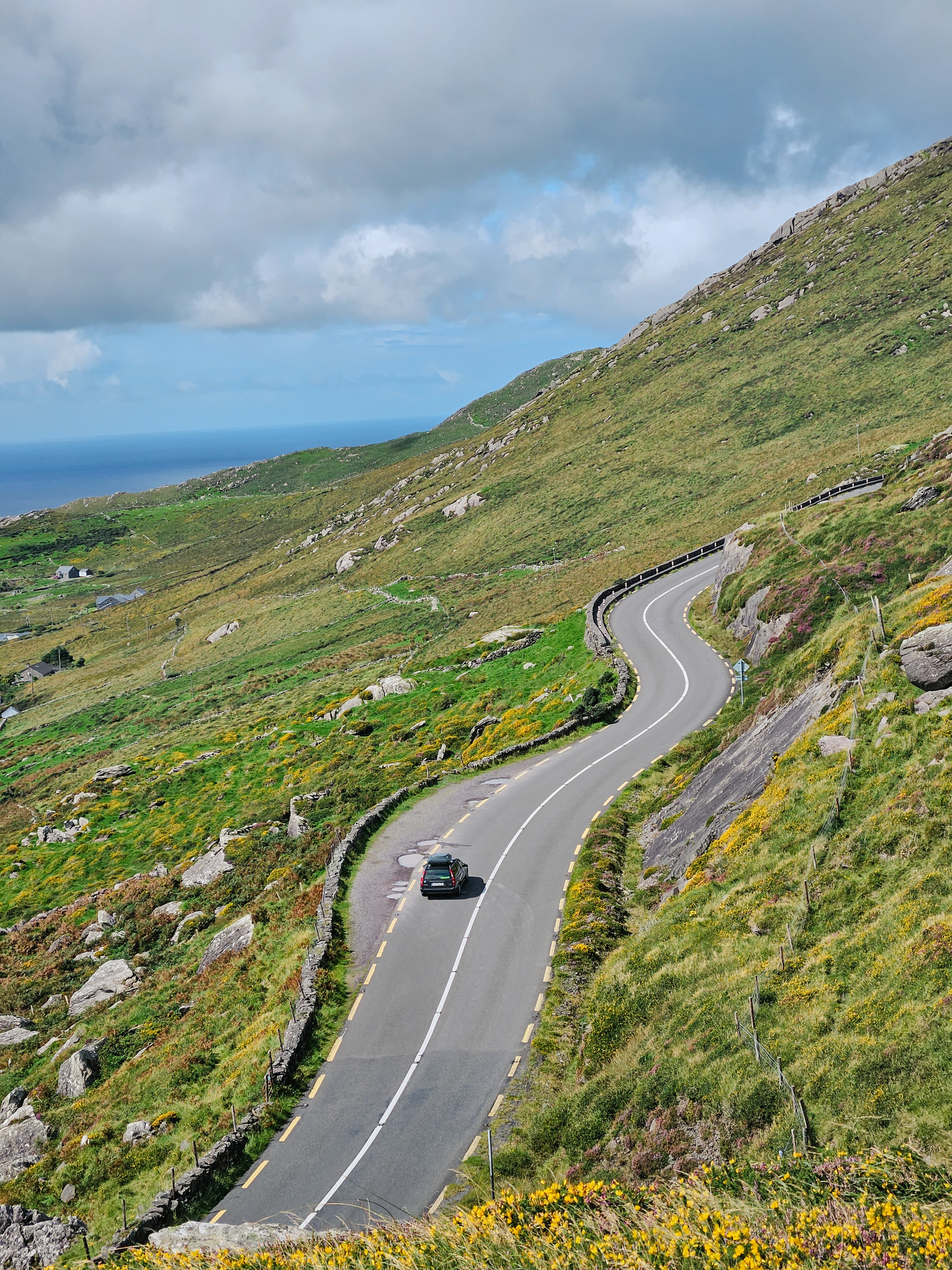
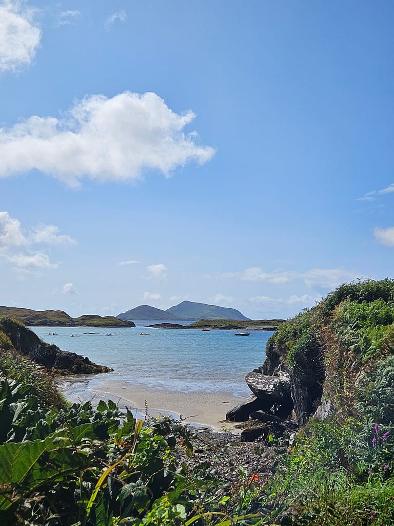
The Kerry Way is approximately 200 km long (alternative routes extend up to 214 km) and is one of Ireland's most famous walking routes. It starts in Killarney and ends in the same spot. It is also famous in the same region. Ring of kerry There's also a driving route. This route, particularly popular with caravaners and motorcyclists, circumnavigates the Kerry Peninsula, offering impressive views, though not as impressive as a walking route. So, it's a great alternative for those who don't want to walk but want to explore the region.
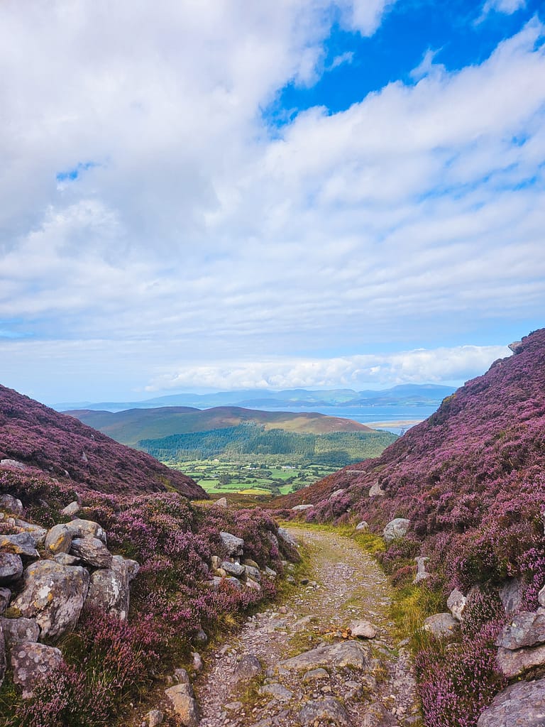
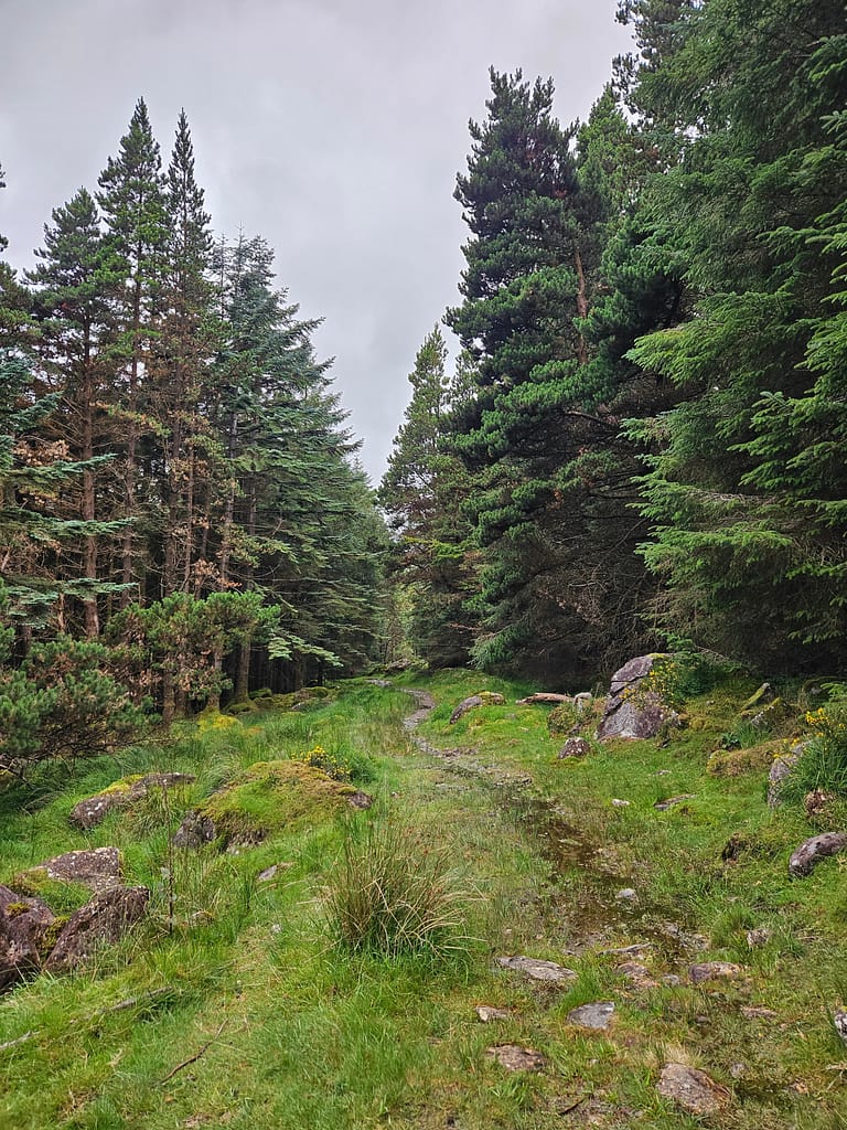
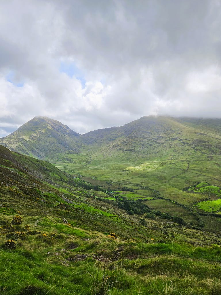
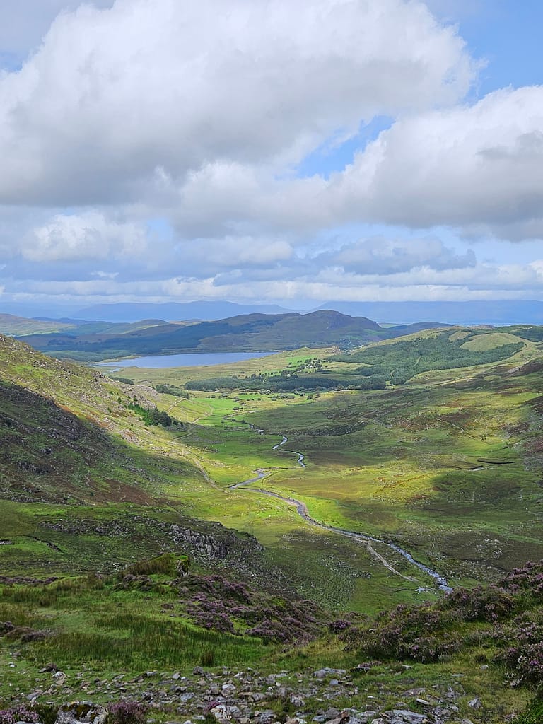
The walking route itself is truly a multi-layered, surprising trail. As you pass through lush forests, mountain passes, Irish moors, and turquoise bays, you're walking in a constantly changing flow, never seeing the same view over and over again in the same day. Seeing so many different landscapes in a 9-10-day period isn't a wish list that any walking route can fulfill. However, if I were planning my first solo hike today, I'd still choose the Kerry Way, as despite its difficulty, each day becomes more interesting and pushes me to explore more each time.

Along the way, it's possible to see ancient Celtic ruins and even swim in the Atlantic Ocean (despite the Irish weather). A major advantage is that much of the route is surrounded by nature, with only limited visits to settlements.
This route can be completed in an average of 8 to 10 days. Of course, it's also possible to complete it in a shorter time or extend the hike, depending on personal performance and preferences. I set out with a 9-day plan; that was the most I could do anyway.
The fact that the route is circular, meaning the start and finish are in the same place, was a huge convenience. This allowed me to leave items I wouldn't need at the beginning and pick them up again on my return.
Difficulty of the Route
The difficulty level of the route may vary depending on your preferences, previous similar experience, and your physical fitness. Factors such as the load you're carrying, whether you plan to complete the route while camping, and the number of days you plan to complete it will all increase or decrease the difficulty level.
The main factors that make this route challenging are that it involves more ups and downs than similar routes in Europe. Some days involve walking over 30 km if you plan to complete it in 9 days or less. Most importantly, because it's a region with frequent rainfall, the weather can be challenging and the roads can be muddy. Therefore, for those wishing to complete the route, trying slightly easier trails of similar length beforehand will increase their chances of completing the Kerry Way. Of course, those with less time can explore the route in short sections rather than walking the entire route.
Overall, I found the route to be moderately difficult. My preference for completing the route was to carry all my camping gear and enough food for the rest of the way, and to camp as much as possible.
Weather Conditions
Ireland may have the most variable weather I've ever experienced. It's quite common to see the sun shine, then storms, then clear weather again shortly afterward—and this can happen multiple times—all in the same day. Therefore, waterproof clothing and equipment are essential for this route.
The best time for hiking is generally recommended as May through September. Although I hiked in August, the average daytime temperature hovered around 18-19°C, dropping to 10-11°C at night. Compared to the temperatures we're used to in Türkiye, I'd say it's quite cool for that time of year.
However, the fact that sunset lasts until 11 p.m. in August is a huge advantage. Being able to benefit from the extended hours of sunlight was especially useful for me, as I could only complete some stages around 9 or 10 p.m.
Route tracking
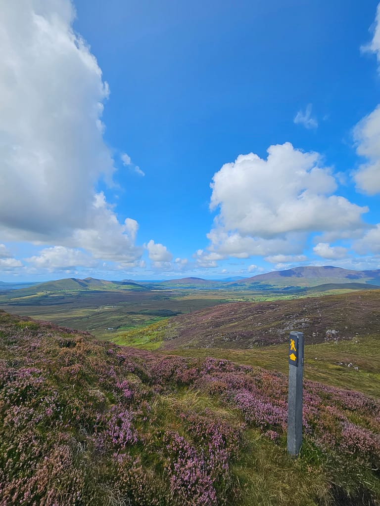
The Kerry Way is a marked route, meaning there are signs at regular intervals indicating where the route passes. The path is also quite well-defined and generally easy to miss. However, weather conditions and heavy mud can make it difficult to identify both the path and the road. As a precaution, it's easy to follow the route using offline maps you can download before you go.
I am for my trekking routes Hiker ve Komoot I use both apps. I use both at the same time because they each have their pros and cons, but it's also possible to proceed with just one. An app that warns you when you stray from your route, especially if you wander off track, virtually eliminates the risk of getting lost because it guides you even if you're distracted.
Route Sections
For those wishing to walk all nine days, the general route is as follows. I chose this route. The main reason for this division is that the start and end points of each leg lead to a settlement, providing access to services like accommodation, food, and beverages. Furthermore, I can say that the division is well-suited in terms of difficulty, except for days 4 and 5. I found only these two days quite long and tiring. (I'll explain the details in the sections below.)
This planning is especially important for those who prefer not to camp but will use the facilities along the way. During busy periods, accommodation at your destination may be full, which may require extending or shortening the stages. Therefore, a good strategy is to allow for flexibility and consider alternatives before you arrive. Because some of these areas are popular with summer vacationers, finding suitable accommodation along the coast can be challenging. If you're not planning to camp, I recommend booking in advance. It can be frustrating to arrive in a town and find out at the last minute that you have to walk another 5-6 km because there are no available accommodations.
| Home | Finish | Distance (Km) | |
| 1 | Killarney | Black valley | 23 |
| 2 | Black valley | Glencar | 18 |
| 3 | Glencar | Glenbeigh | 14 |
| 4 | Glenbeigh | Cahersiveen | 30 |
| 5 | Cahersiveen | Waterville | 30 |
| 6 | Waterville | Caherdaniel | 13 |
| 7 | Caherdaniel | Sneem | 17 |
| 8 | Sneem | Kenmare | 30 |
| 9 | Kenmara | Killarney | 25 |
There are two alternative routes, 3 and 5. The distance may increase depending on the route you choose. (I chose the shorter, more scenic versions.)
For those who want to walk 8 days, combining days 2 and 3 or days 6 and 7 might be an option. However, this would mean a rather long and challenging day.
Those who want to complete the hike over a longer period can split the fourth or fifth day into two. However, in this case, it's important to research accommodation options in advance or consider camping. Some sections may be uninhabited for extended periods.
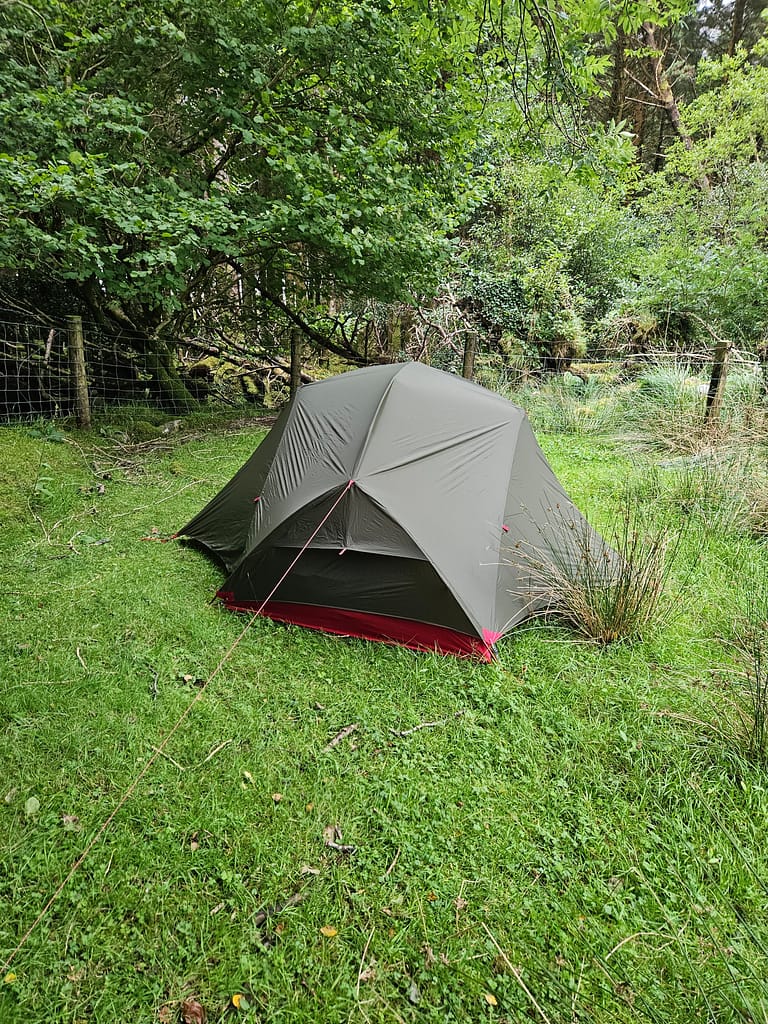
My preference was to camp as much as possible and be flexible. Therefore, before setting off, I only booked accommodation in Killarney for the first day before setting off, and started hiking without booking the remaining days in advance.
Camping
Camping in Ireland, outside of privately run campsites, is quite difficult and limited. To my surprise, since so much of the country is privately owned, accessing public land is nearly impossible. Almost all the areas along the way are fenced off with barbed wire and owned by the owner. Even forests, mountains, and waterfalls. 😊 So, while it's theoretically possible to camp with permission from the landowner, it's often quite difficult to find anyone you can reach.
Furthermore, Ireland's constantly rainy climate leaves much of the land covered in water. It's often possible to see the ground submerged by three or four inches. As a result, finding a dry spot while still avoiding the barbed wire fence has become nearly impossible. This has frustrated my dream of camping alone in the wild.
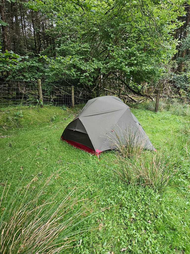
Privately run campsites were quite limited. In fact, some towns had no campsites at all. As a result, I only managed to camp for half of my eight-night itinerary. Only one of these was in nature, a true "wild camping" experience.
Water resources
Natural water sources are plentiful along the route, so you don't need to carry a lot of extra water. You'll have the opportunity to refill your water several times throughout the day. However, since almost all of these sources are natural, it's a good idea to bring a water purifier or water purifier tablet to ensure the safety of your water.
Preparation
Preparation is one of the most crucial aspects of a successful solo journey. While physical preparation is often the first thing that comes to mind, it's lower on my list. However, it's certainly essential. For those planning a long hike, especially for the first time, I recommend starting preparations at least three months in advance and regularly participating in long, even multi-day hikes in nature. This way, you can prepare for the journey both physically and mentally.
Furthermore, to truly prepare for the challenges you might encounter during your hike, I find it even more crucial to thoroughly examine the route beforehand, carefully plan your itinerary, and equip yourself with gear suitable for all weather and terrain conditions. These preparations not only increase the comfort of the hike but also significantly increase your chances of successfully completing the journey.
Especially when hiking without a guide and making your own decisions, thorough knowledge of the route is crucial for coping with unexpected conditions. Before my own trip, I thoroughly researched all the details—distances to settlements, water sources, campsites, and terrain—using both various blogs and the Kerry Way guidebook, and I practically memorized the route. I also marked important notes on a small map that I could use during the hike. Such precautions are essential, especially for those planning to camp in the wild; otherwise, you could end up walking for miles and finding a suitable campsite without finding a suitable spot.
There were two blogs I used when developing my plan. Both provide detailed information. Reading real-world experiences is always more helpful than reading guidebooks.
https://toughsoles.ie/blog/the-kerry-way-part-one
You can also get information about maps, businesses, etc. from the Kerry Way official website.
In addition, one of the most important things you should do before setting out on a solo hike is to inform someone close to you about your route and planned accommodations, and to keep them informed about your whereabouts at regular intervals throughout the hike if possible. I did exactly this on my own journey and left a copy of the plan I prepared day by day with my relatives.
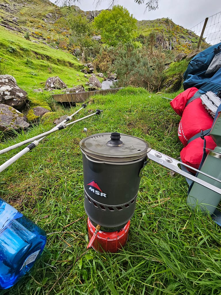
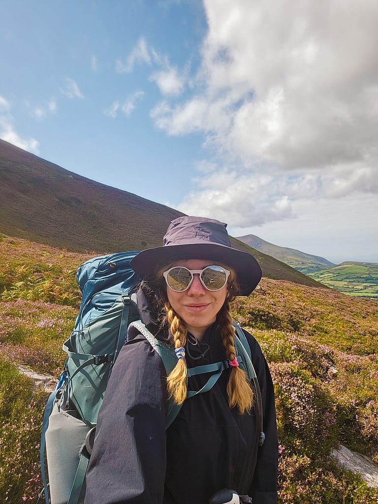
Besides learning the route, I also spent another stage of preparation on supplies. For years, having always done these activities in groups, my gear was too heavy to carry alone. The recommended backpack weight for long-distance hikes is approximately 20-25% of your total body weight. On a nine-day camping hike, the tent, sleeping bag, mat, stove, cooking equipment, and food make up the majority of this weight. Therefore, when I began my journey, I only packed enough food for half of the nine-day journey. I planned to procure the rest from the settlements along the route.
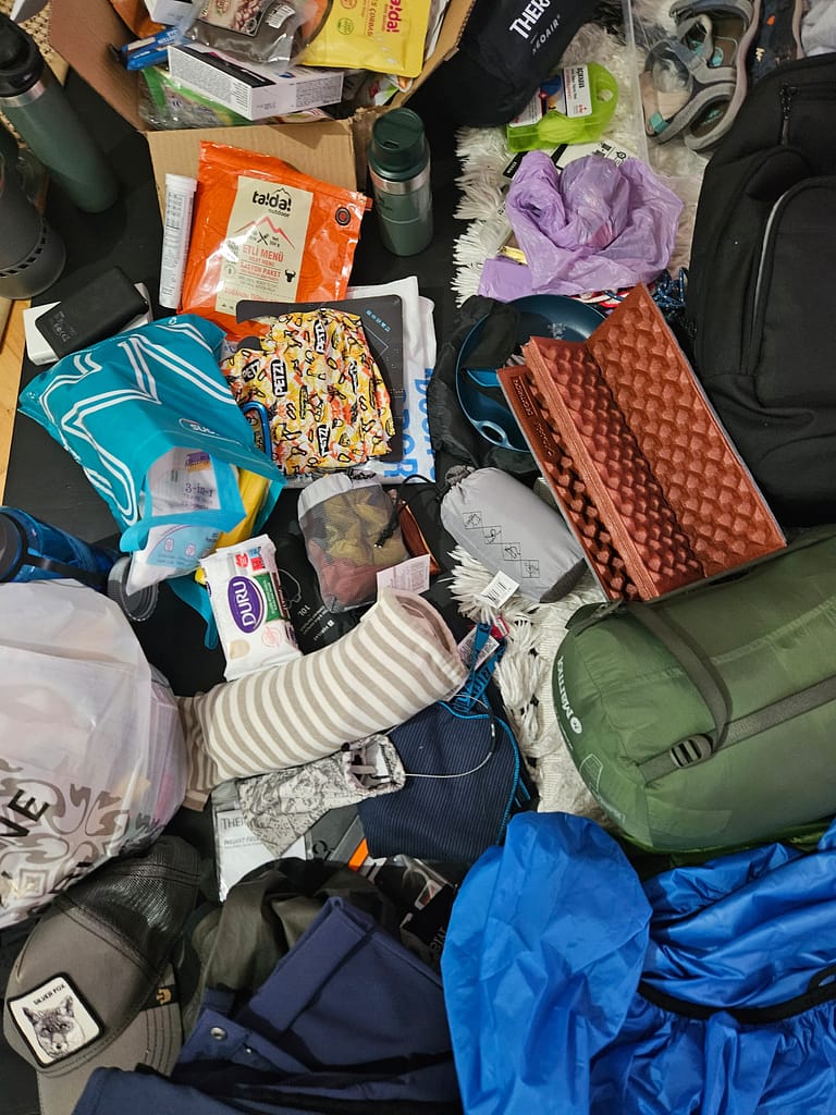
In this context, I re-examined my camping equipment and made sure to choose the lightest ones possible, and made sure that my total backpack weight (including the water I carry daily) did not exceed 16-17 kg.
Being minimalist (even though I struggle with it) is essential for this kind of solo, camping trip. I try to only pack a limited amount of the right gear.
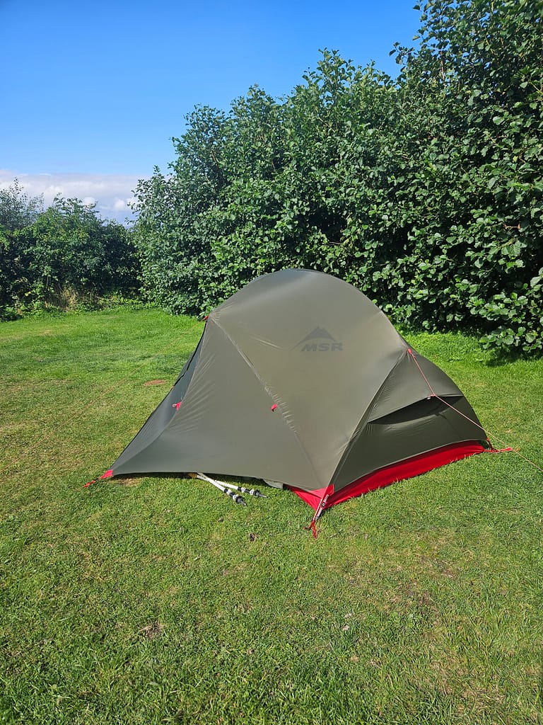
Another important factor is ensuring your gear is suitable for the climate conditions of your destination. Ireland is renowned for its constant rainfall, so your tent and backpack, along with your clothing, need to be waterproof. Also, due to the constant wetness of the ground, I recommend using a tent groundsheet, which I haven't used much during my travels in Türkiye but have found quite useful in the UK.
Setting out
Ireland accepts Schengen and UK visas, but to enter with a UK visa, you must have entered the UK within the last six months. This six-month period is critical because, in the sources I consulted before going, I saw that the same visa validity period was sufficient, but the officers at the gate specifically paid attention to whether it was within six months.
To reach Killarney, the starting point of the hiking route, I first booked a flight to Dublin. I was arriving on Saturday evening, and since everything would be closed on Sunday, I needed to pick up the gas stove I'd be using while camping in Dublin (I couldn't bring it from Türkiye because gas stoves are banned on planes). Before my trip, I purchased the necessary items, including a gas stove, tent cover, and knife, online from an outdoor shop in Dublin and selected the store as my pick-up point.
I actually thought I had plenty of time to pick up the items, but that changed when my flight was delayed. Upon landing in Dublin, I stopped by the outdoor store to pick up the items and had only a short time to catch the train. The Irish are very strict about their opening hours; we asked the store to close by 10 minutes, but they refused. As a last resort, my wife called the store while I was on the plane and convinced the staff to leave the items at the bar next door. I arrived just a minute or two before closing time, holding off the taxi to pick up the items. Then, I quickly hurried to the train station and caught the train.
If I hadn't received the products, I probably would have had to start the hike late or change my plans entirely. I think this was the most stressful moment of the entire trip.
It was evening when I arrived in Killarney, transferring to the train. With my large backpack on my back and a smaller one on my lap, where I planned to leave my extra belongings, I started walking towards the hostel. This walk, which was uncomfortable due to the load, took about 15-20 minutes. I stopped briefly at a gas station along the way, and when I got out, I encountered drunk young men yelling and hurling insults at me from their cars. One of the main reasons I chose Ireland was that it was a "relatively" safe country for women. Thankfully, this incident was short-lived and didn't escalate. But of course, it clouded my mind with fear even before I set off on the walk. As I walked to the hostel, demoralized, the question always lingered in my mind: "Is there really a safe place in the world for women?"
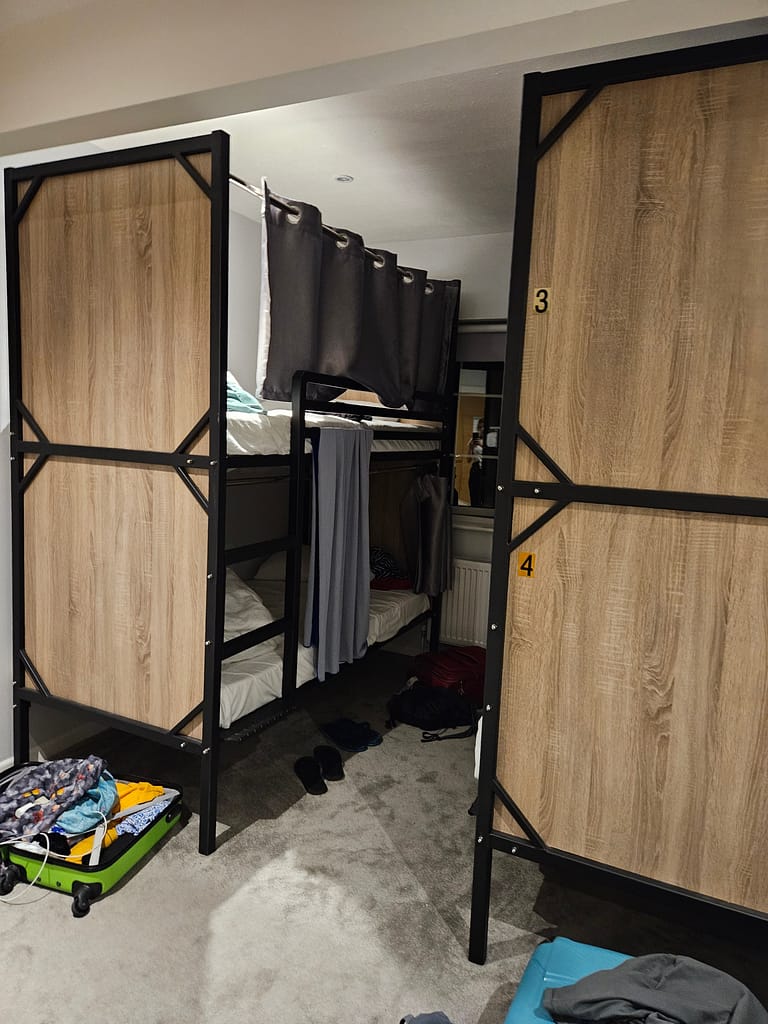
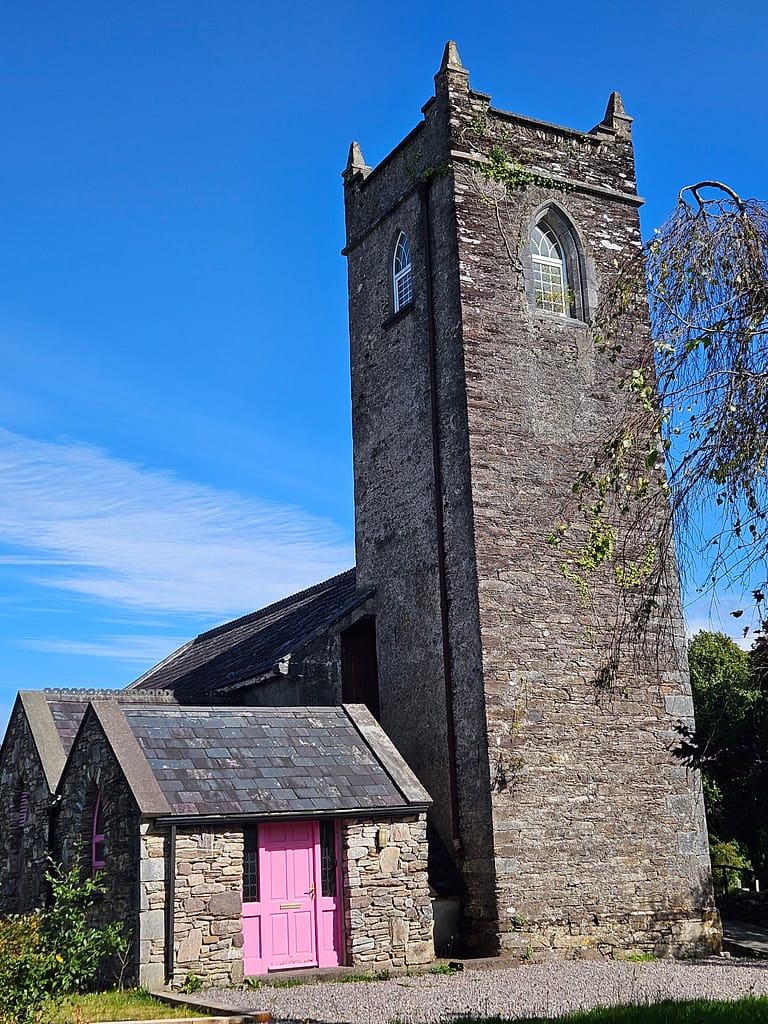
The hostel operated with a self-check-in system, a first I'd encountered. I checked in using the password I'd been given in advance and was then shown to my previously assigned room. It was a very comfortable hostel with a private bathroom that fit four people. I quickly grabbed a snack from the gas station, set my alarm for the next day, and drifted off to sleep.
Day by day route
Day 1 Killarney – Black Valley
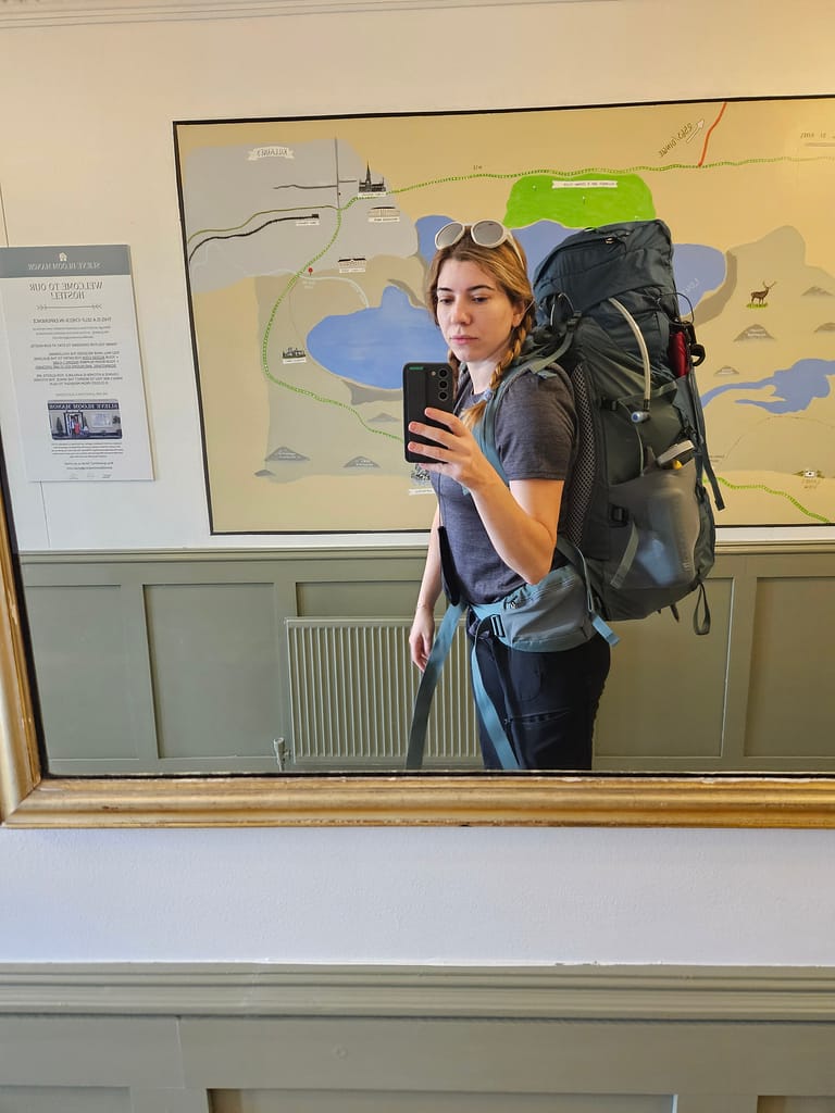
I woke up around 8:00 a.m., had breakfast at the hostel first thing, and then started sorting out the items I'd leave behind for later. Since the hostel is a place primarily used by hikers, they let you leave your belongings, provided you bring your own lock. Not wanting to carry even 100 grams of extra luggage, I carefully sorted my belongings as planned and placed them in the locker. After filling the bag with water—and I realized in the coming days that it wouldn't be necessary to set out with so much water—the bag weighed approximately 17 kg. I took a short souvenir photo and set off.
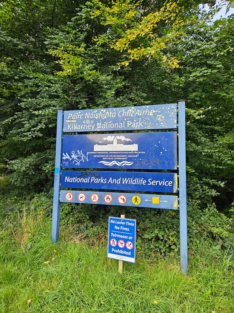
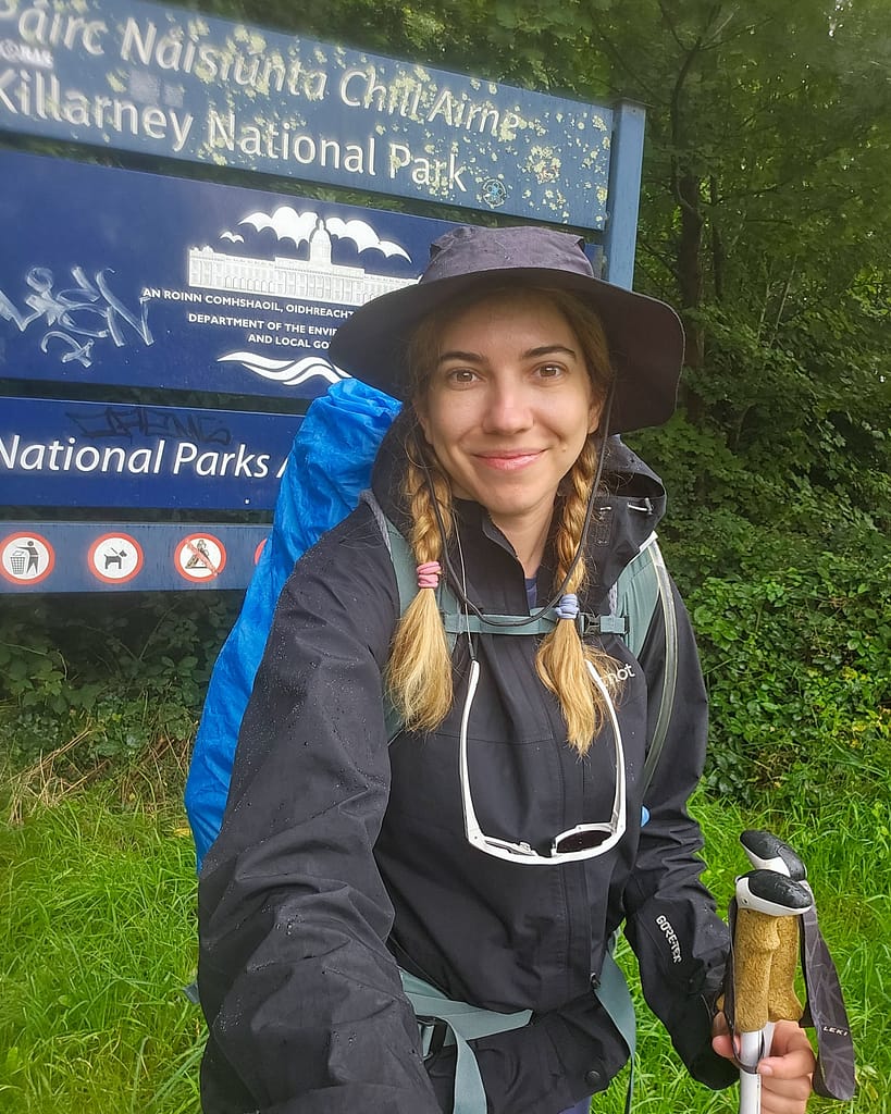
The official walking route begins at Killarney Nature Park. It's about a half-hour walk from the hostel to the park, following the footpath. Once you enter the park, you'll first see signs for the Kerry Way.
As I followed the signs and continued down the path, for the first time in my life, I felt so alive and happy—I think "euphoric" is the right word—and tears welled up in my eyes. For the first time, something I'd imagined felt exactly like I'd imagined it. It was as if with each step, I was getting closer to who I was meant to be. How many times do we get to witness our dreams come true? All the stress and anxiety I'd carried for the past month melted away with every step I took.
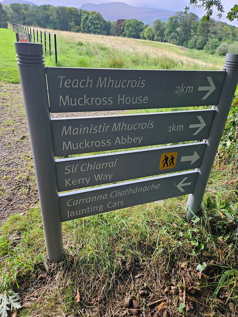
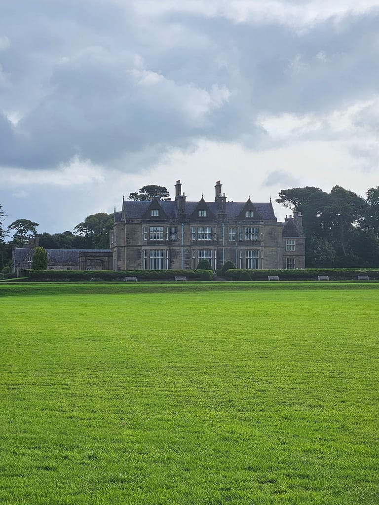
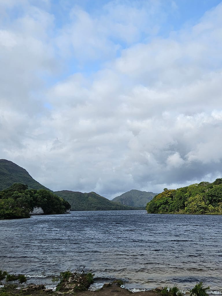
First, I passed through a green forest and then along a lake before arriving at the 19th-century Muckross House. There's a coffee shop and restroom here for those who need a break. However, feeling fine, I didn't spend much time there, so I continued on my way.
Not far from the manor house, the lake views appeared again. The road that follows parallels the lake, passing through green plains and trees.
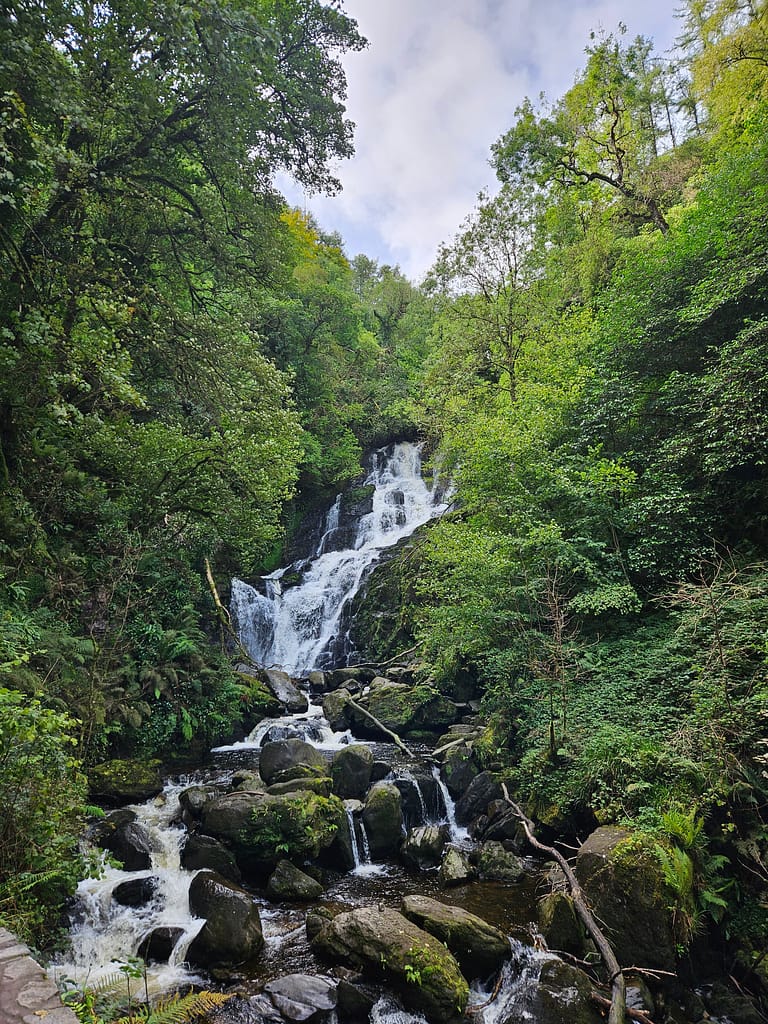
After a while, you begin to ascend slowly, following signs that curve left. After passing through a small stone tunnel, you'll come across Torc Waterfall, which flows from a height of about 20 meters. There's another restroom just before you reach the waterfall. The area around the waterfall was quite crowded with day visitors, which I suspect was due to my visit being there on a Sunday.
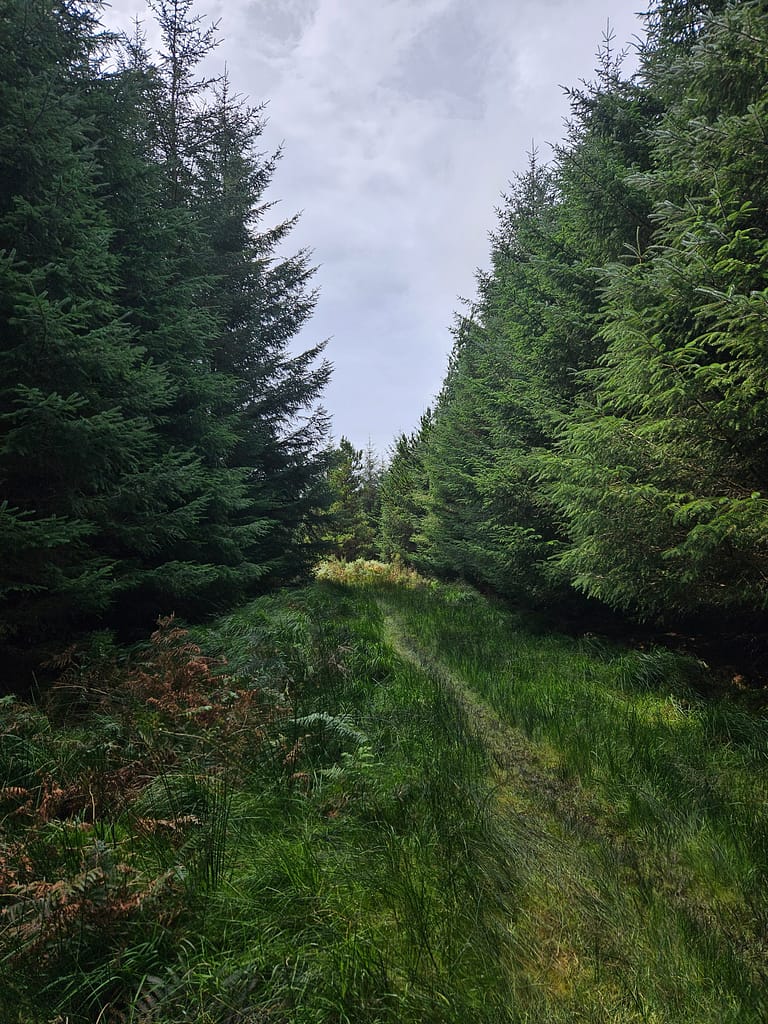
After this, you encounter the first rise in the road and begin your climb uphill. While the first day, with a heavy pack, isn't particularly challenging, it's still a tiring climb. As you ascend, the forest structure changes, and the surrounding trees begin to transform into pine forests. At the same time, some of the day-trip visitors begin to thin out.
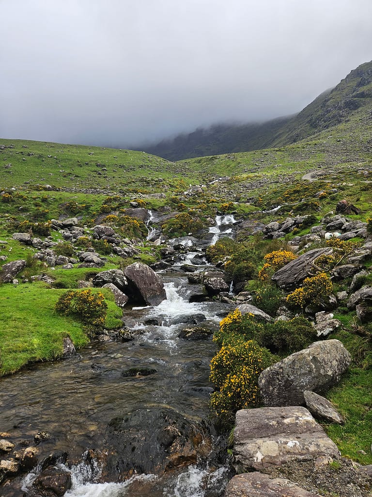
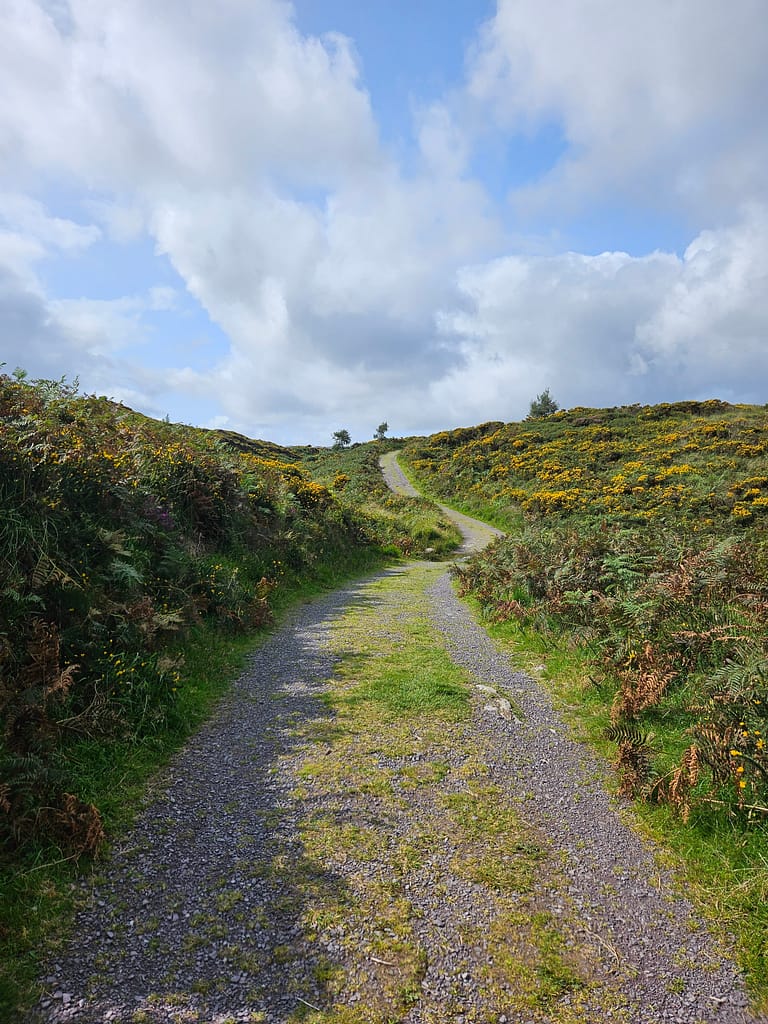
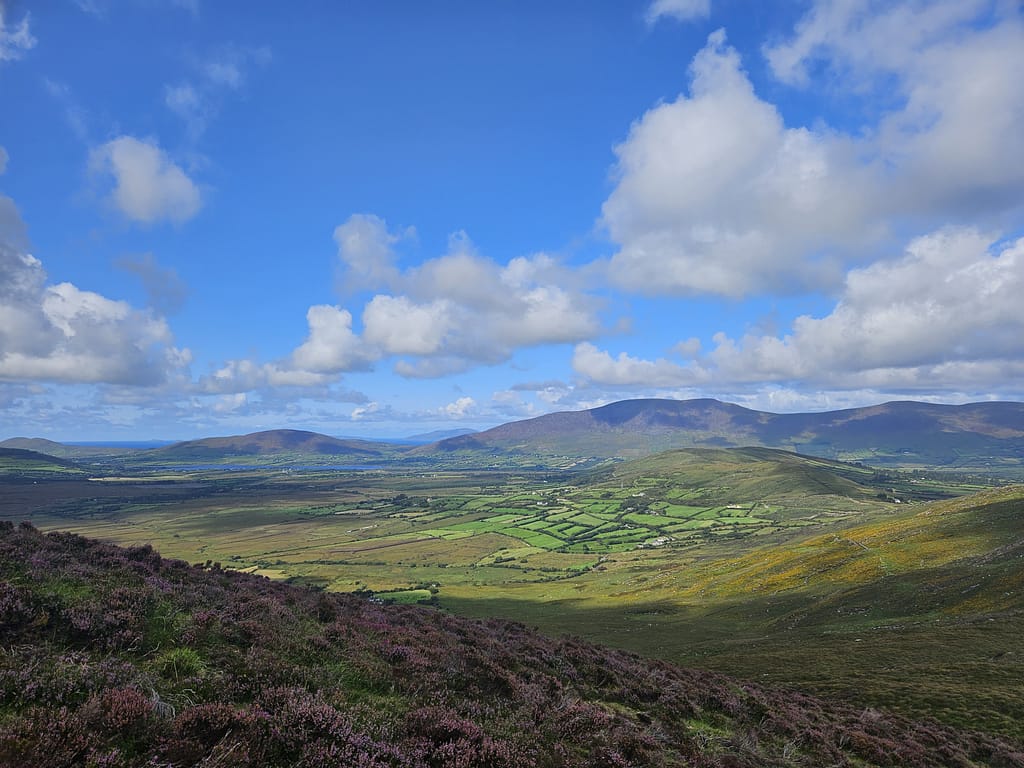
Once you reach the top, the pine forests give way to meadows filled with colorful wildflowers. The endless meadows on this hilltop are truly one of my favorite views in Ireland. It's a fairytale-like setting, with small streams occasionally flowing as you progress along the path.
As you continue along the road from the end of the green meadows, you pass through rising forests, exit Killarney Park and reach the junction where we will return on the last day.
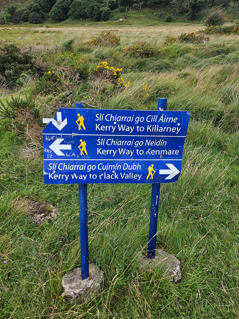
Because this route is essentially a loop, it can be walked in either direction. However, in terms of scenery and difficulty, I generally agree that walking the route counterclockwise would be more enjoyable.
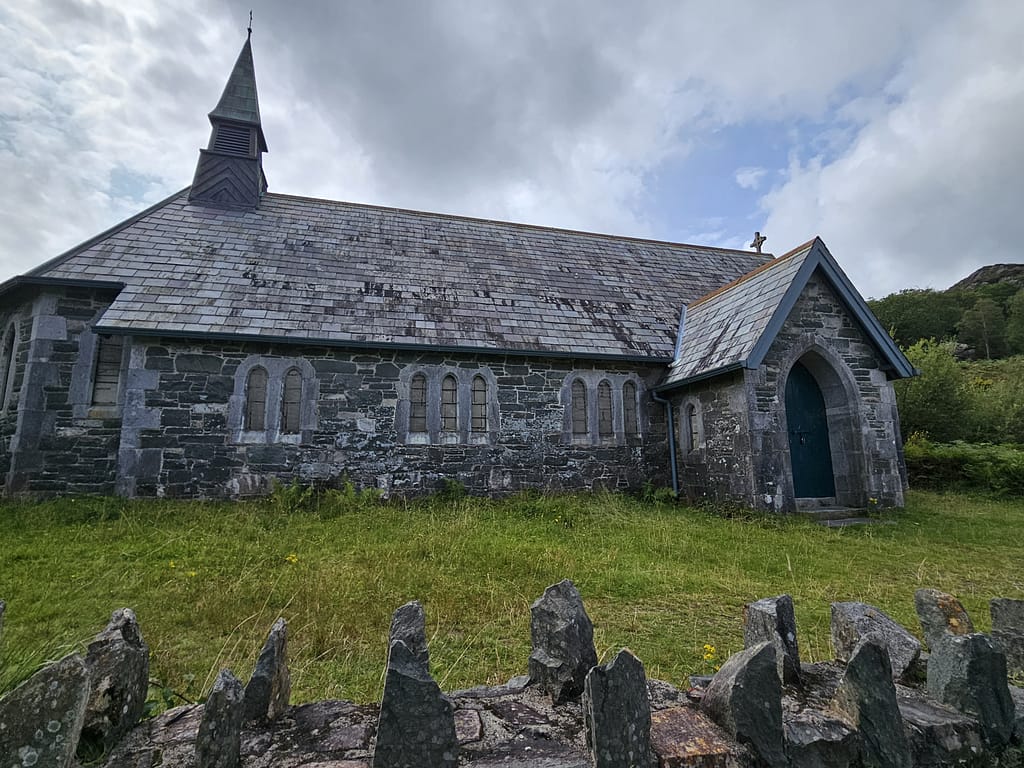
After the turnoff, the road begins to wind towards Derrycunnihy Church, and soon you'll see the Black Valley with its lake views in the distance. Just past the lake, there's a coffee shop where you can stop for a bite to eat. It was around 4:00 PM when I arrived. I took a short break, guided by the sign on the wall, and called my wife to update her on my situation.
After this, I was very close to Black Valley, the final destination of the day. My initial plan was to find a suitable spot and set up camp. However, as I progressed, I began to realize that this wouldn't be easy. Almost all the land was surrounded by barbed wire or flooded. Black Valley was actually full of charming little hostels and guesthouses, but today was the perfect opportunity for me to go wild camping. Camping alone in the wild was the culmination of my solo dreams, and I was afraid I wouldn't find another opportunity. So I made a decision there, crossed Black Valley, and continued until I found a suitable spot.
Almost desperately, I walked for another two hours before finding a suitable place. I was completely exhausted by now, and my knees were starting to tell me I shouldn't walk any further. Just then, a major storm began to approach. The weather had been quite pleasant all day, and for the first time, I was about to experience the truly famous Irish weather.
As the rain and wind intensified, I was passing through a farmstead nestled on a pine-covered hillside. A small flat area down the path was the only suitable spot I could see. However, there were numerous small streambeds surrounding it, and if the rain intensified, there was a risk of flooding. In a bit of desperation, I decided to pitch a tent. I climbed down the main path, out of sight, and began setting up the tent.
The rain was pouring down, and the wind was picking up enough to blow everything away. As I hurriedly tried to set up the tent, I was maddeningly unable to put on the raincoat. This was a huge lesson for me. I know you should be 100% sure of your equipment before heading out into the wild. Although I'd set up my new lightweight tent at home, I hadn't tried the top part because I didn't have time. Despite having set up and put away my tent hundreds of times before, I couldn't get the raincoat on because it was a different system. Every time I tried, the wind blew the raincoat out of my hand, and the inside of the tent got increasingly wet.
I was starting to panic now. After a while, I tried to calm myself down by talking to myself out loud—which actually worked. As soon as I did, I quickly pitched the tent and threw myself inside as the storm intensified.
As I sat in the tent, demoralized because something hadn't gone as planned—as if the original intention had changed—I realized something that would demoralize me even further: My phone had no signal, and I hadn't informed my wife that something like this might happen. Frankly, the thought of worrying anyone was making me very uneasy. While it seemed pointless to worry about that more than my own situation at the time, that's how I felt.
When the rain eased a bit, I started climbing upward. My goal was to get as high as possible and find a spot with phone reception. After walking for a while, I came across a few abandoned hunting cabins, littered with alcohol bottles, and frankly, this sight made me even more uneasy. It brought back memories of the drunken young men I'd encountered at the station exit the day before, and the two images merged in my mind. Ultimately, I couldn't find any spot with phone reception, and in despair, I returned to my tent.
The storm raged almost all night, and the uneasiness of my position, and the wind shaking the tent poles with such force that I was inclined to break them, made for a very uncomfortable and sleepless night. I woke with a start at every sound.
A male mountaineering friend of mine, to whom I later told this story, said, "You should have put on your headphones and fallen asleep." That sentence echoed in my head for a long time. Sleeping comfortably in a tent with headphones on... Can a man truly understand what it means to be a woman?
Day 2 Black Valley- Glencar
When I woke up around 5:00 a.m., the weather had cleared, and the wind and rain had subsided. I decided to take advantage of this opportunity to quickly pack up my tent without breakfast and hit the road. As I started walking, I passed a small pine forest and realized I'd actually passed a much more suitable campsite, and I was a little annoyed with myself. I could have walked another half hour, but that's the nature of hiking alone without a guide. I had to make some choices, and those choices weren't always the best.
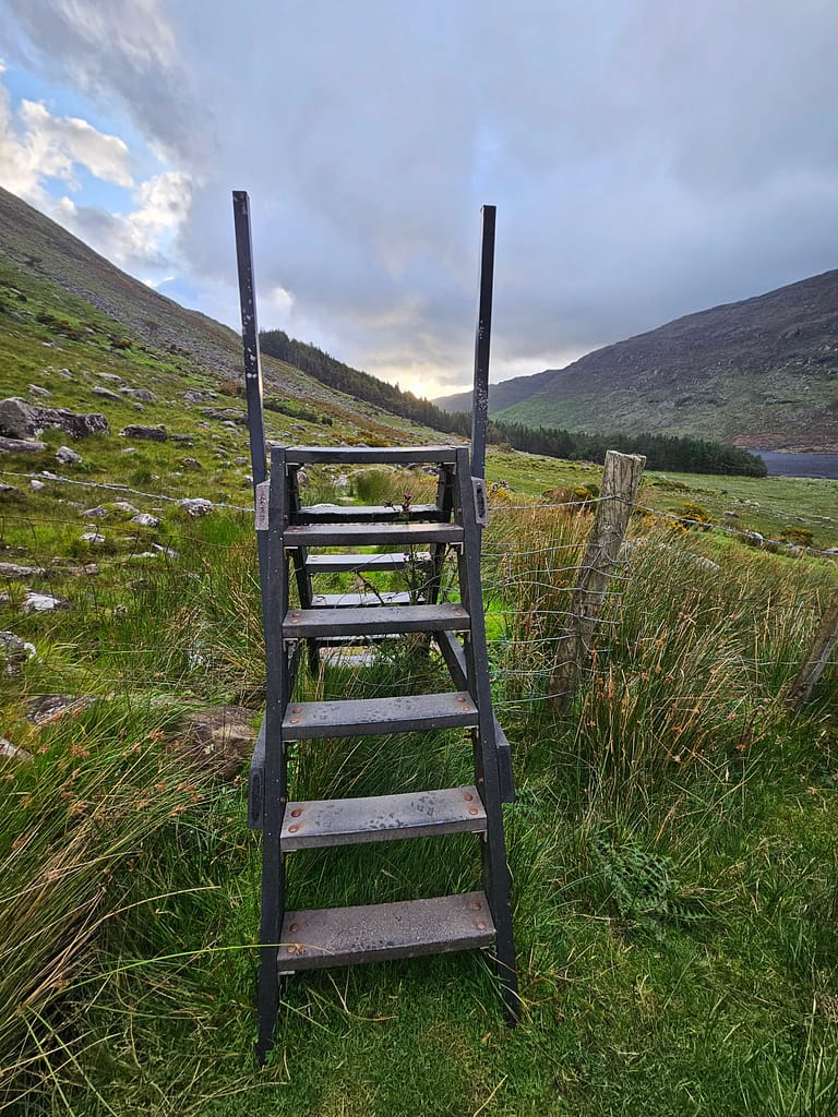
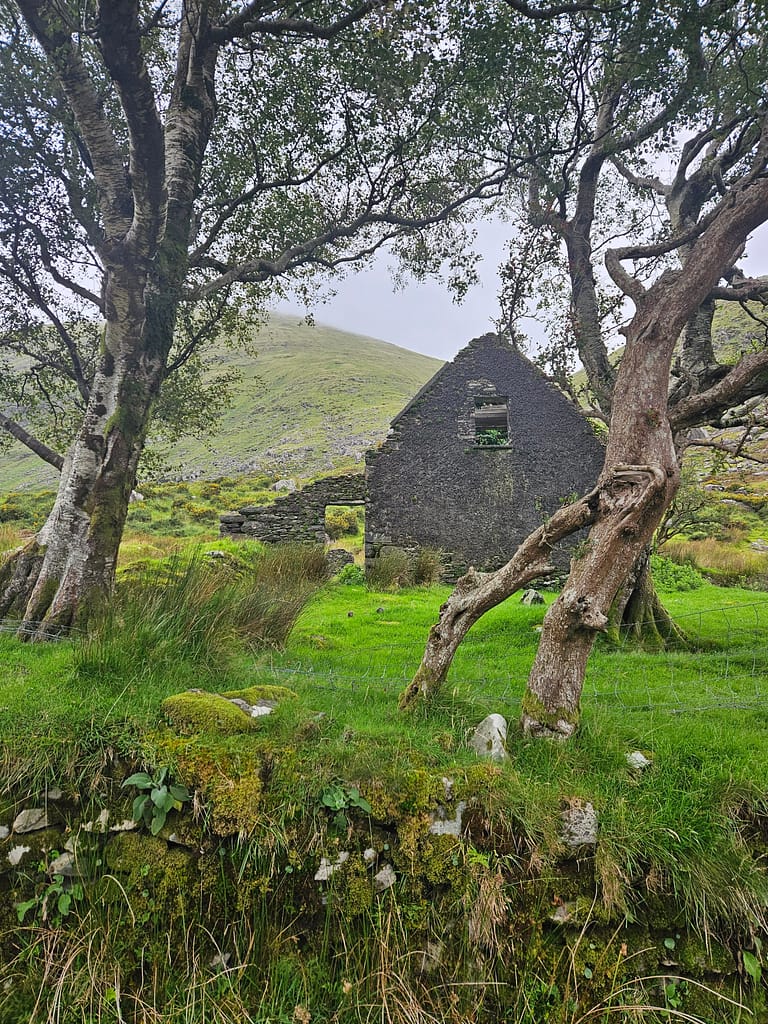
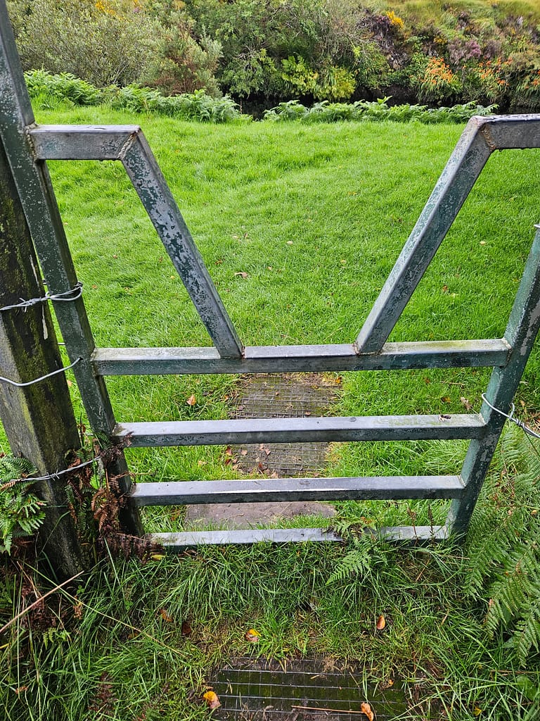
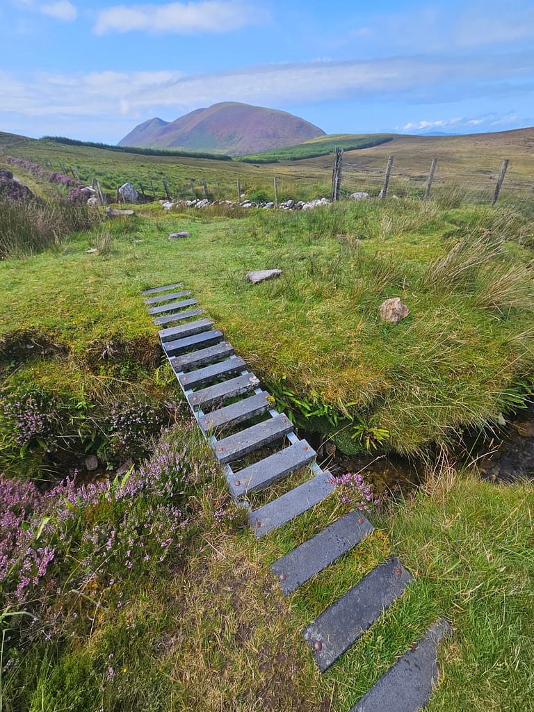
The path wound its way through the valley, occasionally passing through pine forests and meadows. As I mentioned earlier, since all of these areas are privately owned, you have to use stairs along passages fenced in with barbed wire. After passing a few abandoned village houses along the way, I began my journey toward the first mountain pass of the day.
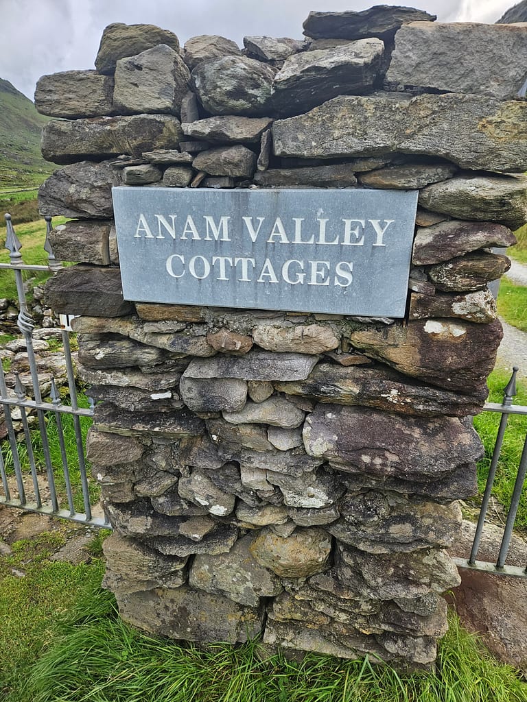
Just before the mountain pass, you pass the ANAM Valley Cottages. This is a private farmhouse located at the end of Black Valley. It was around 10 a.m. when I began my gradual ascent along the path, leaving Black Valley behind, and I still had no phone signal. The wind intensified as I approached the summit, but the view was breathtakingly beautiful. Sunlight filtered through the clouds, illuminating the valley like a spotlight. At that moment, my phone started receiving signal, and I was able to inform anyone who was interested in me, thus alleviating my uneasiness.
As I descended the path, I passed through a small, quiet town. Unlike the first day, I hadn't encountered anyone since last night. However, a father and son cycling along the road stopped me. The father, a rather friendly Irish man, asked my direction. As a woman traveling alone, I knew better than to share my travel plans with strangers. So, I simply told them my destination town and didn't elaborate. The man insisted I take the forest road—which was my plan anyway—and described its beauty, insisting I absolutely had to go that way. I left them and continued on my way.
There was a cute little cookie and coffee shop in town, but since it opened at noon, I arrived early and couldn't stop. Just before starting the second mountain pass, I stopped by a small stream. This place made me feel like the ancient pilgrims, navigating nature. I was able to savor a life where everything was so simple—and it was at that moment. I think there's something meditative about walking a long distance alone. I can't think of a better way to escape all the noise, leave daily worries behind, appreciate what's important, and return to your true self.
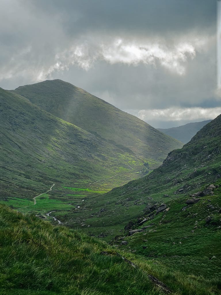
After my break, I embarked on what I considered the most strenuous ascent of the entire journey. I ascended the mountainside along a path, slowly due to the weight of my pack, toward the summit. Even so, I stopped every five steps to look back, for the narrowing valley beyond offered incredible views.
The highest point of the mountain pass—a spot I imagine would make a perfect campsite for those wanting to end the day—was also surrounded by barbed wire. This wire, extending all the way to the summit, made me think that even a mountain might have a deeded owner, and I found it quite intriguing.
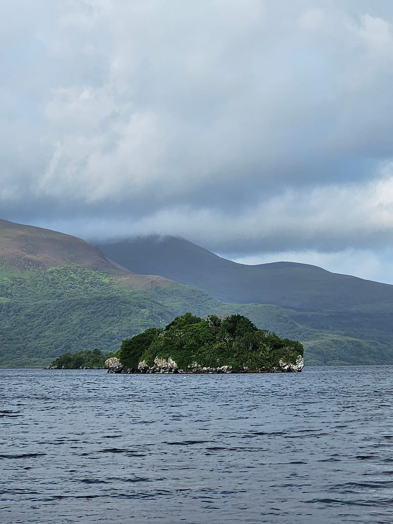
On the other side of the mountain, a valley with a lake at its edge greets you. The winding road to the lake is quite pleasant. Upon reaching the lake, you have a choice: either drive through Glencar Forest or take the second route, which skirts the lake. Since the latter route is more of a driveway and a bit of a detour, I had planned to take the forest road before arriving.
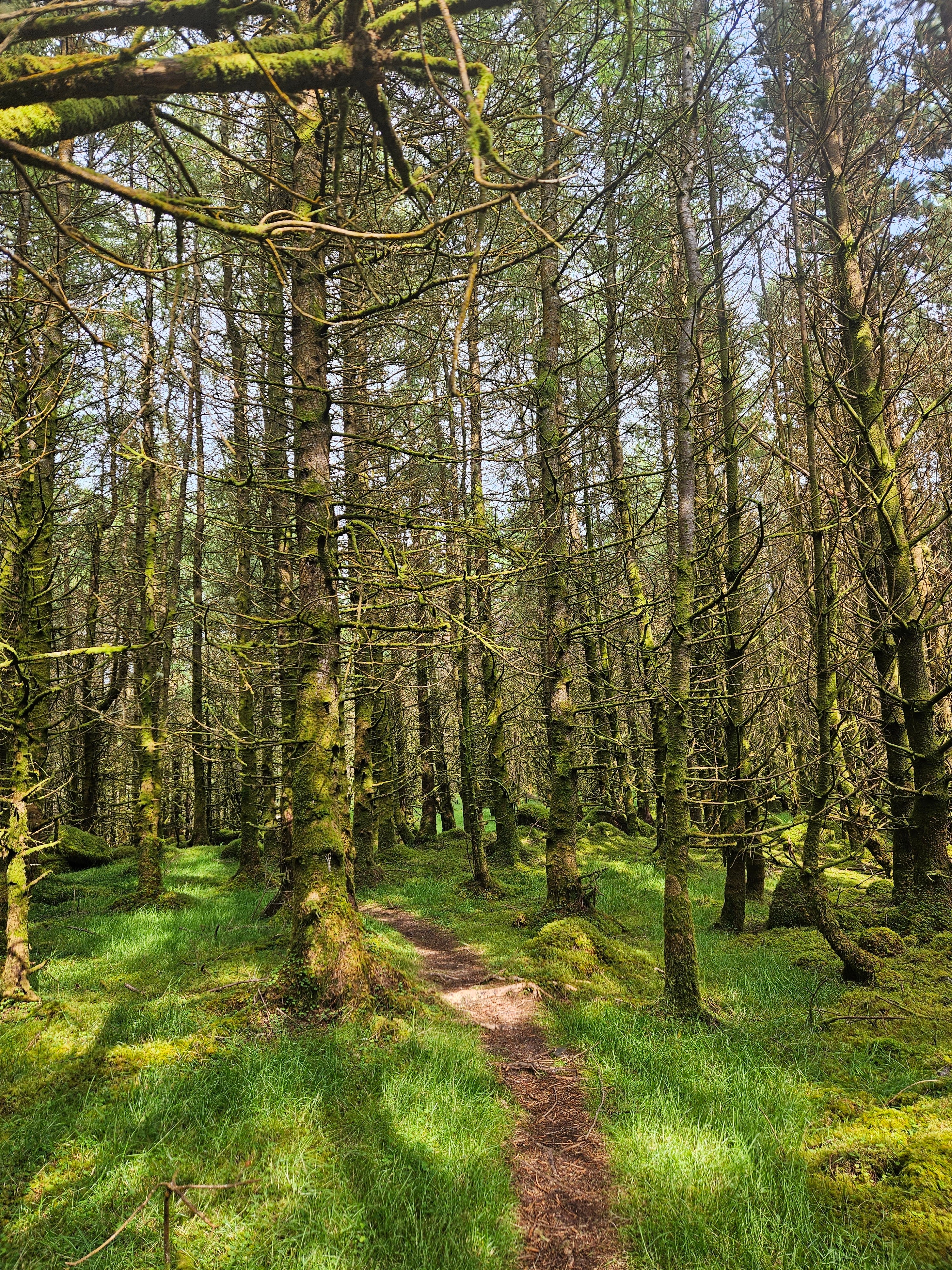
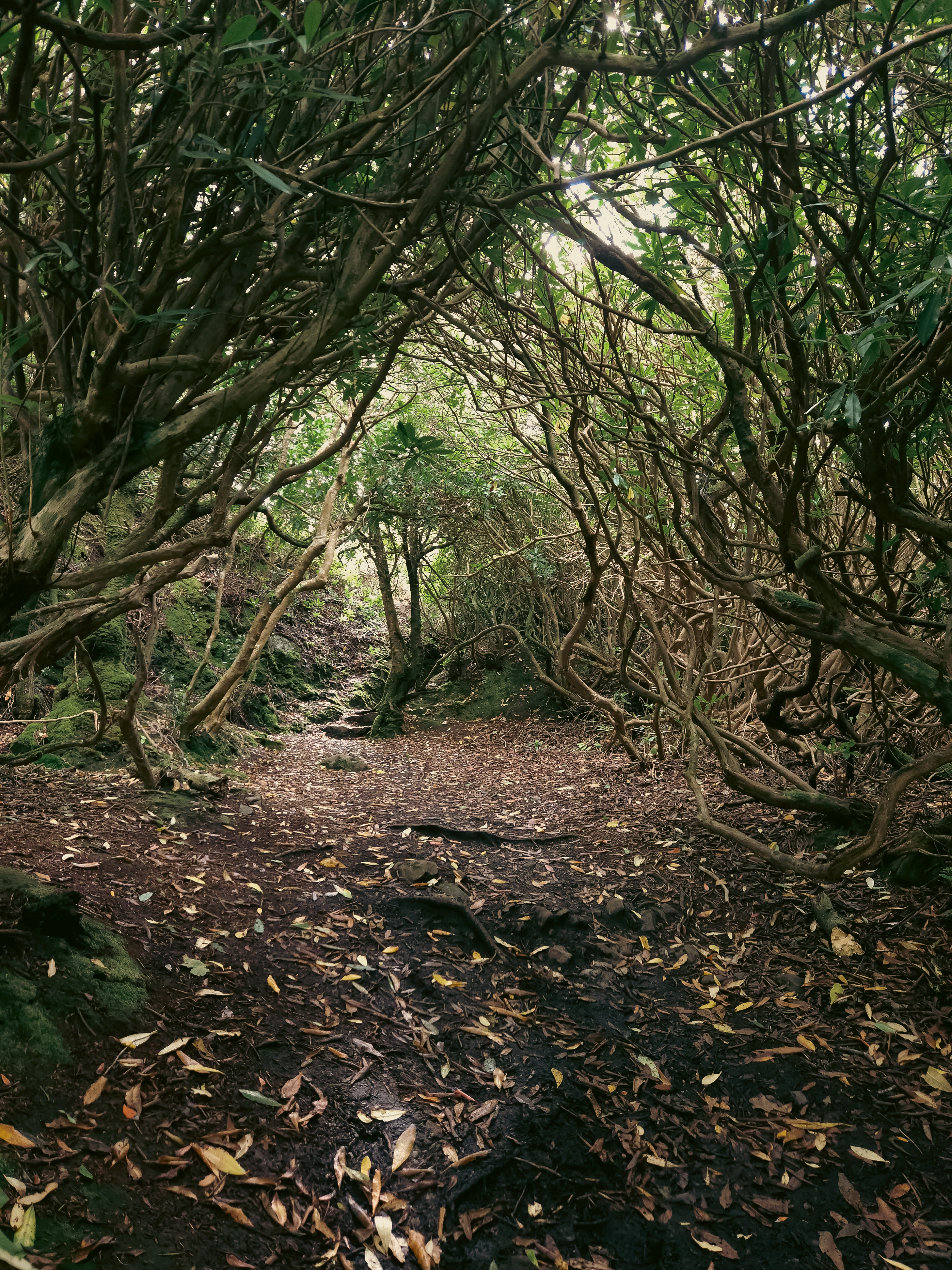
I started by following the lakeside path. This section was quite tedious due to the mud. After escaping the waist-high grass and mud, you head towards Glencar Forest. It's a dense, massive forest surrounded by barbed wire. To enter, you first have to climb a small staircase. The entrance to the forest initially resembles a typical, lush Irish forest, but as you progress, it transforms into an extremely dense pine forest. The density is so great that, even during the day, the forest feels dark inside, almost like night.
I feel comfortable and at peace in the mountains; I suppose that's my comfort zone. But the enclosure and silence of the forests have a certain intimidating quality. Being alone in a vast forest was something I'd never experienced before. The forest stretched out on either side of the path, its boundaries invisible. My mind, already quite hazy for the first two days, was fixated on the father and son I'd encountered in town, who were telling me something, and the man's intense insistence. I reminded myself that I was exactly where they wanted me to go, and I was beginning to feel uneasy when, far away in the forest, I saw someone sitting alone at the roots of a tree, his back to me, wearing a headscarf similar to those worn by beekeepers. While not actually threatening, this sight culminated in the anxiety that had been building up within me for several days. I almost ran to escape, but panicked and I lost my way.
As I continued, everything seemed to look the same, and the more panicked I became, the more lost I became. Recalling the calming technique I'd used when setting up the tent the day before, I calmed myself down by talking to myself, and finally, with the help of a GPS and a map, I figured out where I was and found the right path. I managed to climb a ladder and exit the forest. I think this was the moment I felt most powerless during the entire trip.
As soon as I emerged from the forest, I reached a highway, and luxury cars began to pass me by. Unlike our country, rural Ireland is a region where wealthy people live. At the end of the forest, the path briefly merges with a paved road. After about 2-3 km, I reached Glencar. There's a valley nearby where rock climbing is popular. Therefore, there are campsites and a few B&Bs in the area for climbers. I was originally planning to pitch a tent at the campsite that night, but after a series of negative experiences over the past two days, coupled with a loss of confidence caused by fear, I decided to spend the night in a guesthouse. Frankly, I needed some time to recover, as I still had 150 km to go.
Day 3 Glencar-Glenbeigh
I woke up feeling truly refreshed this morning. I had breakfast at the guesthouse and set off early. Today's route primarily follows the banks of the Caragh River and passes several farms.
There were so many farms along the way that I constantly found myself climbing stairs or jumping fences, which was really frustrating with a heavy backpack.
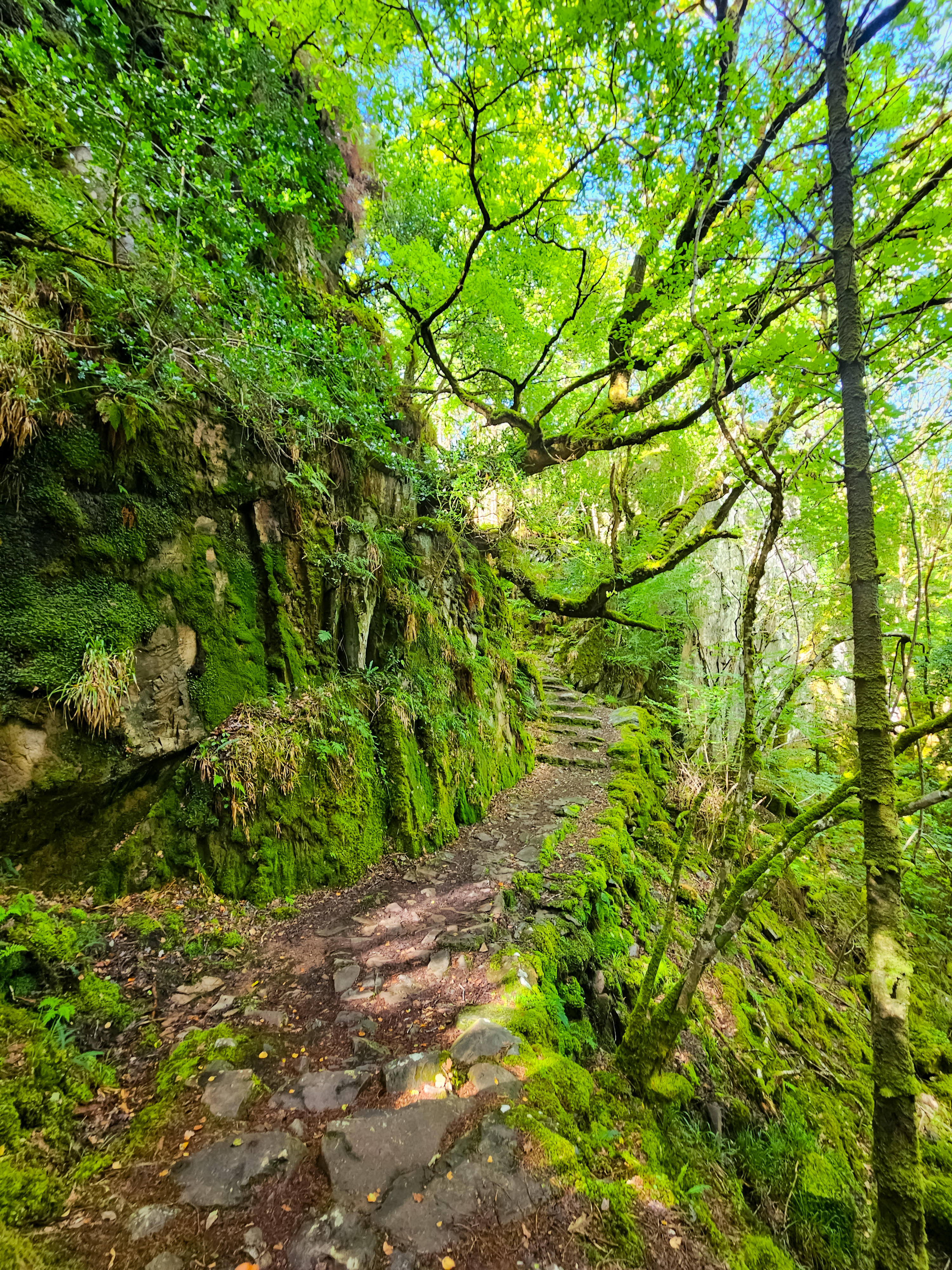
Then I entered the fairytale-beautiful Lickeen Forest, a stunning place that perfectly reflects the greenery Ireland is known for.
Unlike yesterday, today, despite being alone in the forest, I felt quite good. I took plenty of photos along the way. My mind was constantly fixated on the concept of courage. Despite years of extreme sports, I've never considered myself fearless because, like everyone else, I experience fear and anxiety in dangerous situations. I think those who are labeled "fearless" are actually those who don't succumb to their fears. Despite my defeats, my anxieties, and my fears from yesterday, navigating the forest again today—facing fear and controlling it—is, in my opinion, true courage.
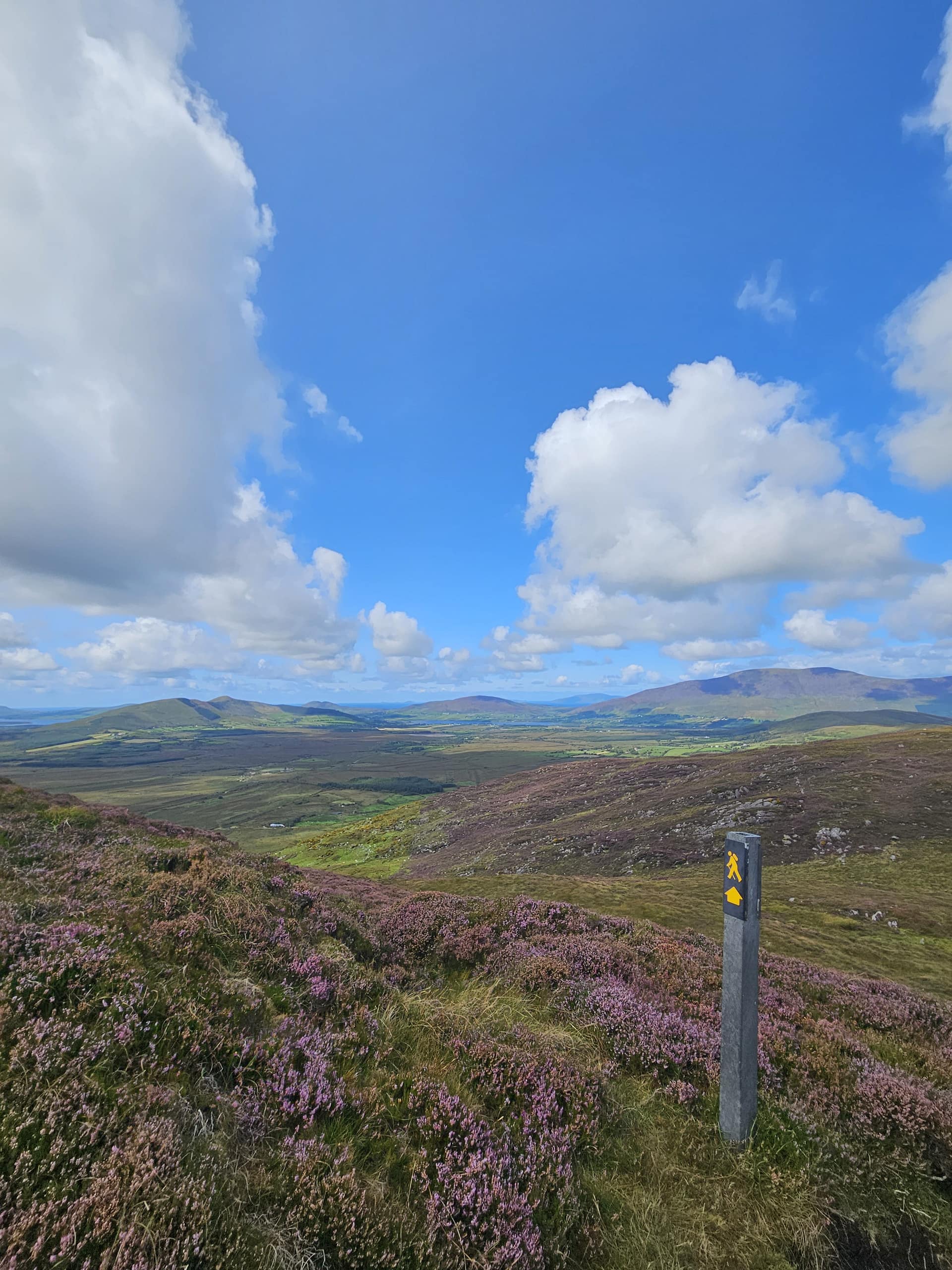
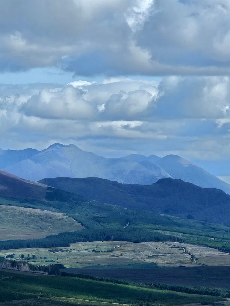
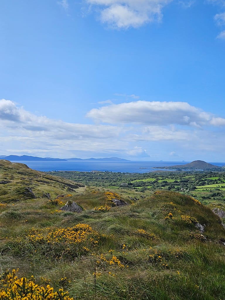
At the end of the forest, I encountered three women walking the Kerry Way; after exchanging brief greetings, I continued on my way. We met again several times throughout the day. After leaving the forest, I began climbing along dirt roads toward Windy Gap, the highest point on the Kerry route. The blogs I'd read beforehand suggested it would be very challenging, but thanks to my boosted spirits, the climb didn't seem too difficult. On the contrary, the views were so beautiful both on the way up and down that I kept taking photos, so I proceeded quite slowly.
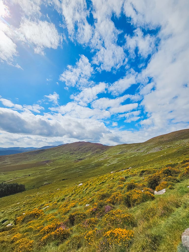
Today, my route was shorter than previous days, so I didn't have to rush. The mountains blanketed in purple and yellow wildflowers, the Atlantic Ocean looming in the distance, and the magnificent view of Dingle Harbour are etched in my memory. It was by far my favorite day.
As I descended Windy Gap, I started to encounter day hikers, and I soon arrived in Glenbeigh early. The weather was quite sunny and pleasant. I had a coffee at a coffee shop before heading to the campsite and setting up my tent. I spent the rest of the day relaxing and enjoying the beautiful weather.
Day 4 Glenbeigh – Cahersiveen
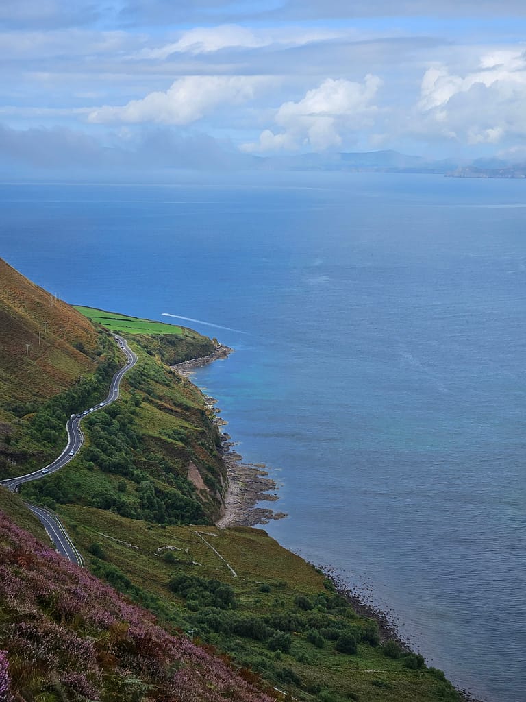
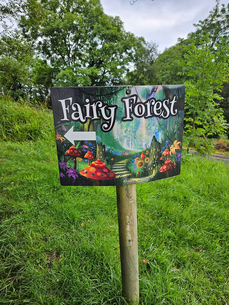
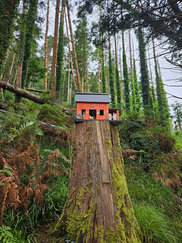
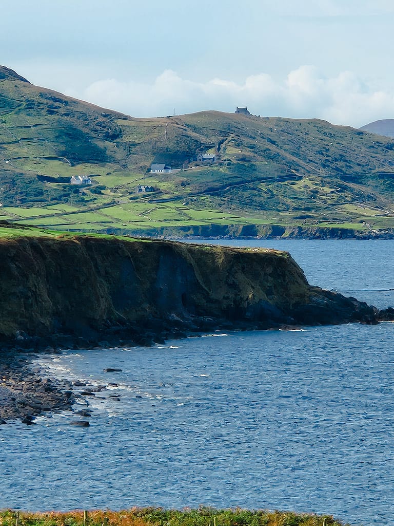
When I woke up this morning, it took me a while to pack up my wet tent due to the overnight rain. As soon as I was ready, I set off. Leaving Glenbeigh behind, today's route began with Ferry Forest. Small fairy houses were scattered throughout the lush forest; as I walked through, you'd think an Irish fairy tale was coming to life. After a while of photographing these houses and the inscriptions, I left the forest. I continued along the tarmac for a while, then was once again greeted by the stunning views of the Atlantic Ocean.
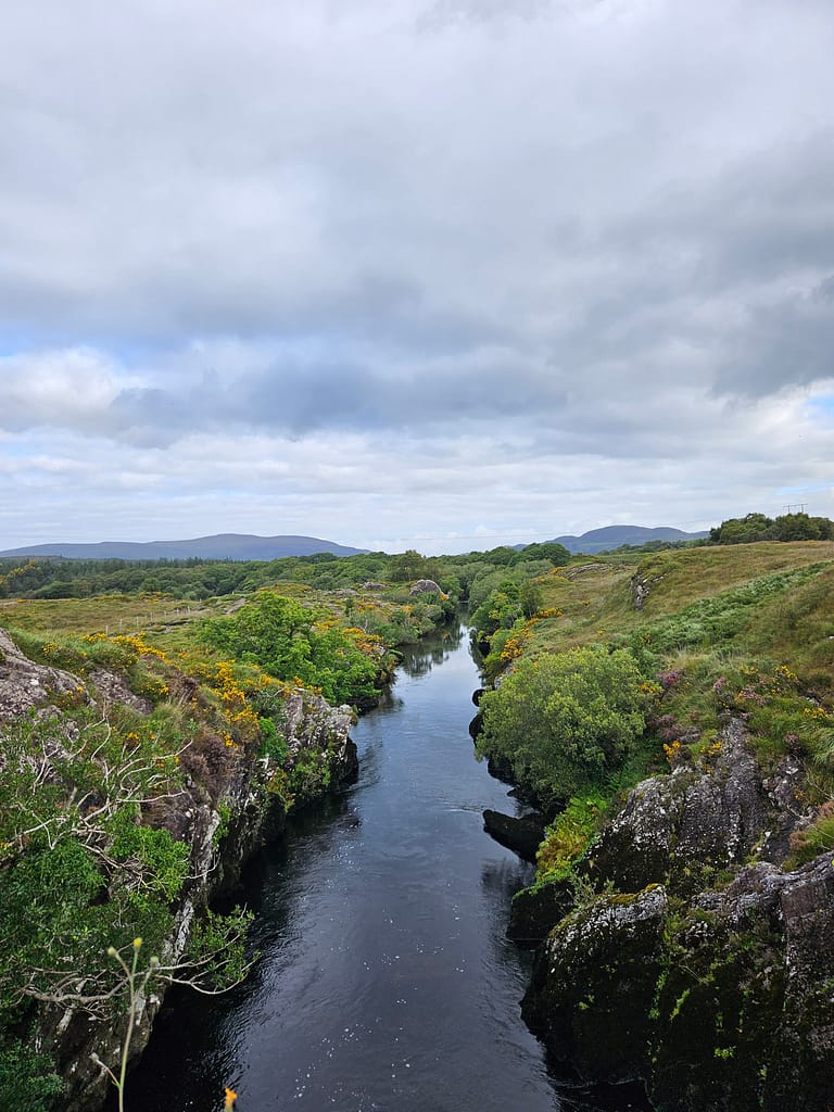
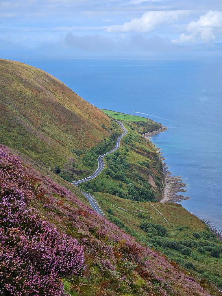
Then, as you follow a higher path, you can see the famous Ring of Kerry road winding below, while on the opposite shore lies the famous Dingle Bay.
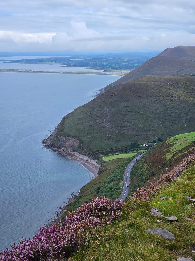
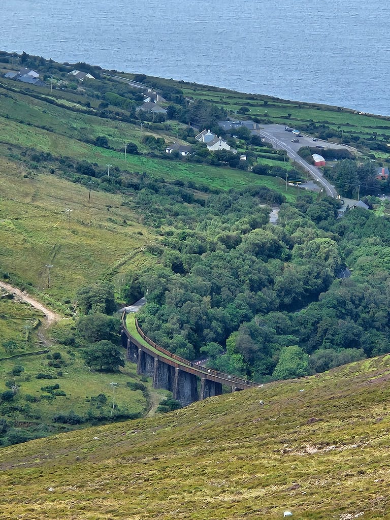
As I continued along the path with these magnificent views, a historical stone bridge below caught my attention.
At the point where the ocean view ended, I had to walk through a forest that had first dried up and then been cut down. Due to last night's rain, this section was flooded in places and covered in swampy mud. It was quite difficult and time-consuming to navigate this section. I took a short break and had something to eat. I also happened to meet a group of Scottish hikers and chatted with them. They were on a tight schedule, trying to complete the route in eight days.
As I continued on, passing several farms and enjoying the purple mountain landscapes covered in wildflowers, I reached the final and most tedious section of the route. It was around 5:00 AM.
Although I was already quite close to Cahersiveen, the road kept getting longer and more winding, heading towards the center. I meandered for nearly three or four hours, passing countless similar farms and side roads. Finally, exhausted and uncomfortable from the mud, I reached the town's entrance.
Entering Cahersiveen leaves the main route. You'll need to return to this junction the next day. Since the campsite I was staying at was located almost at the farthest point of town, I had to walk another half hour through the city. I'd walked a long distance today, about 30 kilometers, and my feet were incredibly sore on the paved road. With all my strength, I stopped at a supermarket along the way and reached the campsite. It was around 8:30 or 9 pm when I arrived. I was so exhausted that I barely had the strength to set up my tent. Fortunately, a helpful French couple came to my aid and helped me set up my tent.
I went inside the tent and tried to gather energy by eating unhealthy junk food I'd bought from the supermarket. All the while, I kept repeating this to myself:
“Every day doesn't have to be perfect, I don't have to feel great all the time; I just have to keep going.”
Day 5 Cahersiveen – Waterville
I was in the middle of the entire hike today. I always think that on these kinds of journeys, when you're halfway there, you're closest to quitting, both mentally and physically. At the beginning, your strength is high and your motivation is full; as you near the end, even if your strength wanes, the motivation of completion pushes you onward. But in the middle, you have a path as far as you've already covered, and quitting seems so easy. Moreover, today was the most challenging day I've ever faced, both in terms of distance and ups and downs.
Having thoroughly researched the route before arriving, I was aware of today's challenges. I had a tough day ahead of me, and the accumulated fatigue of four days was already weighing on me. I woke up as early as possible and, having strayed from the route yesterday, booked a taxi to the starting point. The taxi driver was well-versed in Turkish politics; he was visiting Fethiye with his family for the summer holidays. We chatted along the way. He taught me how to report my location to the authorities using Irish gate numbers if I got lost or something happened to me, and then dropped me off at the start of the hiking route.
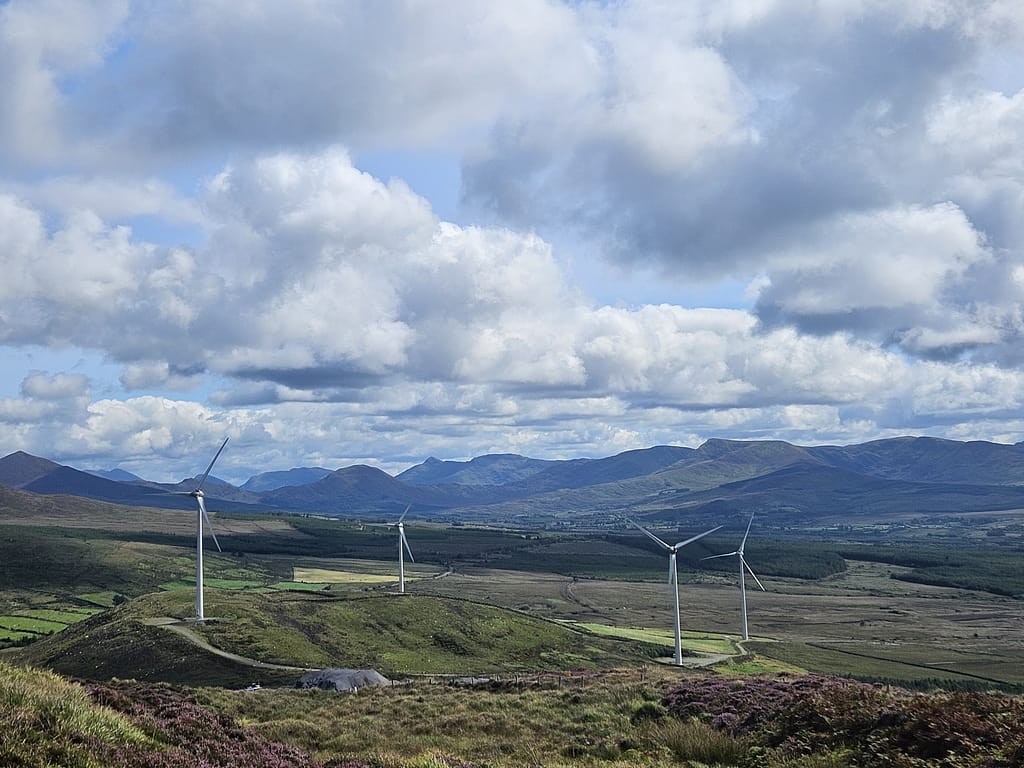
Today's route required ascending and descending numerous hills in quick succession. It was quite challenging, considering my fatigue, heavy pack, and the mud. The scenery, accompanied by wind turbines, was quite beautiful, and I took plenty of photos. The road then became monotonous, revealing the view of Waterville. From this point on, I kept thinking, "I'll be there in about an hour," but the road seemed endless. I arrived in Waterville just as it was beginning to get dark.
Waterville is a rather expensive resort town; it's surrounded by golf clubs and has no campsites. Hotels are also very expensive. Since I arrived at the last minute, I couldn't find a reasonably priced guesthouse and had to stay in the most luxurious hotel I'd stayed in during my trip. It was the Butler Arms, an old hotel but a popular choice for upper-class Irish golfers. As I settled into my room, washed up, and went down to the restaurant, the contrast with the situation I'd been experiencing for days struck me as amusing. To celebrate completing the day, I rewarded myself with dessert and drinks.
Day 6 Waterville – Caherdaniel
There are two routes from Waterville to Caherdaniel: one is a longer, higher-altitude mountain route, and the other follows the coast. I chose the coastal route for its stunning views.
After enjoying a rather luxurious breakfast at the hotel, I set out. I started by exploring a small town. Upon exiting the town, I was greeted by the impressive view of the rocky cliffs, where I took numerous photos.
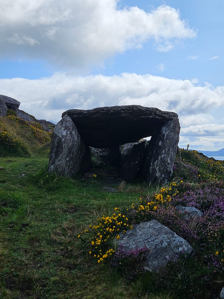
For most of today's route, the ocean view is on your right. First, you ascend a bit, reaching a hill overlooking the view. It was quite windy today. As you continue up the hill, you encounter Bronze Age tombs. The stone tombs and the sea view reminded me of the Lycian Way.
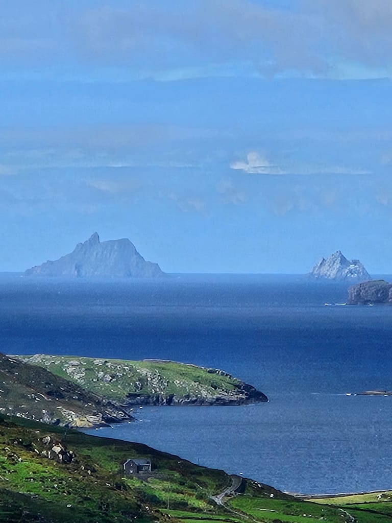
After passing the stone tombs, the famous Ring of Kerry road winds below. Looking across the ocean, you'll see the famous Skellig Islands. These islands are a UNESCO World Heritage Site and boast 6th-century monasteries. Part of Star Wars: The Last Jedi was also filmed here. You can visit them as a day trip by boat from Waterville or Cahersiveen. I had to skip this trip because I didn't have much time, but if I ever return to the region, it will definitely be on my list of places to visit.
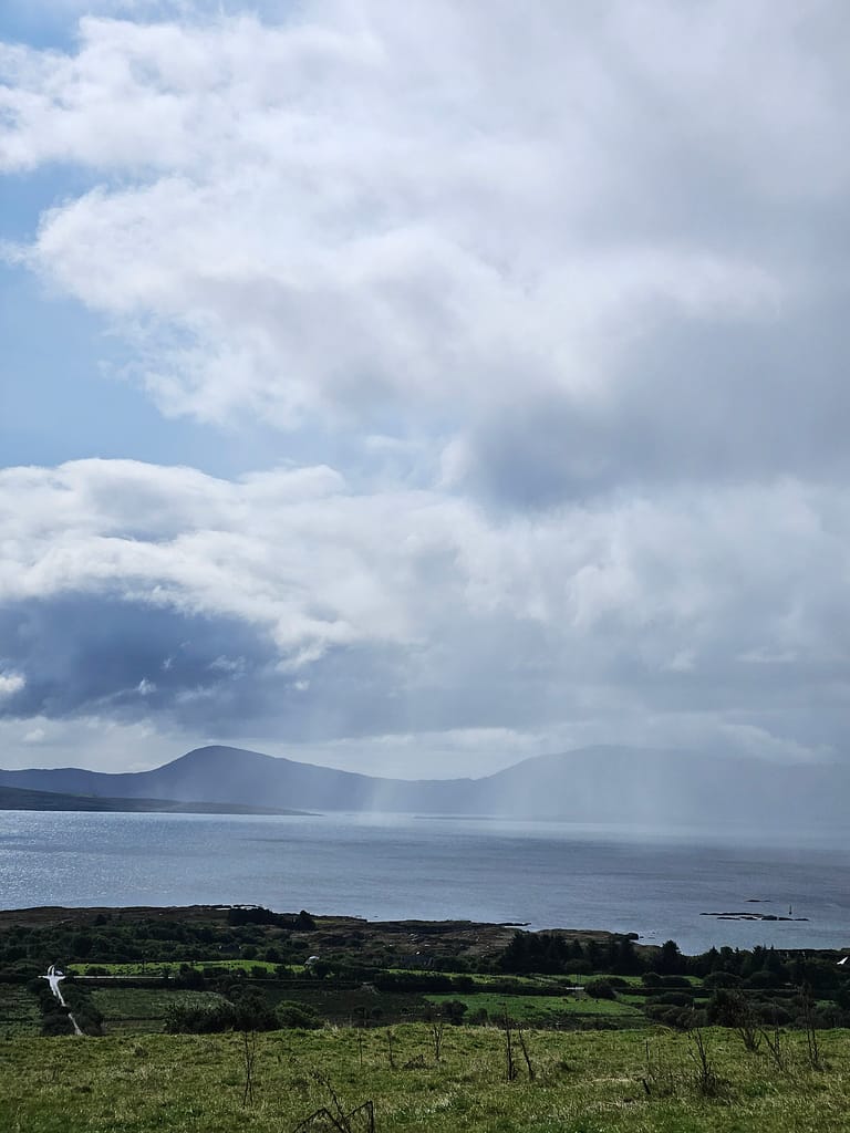
After descending the hill, you begin walking along the coast. Here, you pass by many summer houses and emerge into hidden coves. I stopped at one of these coves, taking advantage of the sun to soak up some sun. However, the rain soon began, then stopped. I continued my walk throughout the day, amidst the changing weather.
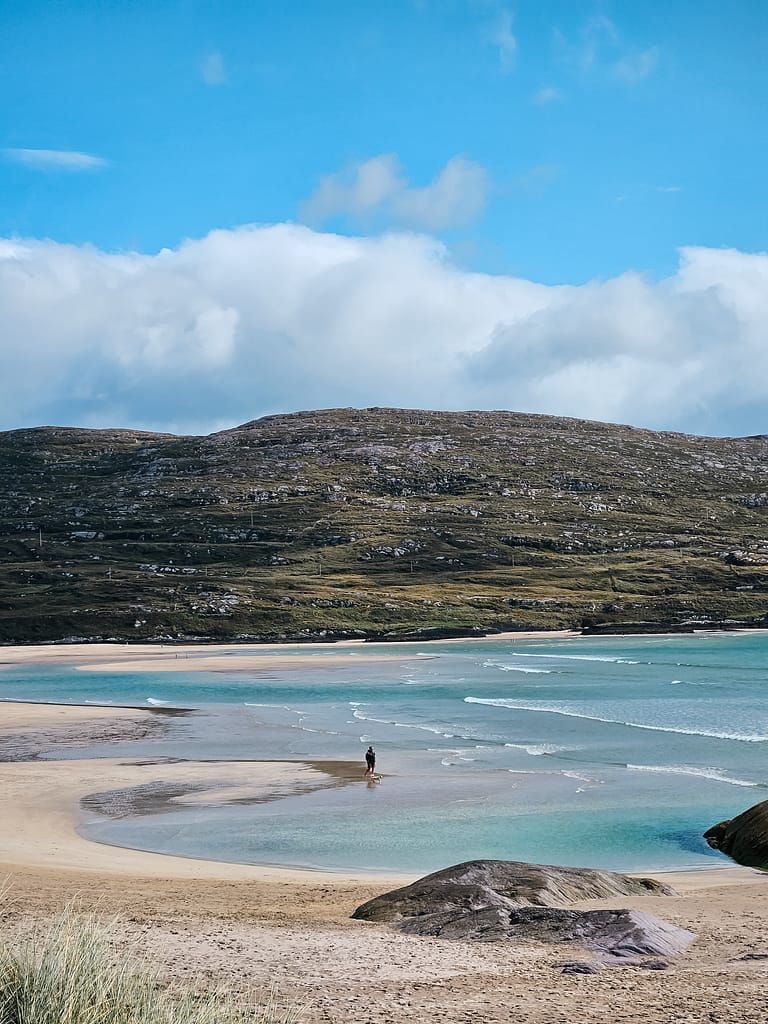
After climbing up and down a few small hills along the path, I reached a protected beach with pristine white sand. This beach reminded me of Patara Beach, which I'd encountered years ago while hiking part of the Lycian Way. It was incredibly special to me at that moment, and so was this one. I took another break here and tried to savor the moment. My mind was constantly on the new doors freedom was opening up to me. I was now defining my own freedom. All the emotions I'd experienced over the past few days, all the exhaustion, were worth it for the beauty of this moment.
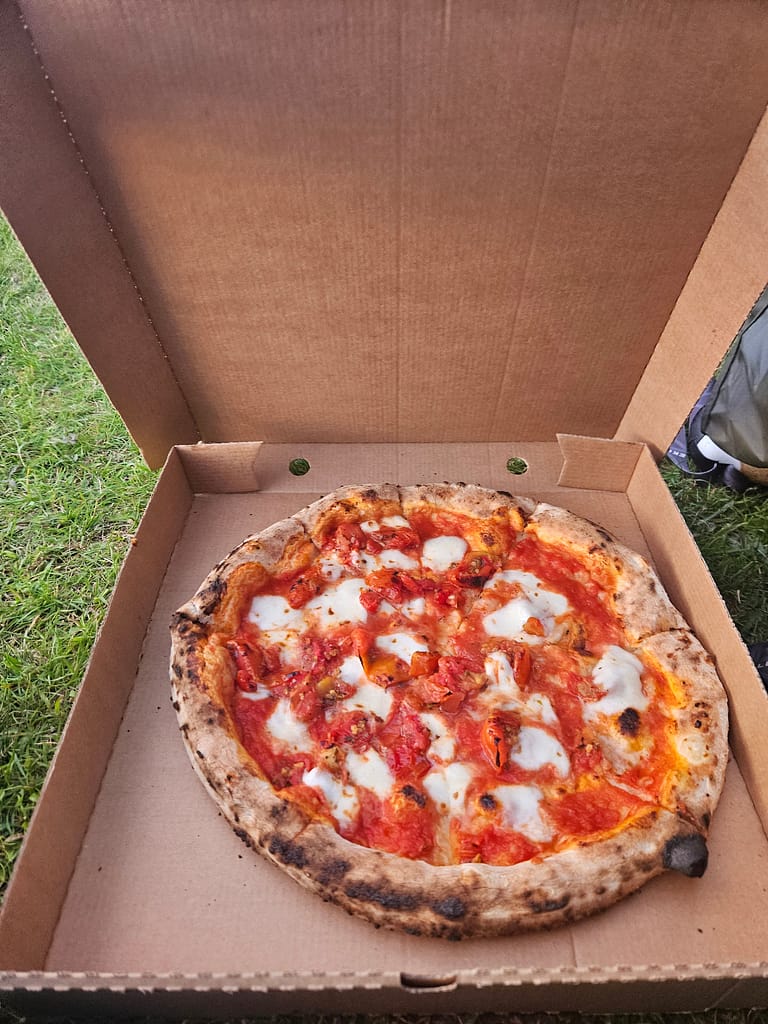
Because today's journey was relatively short, I arrived in Caherdaniel quite early. I stopped in the town first and had dinner. Then I walked to the campsite, about 20 minutes from town. The campsite I stayed in was quite nice, situated on the cliffs by the sea. However, it was quite busy and a bit noisy. Right at the entrance was a pizzeria that made pizzas in a wood-burning oven. Even though I had already eaten dinner, I ordered a large pizza. Afterward, I washed my clothes in the laundromat.
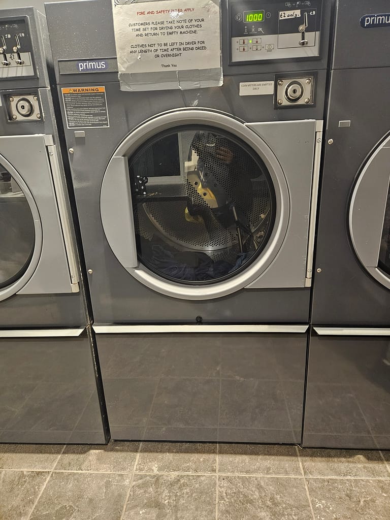
While waiting at the laundromat, I felt like I'd gotten used to this routine and could do it for days to come. A life filled with simple yet sufficient actions like being in a different place every day, setting up a tent, cooking a meal... And yet, self-sufficiency and not feeling inadequate. A life filled with fulfillment, free from all the struggles in our daily lives that make us feel inadequate. Why not?
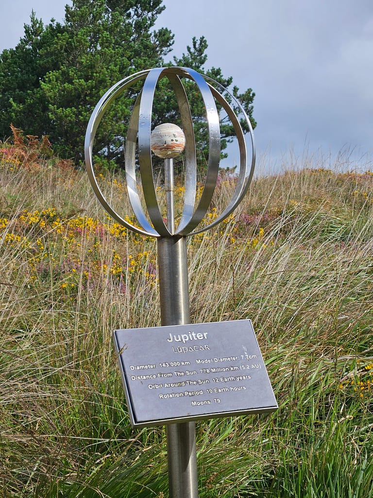
Day 7 Cahardaniel- Sneem
After breakfast at the campsite overlooking the Atlantic, I walked back to Caherdaniel. From Caherdaniel, I began the first section of the trail. At the beginning of the trail, there were statues representing the planets; the distance between the statues was determined by the distance between the planets. After examining the statues and their descriptions, I noticed rain clouds in the distance.
Today was a typical day of showers followed by sunshine, so I got to see plenty of rainbows, and even a double rainbow at one point.
The road rose slightly, moving away from the ocean and paralleling it. The view of the Atlantic Ocean loomed large in the distance. I mostly followed paths through the meadows.
Today, for the first time, I experienced a moment where I was completely free of the daily problems I'd left behind. Sometimes, the mind is slow to follow the body. Even though I've been physically immersed in nature and away from crowds for almost a week, my mind still dwells on the work problems I'd left behind.behind. Besides, when I got back, I kept thinking about what needed to be done. But since waking up this morning, my soul has captured my body, and I've finally managed to stay in the moment.
After continuing for a while through meadows and muddy paths, the path merged with the asphalt and stone road and passing through beautiful stone houses, I reached Sneem.
Unfortunately, there weren't any real campsites in Sneem. The only option was a caravan campsite, which I discovered didn't have any toilets. The lack of one in a campsite in the city seemed absurd to me. So I decided to stay at a guesthouse. It was a modest one with a fish restaurant downstairs. I usually prefer to stay in a tent, but it was sufficient for a night's stay.
Day 8 Sneem- Kenmare
This morning, I woke up with incredible pain in my feet. The fatigue of the day was starting to take its toll, and sores had opened up on my feet. What's more, I had another long and tiring day ahead of me.
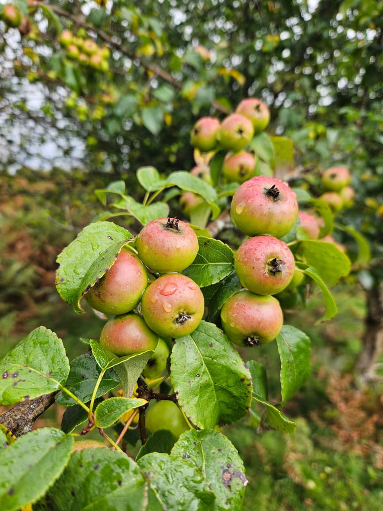
After breakfast at the guesthouse, I set off early without delay. Since today's route was approximately 30 km, I needed to manage my time carefully. It was quite foggy and misty this morning. The first part of the journey was mostly through village houses and farms. As I passed the occasional ruined house, I had the chance to sample plenty of apples from the orchards or blackberries growing along the roadside.
Then the road approached the ocean again, starting to run along the coast. Since it was a long distance today, I stopped by the shore to eat and rest for a bit. It was a very peaceful moment.
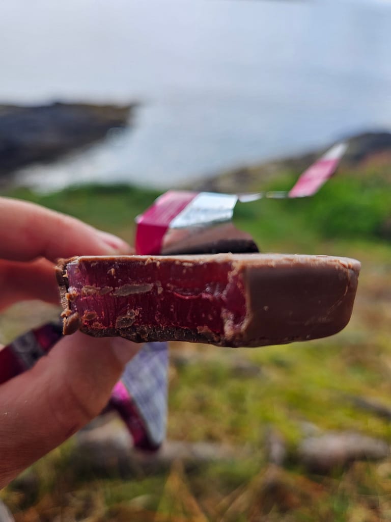
After dinner, I opened a snack I'd bought at the market a few days earlier that said "Turkish Delight." It was a wafer filled with Turkish delight. Smiling a little at the dessert, I pulled myself together and set off again.
The road continued along the ocean for a bit longer and then merged with a paved road. Here, I came across an impressive stone house, truly reminiscent of a castle. I took a few photos and continued walking. After that, I had to walk along the paved road for a long time, which made my feet even more painful.
Finally, I entered a path that curved inward across the asphalt road. The pain in my feet had reached an unbearable point, so I took a short break and rested by taking off my shoes.
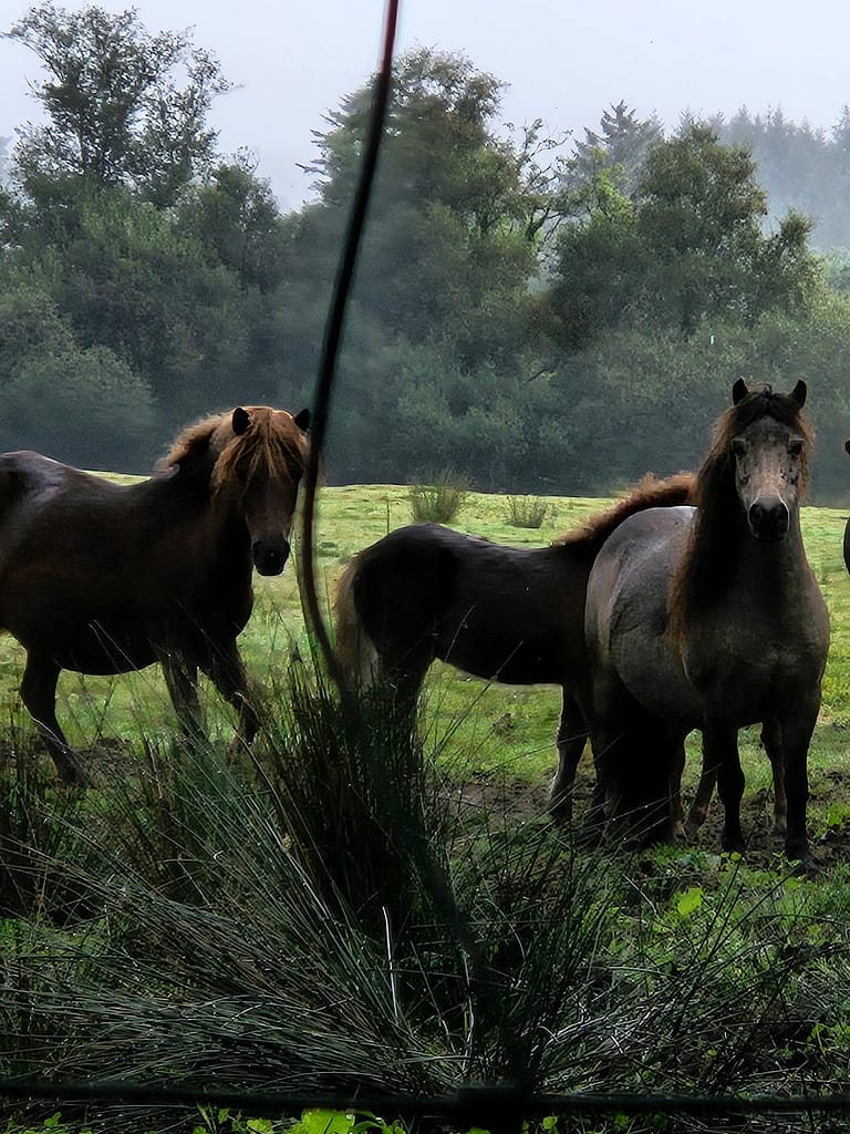
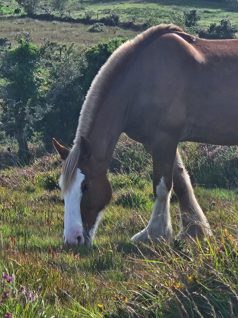
After relaxing a bit, the path began to pass through a large horse ranch. Walking among the enormous, thoroughbred horses was truly an incredible experience. The horses were exceptionally beautiful.
As the pain in my foot worsens, I realize that behind my life's successes lies something much deeper than talent: a stubborn resilience. It's a strange and powerful resistance within me that sometimes exhausts and beats me down, but even in the most difficult moments, it doesn't let me give up. It's a force that compels me to keep going, no matter what.
The next section of the trail begins with small wooded areas, ascending a hill. Then, you wind your way gently down the hill toward Kenmare. By this time, the sky had begun to darken. Along the way, I met a woman who, like me, was walking alone, and we chatted for a bit. She explained that she usually walks with her brother, but today, her brother had to go to the hospital because his feet were injured, so she was continuing on alone. While we were talking about walking alone, she asked me about the Lycian Way and wanted to know if I recommended she walk it alone. I regretfully told her I couldn't. After we left, a bittersweet feeling welled up inside me; even though I loved Lycia more than any other trail I'd ever walked, I was truly saddened to find myself unable to recommend it to a woman alone.
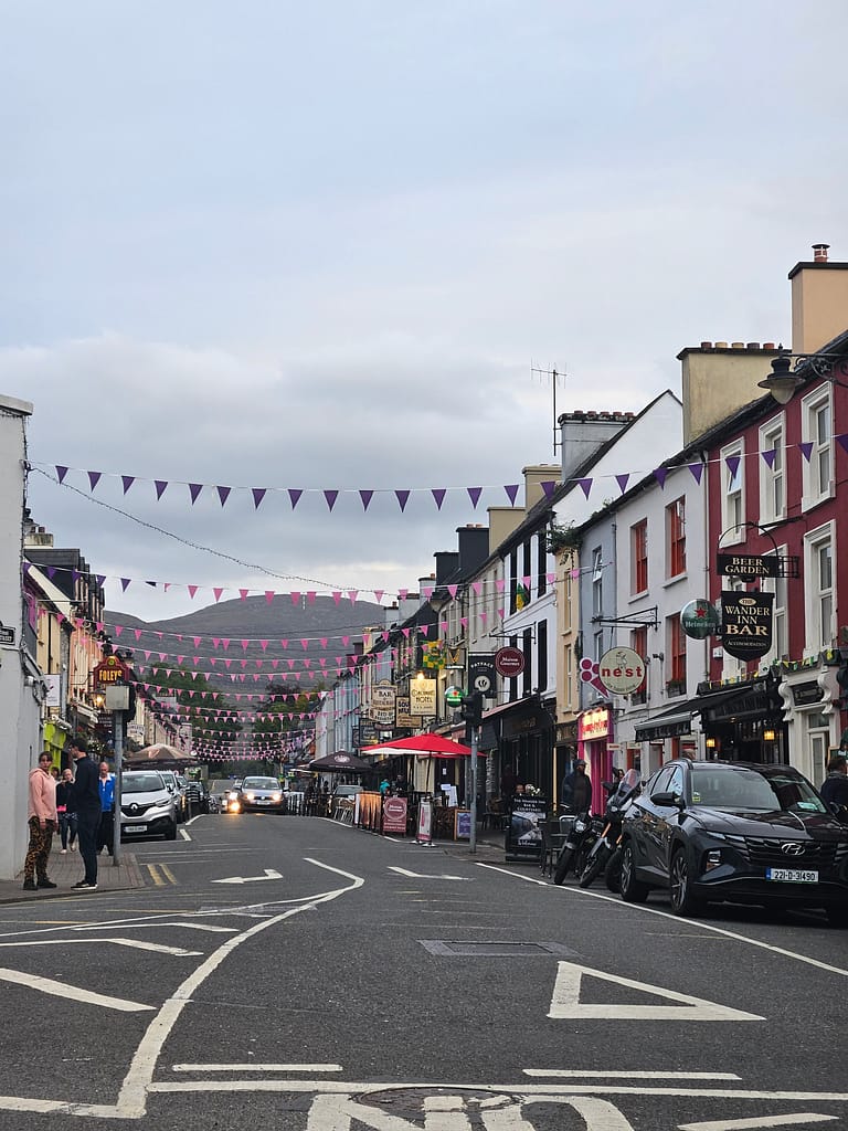
Kenmare is a small but lively settlement. It even has a Michelin-starred restaurant. I had originally planned to spend the evening outside, but after arriving at the guesthouse (again, I couldn't find a campsite, unfortunately) I couldn't go out because of the pain in my feet. I just ate a biscuit and fell asleep. Tomorrow was the last day of my hike.
9. Kenmare-Killarney
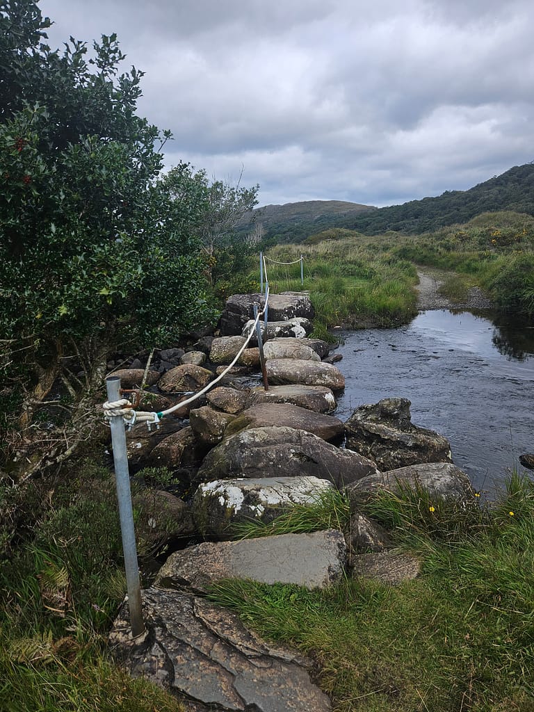
I woke up early, had a quick breakfast at the guesthouse, and then set off. Leaving Kenmare behind, I followed the paved road up a hill. Then, I crossed several streams, both large and small, until I reached the same junction I'd crossed the first day. Since it was August, the crossings weren't particularly challenging, but things might be different in the rainier months.
After reaching the junction, I reversed the route from the first day. I first walked through Killarney National Park, heading towards higher elevations. Then, when I reached a waterfall, I took a break because my feet were so sore that I couldn't walk anymore. Today's stop was truly a dream; I sat on the grass next to the waterfall on the hill, took off my shoes, and tried to savor the moment despite the pain.
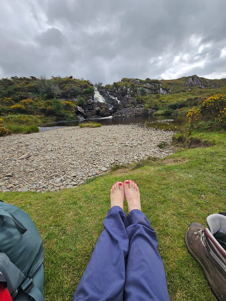
On my way back, I first reached the waterfall I'd seen the first day, and then Muckross Manor. Even though the journey was only 40-45 minutes away, the pain in my feet had become unbearable; I was forced to take breaks almost every five minutes. The tears of joy I'd shed the first day were replaced by tears of pain the last. To distract myself, I called acquaintances and asked them to tell me about the weather. At this point, I could have taken a taxi back to the hostel, but for some reason, having vowed to walk the entire route I'd started, I didn't allow myself to do so. First, I reached the Killary National Park sign and struck a victory pose. Then, thanks to the phone calls and the morale boost I'd received, I walked back to my hostel the first day.
I briefly regrouped at the hostel and went out to an awards dinner. I hadn't felt this accomplished in a long time. I celebrated with a few drinks.
The next day, I arrived in Dublin by train again, and since I didn't have time, I went straight to the airport. I boarded my return flight, knowing that my first solo adventure wouldn't be my last.
Publication
Updated
Frequently Asked Questions
Generally speaking, yes. The route is well-marked and frequently used. But walking alone always requires extra caution. I informed my relatives where I would be each day and also used an offline map. These small precautions are very reassuring.
I completed the route in nine days. The distance varies considerably from day to day—some days approaching 30 km, others shorter. A fast walker could complete it in seven or eight days, but I took my time and enjoyed the scenery.
May to September is the ideal time. I hiked in August; temperatures were around 18-19 degrees Celsius during the day and 10-11 degrees Celsius at night. Rain is inevitable, but it's usually short-lived.
Yes, but it's limited. I stayed at some campsites along the route and wild camped for a few nights. Since most of the land is privately owned, it's important to choose a location carefully. The locals are generally understanding, but it's a good idea to ask permission.
It's quite easy. There are plenty of streams and springs, but I always filtered my water before drinking. Carrying a small water filter is both lightweight and safe.
Irish weather is full of surprises 🙂 A waterproof jacket, spare socks, and a tent groundsheet came in handy. My pack weighed around 16-17 kilos — you learn to be a minimalist the more you carry.
The route is generally very well marked, but caution is necessary in fog or muddy areas. I used an offline map (Komoot), which was very helpful. Even with the changing weather, finding your way was no problem.
Estimated reading time: 178 minute
Write a Reply