- (I.e.Long, open water passages in lochs
- (I.e.Highland and forest landscapes
- (I.e.Portage (canoe/kayak transport) sections
Before we start
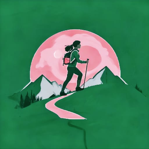
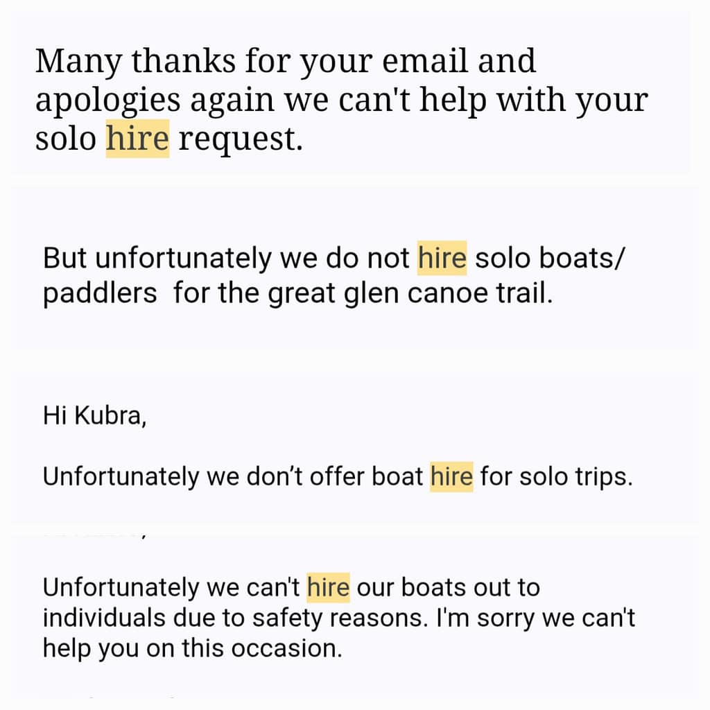
In 2024 West Highland Way After deciding to walk, I started looking at alternative routes I could add to the end of the hike, given my time. During my search, I was incredibly excited when I came across the Great Glen Canoe Trail; it had been a long-standing dream of mine to travel long distances by canoe/sea kayak and go camping. I immediately researched the route and found companies where I could rent sea kayaks (canoes). A month before my departure, I contacted each company individually, telling them I wanted to rent a sea kayak. However, something unexpected happened: None of the companies would allow me to rent a sea kayak on my own due to safety concerns. Unfortunately, I had to postpone my request for the time being because I was short on time, but I didn't give up.
For about a year, I corresponded with numerous companies. Some referred me to another company, and then to another, and I was bombarded with endless emails. After all this correspondence, I finally convinced one company to rent me a sea kayak on my own. Perhaps I should have given up when I encountered so much resistance, but at some point, this feeling turned into stubbornness. I needed to prove to myself that I could face uncertainty and risk, that I could truly succeed. I think, until this journey, the risks I took in nature had always been limited, and as a woman, that limit wasn't often exceeded. In this sense, this journey became a personal matter for me.
When I received a confirmation email from a company, I started planning for May 2025.
Great Glen Canoe Trail
General Information
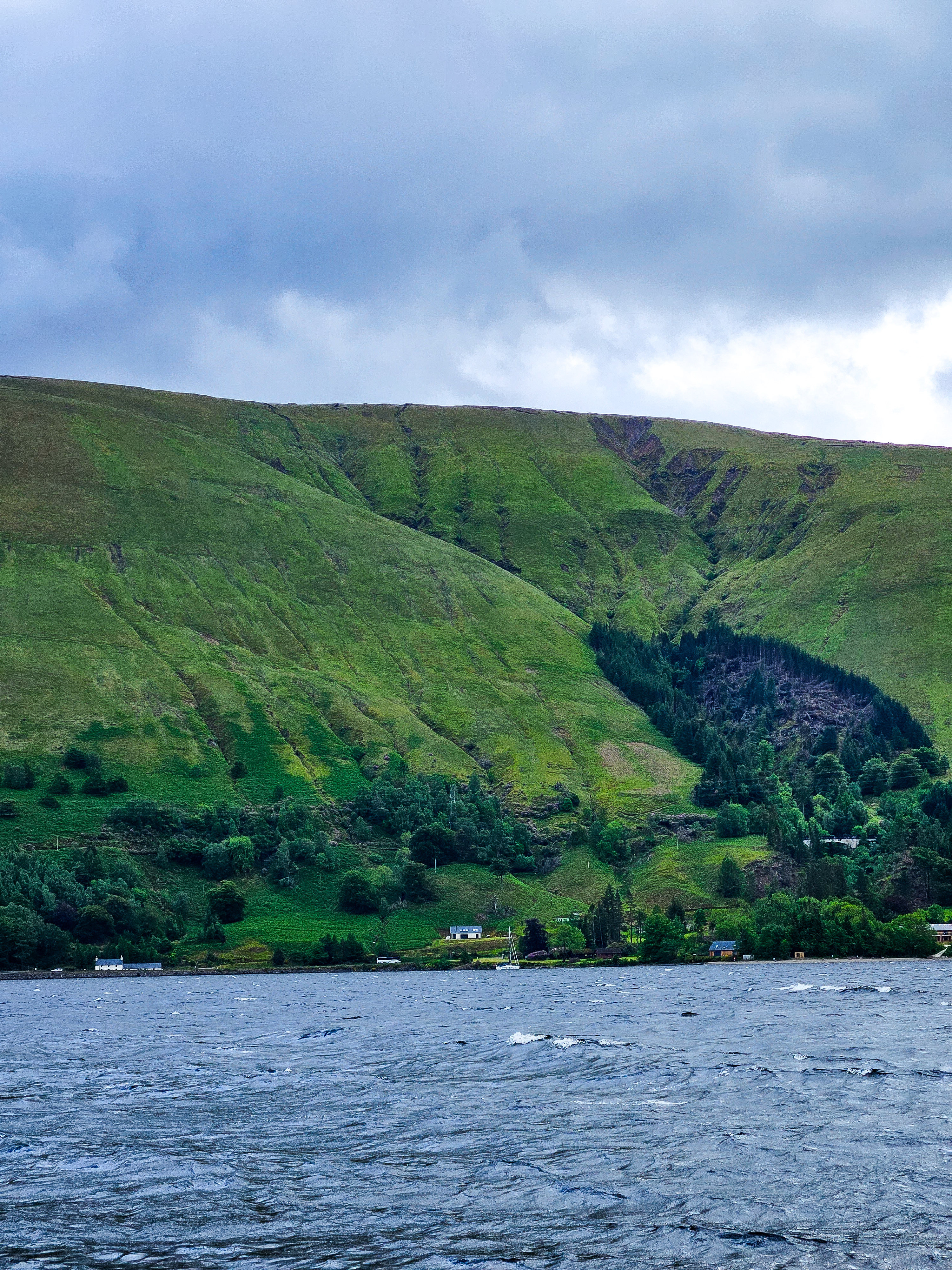
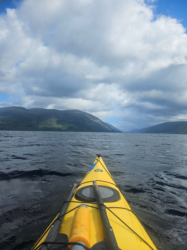
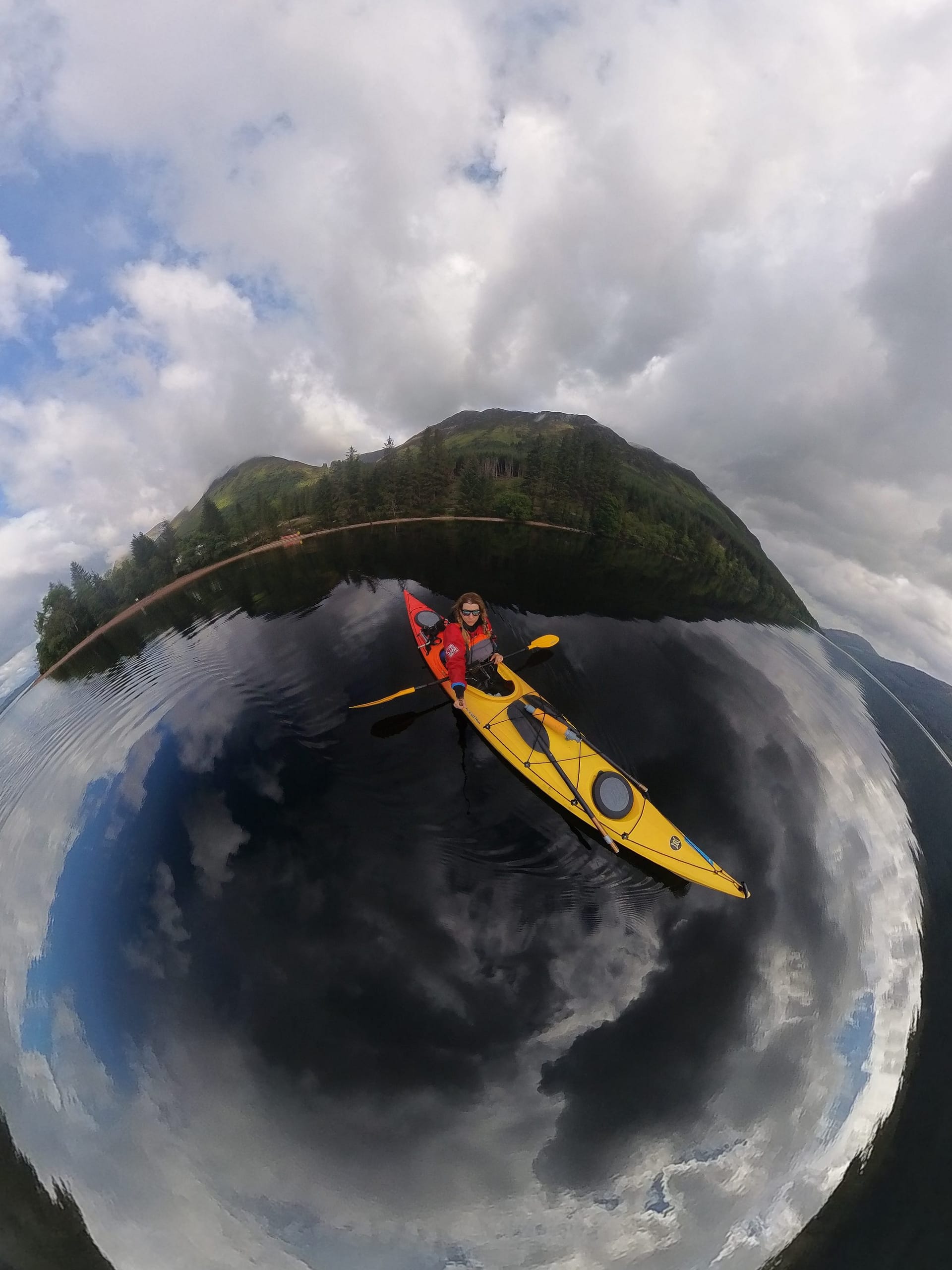
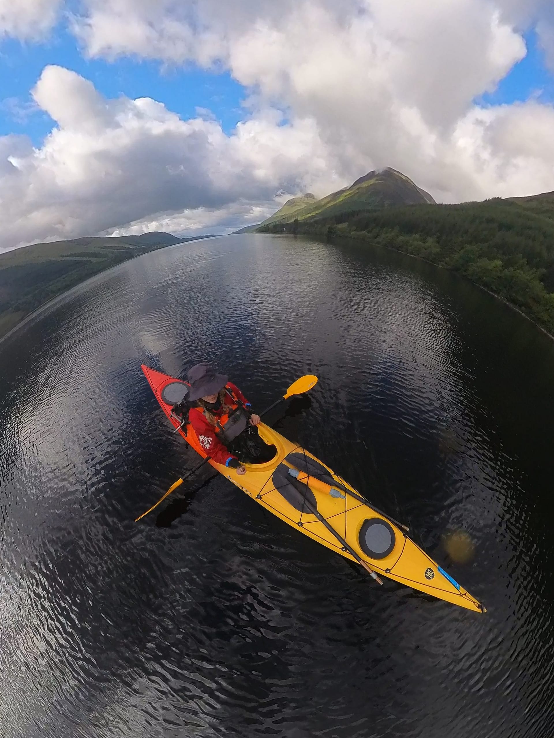
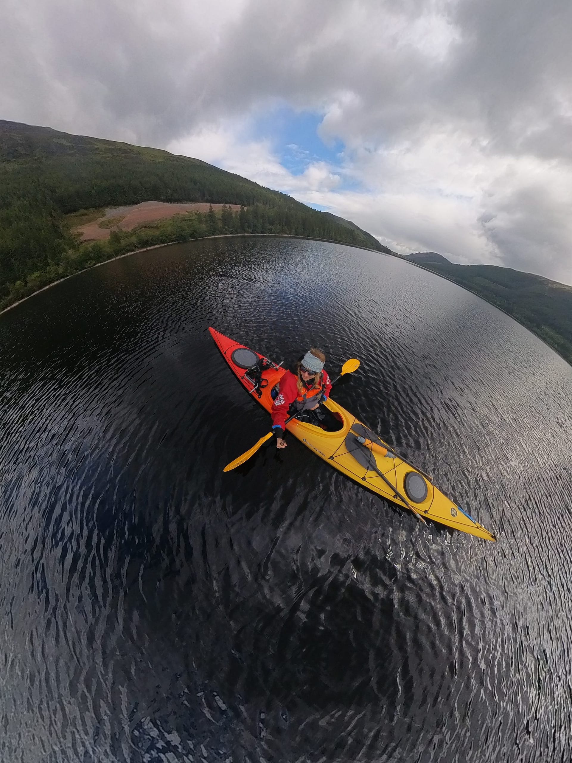
The Great Glen Canoe Trail is a 100-kilometer route from Fort William to Inverness, traversing Caledonian canals and lochs. Along the way, you'll encounter Highland landscapes and extensive woodlands. It's also a popular route for shipping and private yachts.
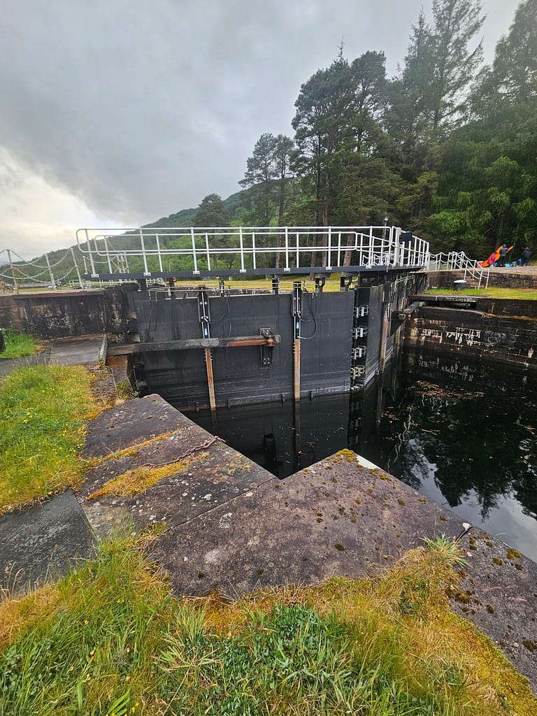
Along the route, you'll travel through channels and crossings connecting lochs. Because the lakes are at different elevations, motorized or large boats are ferried into locks where the water level is adjusted. However, this system doesn't work for human-powered vehicles like canoes and kayaks, so they're transported by land at the crossing points.
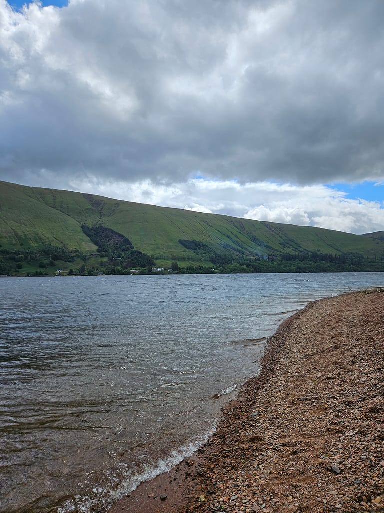
There are three major lochs on the Great Glen Canoe Trail: Loch Oich, Loch Lochy, and Loch Ness. These lochs can reach depths of up to 250 meters. This depth, combined with Scottish winds, can create high waves. Wave heights can reach up to 2-3 meters, and water temperatures can drop to 4 degrees Celsius in winter. The main reason companies are reluctant to rent to me alone is because these lochs can be potentially dangerous.
Route
The Great Glen Route is typically divided into five sections. However, thanks to the variety of campsites along the way, it's possible to split it into several days. Some people complete it in a shorter time, in three or four days. However, I found five days sufficiently challenging. When planning your route, it's a good idea to consider the maximum distance you can paddle in a day. If you're camping at the end of the day and carrying all your equipment, it's important to remember that the weight of your canoe or kayak will significantly affect your speed.
The route is mostly south-to-north due to the prevailing wind direction; however, it's also possible to reverse the route when the wind periodically changes direction. In fact, the most challenging part of the route is the loch crossings, especially Loch Ness. Its size and depth make it almost as impressive as the Bosphorus, yet also intimidating. It's crucial to stay as close to shore as possible in the lochs. While the wind varies, the west shore of Loch Oich is generally more sheltered and safer, while the east shore of Loch Lochy and Loch Ness is generally more protected and safe.
The biggest mistake to avoid on the route is trying to cross the lochs diagonally from one side to the other. While it may seem close at first glance, the distance is actually quite long, and such a crossing creates an extremely risky situation, leaving you completely exposed to the waves.
Route Planning
When planning the Great Glen Canoe Trail route, I used the guidebook and the guide map published by Scottish Canals and made the plan directly according to the sections suggested in these sources.
https://www.scottishcanals.co.uk/visit/things-to-do/paddling/discover-the-great-glen-canoe-trail
Briefly, the route sections and my original plan.
| Day | Start → End | Approximate Distance | Section / Lake | Camping / Accommodation Options | Difficulty | Channel Transition |
| 1. Day | Banavie (Fort William) → Gairlochy | ~ 12 km | Caledonian Canal | Gairlochy campsite | Easy | 1 |
| 2. Day | Gairlochy → Loch Lochy → Loch Oich (Leiterfearn) | ~ 22 km | Loch Lochy + Loch Oich + Canal | Leiterfearn campsite | Medium | 1 |
| 3. Day | Loch Oich → Fort Augustus → Foyers | ~ 26,5 km | Loch Oich + Canal | Foyers campsite | Hardly | 3 |
| 4. Day | Foyers → Dochgarroch | ~ 23,5 km | Southern part of Loch Ness | Dochgarroch campsite | Hardly | 0 |
| 5. Day | Dochgarroch → Inverness (End) | ~ 8 km | North of Loch Ness + Dochgarroch | Inverness camping/accommodation | Easy | 1 or 2 |
However, due to the weather, rain, and wind, I couldn't stick to my plan. Although I had a five-day rental period, I only managed to canoe for four. Some days I had to finish early or start late. On Day 5, the wind changed, so I didn't make any progress. As a result, I only made it halfway to Fort Augustus, and my route was as follows:
| Day | Start → End | Approximate Distance | Camping | Channel Transition |
| 1. Day | Banavie (Fort William) → Gairlochy | ~ 10 km | Gairlochy campsite | 1 |
| 2. Day | Gairlochy → Glas-dhoire | ~ 12km | Glas-dhoire | 0 |
| 3. Day | Glas-dhoire → Loch Oich (Leiterfearn) | ~ 14km | Leiterfearn campsite | 1 |
| 4. Day | Loch Oich (Leiterfearn)→Fort Augustus | ~ 12km | Small green space by the harbor in Fort Augustus | 3 |
My biggest mistake while planning was thinking like a hiker, renting a sea kayak for only five days and buying my return ticket accordingly. It's possible to make some progress on the hike when it's rainy or windy, unless you're at high altitude. However, in the water, it's much riskier because the wave height and risk of capsizing increase rapidly. Therefore, my advice to anyone planning ahead is to add a buffer of one or two days to their itinerary.
Route Tracking
I usually use GPS logs, accessible through apps like Hiker or Komoot, for my hikes. However, for this canoe trail, I couldn't access GPS from any app or online. So, after a long period of learning and research, I decided to create my own route. Using Garmin apps and the help of a guidebook, I mapped out the five-day GPS route myself. Along the way, I marked campsites, shopping spots, portages, canal gates, and so on. I then sent these GPS maps to my Garmin watch and followed them from there. I was able to map them with almost 95% accuracy. However, it turned out I had placed the markers earlier than intended in some places. I also added notes on the map for some important points, such as "stay to the right due to the current," "beware of fish farms," and so on. You can access the GPS logs for each of the five days via the link below. Since I had only reached Fort Augustus, I didn't have a chance to use the logs from Days 4 and 5.
Doing a Solo
The British Canoeing organization (similar to our sports federations) recommends that canoeing, kayaking, and SUP activities be carried out with at least two people for safety reasons. Therefore, companies can consider solo rentals risky.
The biggest risk of soloing is not having someone to help you if something happens, or at least notify the authorities. For safety reasons, I always carry my Garmin InReach Mini with me on all my solo activities. It allows you to place an SOS call in case of emergency and send and receive messages via satellite even if your phone doesn't have signal. It also lets you share your live location.
Despite all the risks I took, I must say I didn't struggle too much with the solo portion. Although my sea kayaking experience is limited, I think my existing outdoor experience and decision-making skills helped me manage the risks. I stopped when I needed to and didn't take unnecessary risks just to finish the route. I managed to stay calm during challenging moments. Therefore, it's essential to have a high level of confidence in these areas before embarking on a similar solo journey.
As a solo woman, I'd also like to point out that Scotland is a very safe place. I encountered other hikers and canoeists at the campsites, and I didn't experience any safety issues. Everyone was incredibly friendly.
What should be taken into consideration in the Caledonian Canals?
To proceed safely on the canal sections of the Great Glen Canoe Trail, it is necessary to observe some basic rules. Always You have to go to the rightLochs can be navigated from any shore. You may see signs indicating shallow water at some points, but this is more important for boats. I didn't encounter any shallows that would pose a problem for sea kayaks or canoes.
Some of the piers as you approach the channels high It can be difficult, so it's essential to have a rope/rope ready when docking. The current in the channel is generally gentle, but it can increase after rain or at river junctions. Generally, the channel sections are calmer than the lochs, but caution is necessary as boats pass very close by. If you see a boat approaching, be sure to keep your distance.
Route Preparation
I can say that route preparation was the most challenging part of the process. Before embarking on this trip, I was actually quite amateur in sea kayaking. Previously, I had only done short, one- to two-hour routes per day, and my experience with sea kayaking was mostly activity-based. I hadn't received any training. I had already paddled a few times on lakes around Istanbul in inflatable kayaks purchased from Decathlon and participated in one-hour canoeing events on the Bosphorus. So, although I didn't realize it at the time, this trip was actually well above my level.
Throughout the preparation process, I watched a lot of YouTube videos and reread the guidebook over and over. While I tried to fill my gaps in knowledge this way, I eventually realized how much I was missing, but it was too late now.
From this experience, I gathered important topics based on both what I learned in my research and the lessons I learned from the mistakes I made.
Canoe or Sea Kayak?
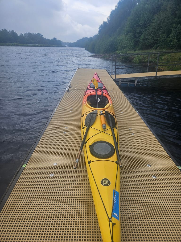
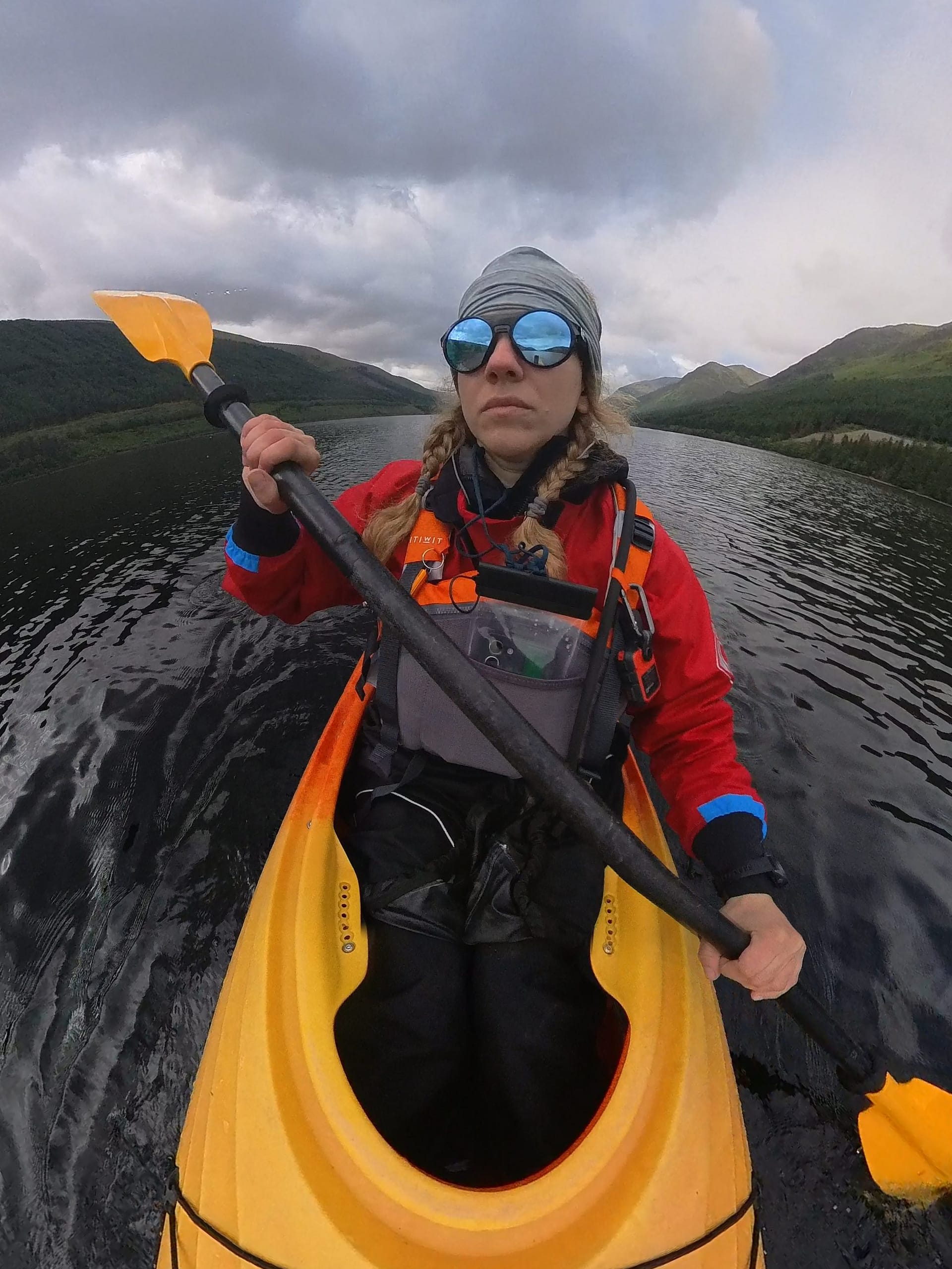
Although canoeing and sea kayaking are generally pronounced as "canoe" in Turkish, in practice, they are two distinct, human-powered modes of transportation. A canoe is wider and more open than a sea kayak, typically propelled by a single paddle. Sea kayaks, on the other hand, come in two varieties: sit-in and sit-on. The sit-in is preferred for longer journeys, and the longer, thinner vehicle is usually made of plastic. Both types of boats can be rented for this route, but each has its own advantages and disadvantages.
After extensive research, I've gathered the necessary information to make my decision. In short, let me compare the pros and cons:
| Traits | Canoe | Sea Kayak |
| Stability | Stable with load | Wind resistant |
| cap size | Less likely to be capsized | More likely to be capsized |
| Protection against rain | Due to its open structure, water can fill in. | If kept covered with a spray skirt, the possibility of water ingress is very low. |
| Load Carrying | Can carry a lot of items | It has a more limited volume than a canoe. |
| Speed & Efficiency | Slower; wind sailing option available | Fast and efficient |
| Performance on the Wave | It may be difficult in big waves | When the technique is known, the wave is more controlled. |
| Portage | It is difficult to carry because it is heavier and bulkier. | Easier to carry |
| Solo Use | Difficult to use solo in windy conditions | Ideal for solo use |
| General Suitability | Enjoyable in calm weather | Safer and more practical in most conditions |
In reality, a canoe is less likely to be capacious, so it might seem more logical from a safety perspective at first glance. However, when used alone, it's considerably slower than a sea kayak. Furthermore, because I had to do the portage part alone, a sea kayak seemed more advantageous to me. Finally, because I wasn't used to single-sided paddling and all my previous experience was with double-sided paddling, I opted to rent a sea kayak.
Canoe/Sea Kayak Rental
Rockhopper Sea Kayaking was the only company that responded to my request to rent a sea kayak on my own. I paid beforehand and secured a five-day rental. I rented all the equipment, including a skirt, pump, sponge, spare paddle, and more, and also received transportation services (drop-off at the beginning and pick-up at the end). £420 I paid.
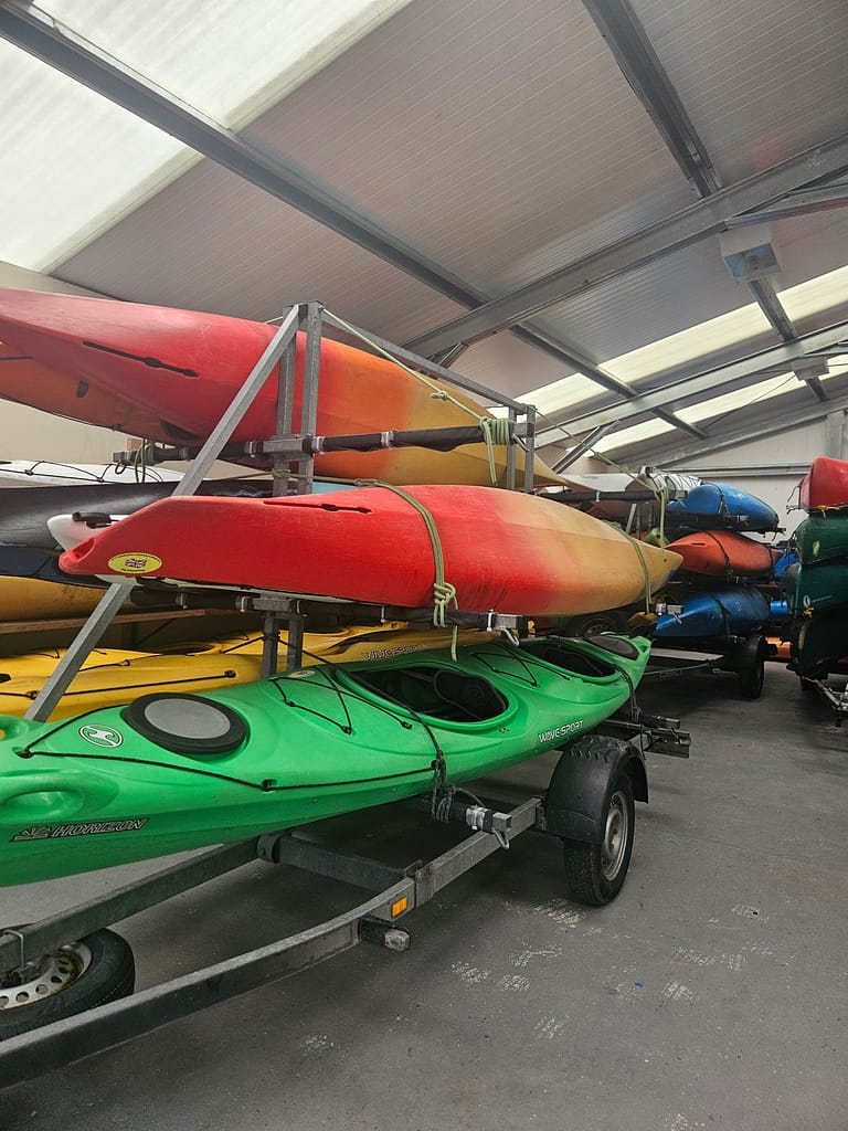
I can say I was very pleased with the service. They responded to emails very quickly, arrived on time for our meetings, and were a very friendly team. They were also very flexible; I had to change the meeting point because I had to cancel my route, and they accommodated this seamlessly. I also appreciated their frequent check-ins to see how I was doing. I plan to use this company again for future visits.
Channel & Portage
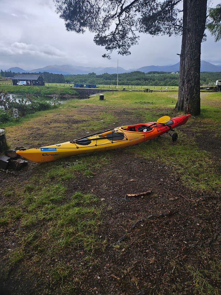
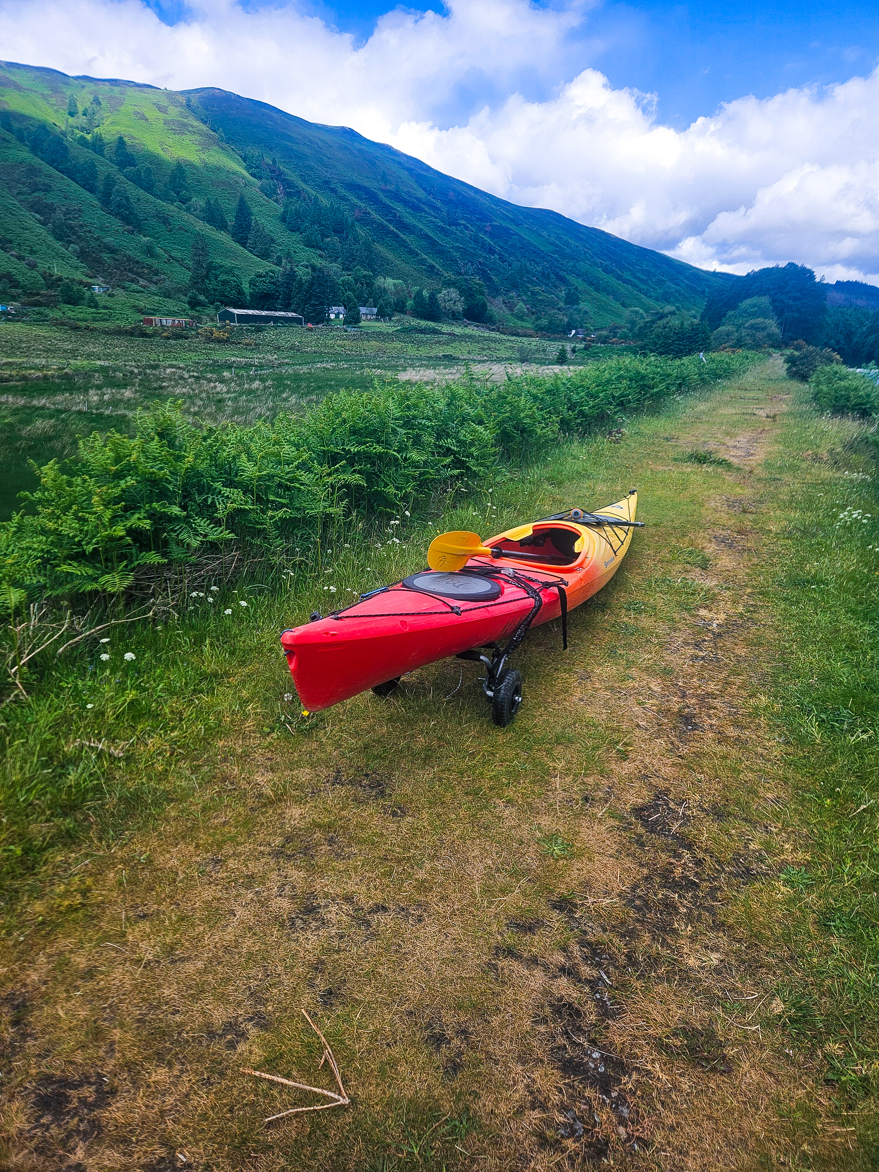
One of the most challenging sections of the Great Glen Canoe Trail porterage The process of moving a kayak/canoe over land, called canoeing. When you reach the canal gates, you lift the kayak out of the water. trolley You need to attach the wheels called "wheels" and pull it from land to the end of the covers, then lower it back into the water.
You have to do this a total of 7-8 times along the way (depending on where you start in Fort William and finish in Inverness). This is something I've never experienced before. Since all my canoe/sea kayak trips in Türkiye started from the seaside, I didn't need any transportation. I watched plenty of videos before going. trolley I tried to learn theoretically how to attach a sea kayak and how to take it out of the water.

However, practice proved far different from theory, and this was the most challenging part of the journey. I hadn't adequately considered the weight of the kayak and the surrounding conditions. When I went to the rental company, the employee showed me how to attach the wheels; it seemed so easy. Simply attach the straps to the wheels and tighten them. However, once I reached the first portage, retrieving the kayak from the water proved much more difficult than I'd anticipated. My sea kayak, which normally weighs 20-25 kg, had swelled to 45-50 kg with my gear, food, and water. I tried to pull it out by the front, but I nearly fell into the water.
After getting it out of the water, I managed to get the wheels back on; but the path was rocky, and because the canoe was heavy, every four or five steps the wheel would come off due to friction, and I had to put them back on. The first portage was about 600 meters and took me almost an hour. The process was truly frustrating.
I kept thinking I was doing something wrong and trying to figure out how to fix it from videos in the tent that evening. After a while, inspired by a few videos, I developed a solution. Luckily, I had brought extra rope and carabiners with me.
When I approached the dock, I first secured myself to the dock using a carabiner using the rope attached to my kayak. This was necessary because some of the piers were quite high. Normally, when transferring from the kayak to the dock, you have to sit up slightly, then extend your legs; however, some of the piers were much higher than I expected—about 50 cm. In this situation, I had the risk of the kayak floating away as I tried to climb onto the dock. This method became one of the solutions I developed along the way.
Once on the dock, I pulled the kayak remotely using a rope; this prevented me from bending over too much and minimized the risk of falling into the water. After retrieving the kayak from the water, I looped the straps around several points instead of just tightening them to prevent slipping. This method allowed me to proceed much more smoothly, although I still encountered some minor issues.
Capsized & Self Rescue
I think that's what I'm most worried about before I set off. be capsized, meaning falling from a sea kayak. Because the temperature of the loch waters can drop to +4 degrees Celsius; when I crossed, the estimated temperature was around 10 degrees Celsius. This is a temperature that can quickly lead to hypothermia if you fall into the water. Furthermore, I had no experience other than theoretical knowledge about what to do in a capsized situation.
A boat that is normally capsized roll technique to correct it or because I did it alone self-rescue having a method Cowboy exit You need to get back on the sea kayak with. Before I set off, I contacted a few canoe/sea kayak event companies and clubs to get a short training session to teach these techniques. However, most places said they didn't offer such short training and couldn't offer it. As far as I could tell, most event organizers lacked expertise in these techniques.
Having set out with this shortcoming, I developed a method for myself: always stay close to shore in case of a capsize. If I fell over, I would pull my kayak ashore, drain the water there, let it dry, and then continue on. Fortunately, the sea kayak the company rented was quite stable. Although I nearly fell in a few places, I never capsized. Since the sea kayak was so heavy due to the materials, I later realized I wouldn't be able to roll.
With my current knowledge, I can clearly see that embarking on this journey without self-rescue skills is quite dangerous. At some points, I couldn't seem to get as close to shore as I'd hoped. When I finished the route, I realized how deficient I was and felt I absolutely needed to get sea kayak training.
Two or three months after Great Glen, I joined BODEKA, a sea kayak club. There, I first learned double rescue techniques and then, through Sea Kayaköy's Sea Award training, learned self-rescue. Although it's late for this trip, I feel more confident about future ones.
When to go & What's the weather like?
Considering Scotland's almost perennial rainfall, the midge problem, and the water temperature, finding a suitable time is a real challenge. While air and water temperatures are typically better in July and August, the abundance of midges (a type of fly) during this period makes the journey quite uncomfortable.
April and May are the best months of the year for rainfall; they receive less rain than other months, and the midge season hasn't yet begun. Even though the water temperature is cooler, I chose May considering the rainfall. Unfortunately, I didn't experience good weather, and it was rainy and windy for the entire week I paddled. Everyone I met before I started told me that the weather had been incredibly good for a month, with barely a drop of rain, and it had started just this week. I guess I was a bit unlucky in that regard.
Because the weather in Scotland changes so quickly, even my GPS forecasts were almost always accurate. I tried to plan my day based on the weather forecast, but when the forecasts weren't right, that wasn't really possible. So I just visually monitored the weather, stopping when it started to get worse and waiting for it to improve. If it didn't, I called it quits after a while.
How Did I Prepare?
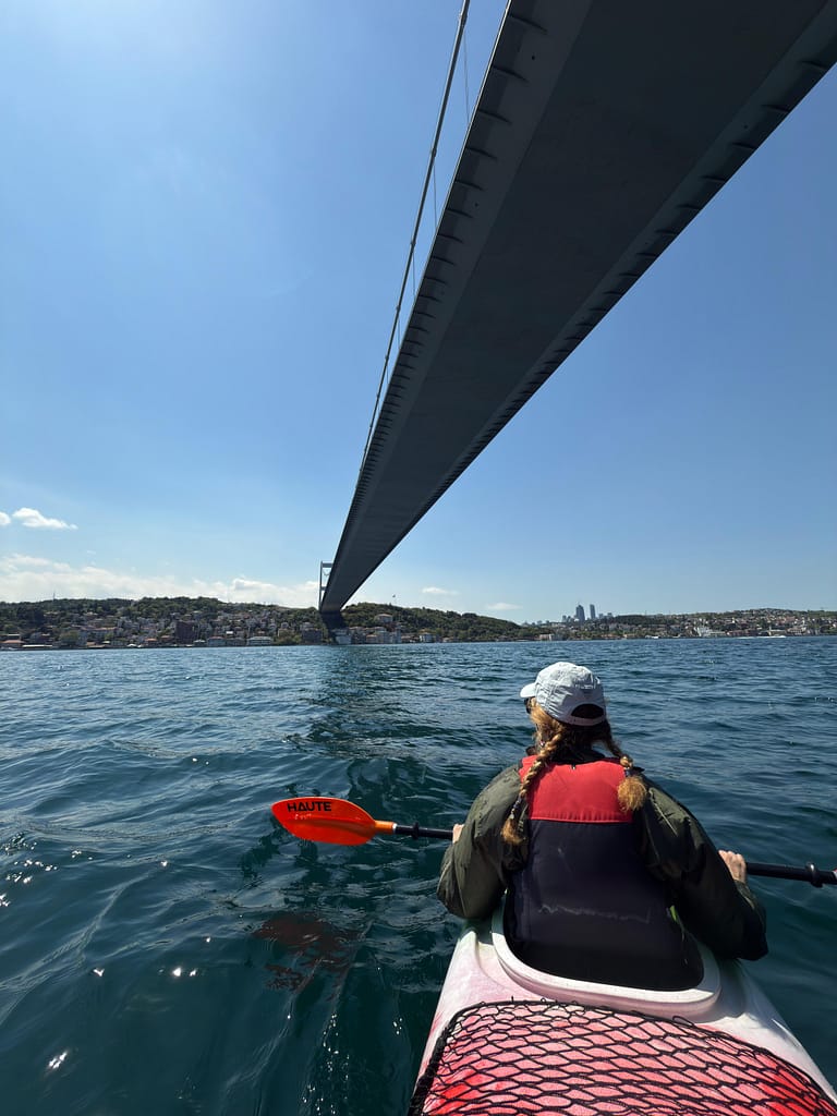
Besides all the planning, the most important thing I needed to do before I set off was to practice a little. I hadn't rowed for almost six months. However, From Nepal Because I had just returned and the weather was not good, I was only able to participate in a sea kayaking event on the Bosphorus once, and that lasted a total of one hour.
I had a funny moment at this event. People usually go to canoeing events on the Bosphorus to take photos. When I participated, the instructor suggested I take photos near the bridge. However, when I said I didn't want photos and wanted to go a little further, he said, "Well, then you're really here for canoeing." I replied, "Yes, I'm here for canoeing." Realizing I was there for a more athletic purpose, we went a little further, and he showed me a few paddling techniques along the way. I thought, at least I'd made some profit for the short day.
But looking back today, I wish I'd gotten in a few longer practices, longer than 4-5 hours, during my preparation. While I'm confident in my walking endurance, rowing for long periods is a completely different discipline and one I definitely needed to improve on. I did 14-15 km on some days during the trip, but I think I might have struggled on the 24-26 km days if the weather had been good and I'd followed the regular route.
Camping & Equipment Preparation
The camping part was within my comfort zone, as I was familiar with it from hiking. I didn't have much trouble deciding what to pack, which was light and sufficient. However, what was new for me was loading the canoe and how to do it. I consulted extensive online resources on this topic.
Clothing was a bit more challenging for me. It was difficult to find sufficient materials, and what I did find was difficult to obtain in Türkiye.
Camping & Water Status
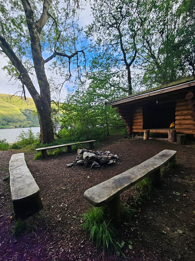
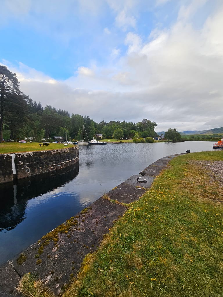
The Great Glen Canoe trail offers a wide variety of camping options. Camping is completely legal in Scotland. Leave no trace means you're allowed to do so almost anywhere without leaving anything behind. Along the way, there are plenty of informal campsites, trailblazers (used by canoeists/sea kayakers), and camping businesses. Here are the places I camped at the end of the day.
| Day | Start → End | Camping |
| 1. Day | Banavie (Fort William) → Gairlochy | Gairlochy informal camping area |
| 2. Day | Gairlochy → Glas-dhoire | Glas-dhoire trailblazer |
| 3. Day | Glas-dhoire → Loch Oich (Leiterfearn) | Leiterfearn trailblazer |
| 4. Day | Loch Oich (Leiterfearn)→Fort Augustus | Small green space by the harbor in Fort Augustus |
Along the way, usually at the points where the canal gates are located, there are small huts belonging to the canal operators where you can use restrooms and showers. To use these, you need to register with the canal operators and get a key. I had already registered, but Rockhopper already had a key, so they lent it to me. They told me it was the last one they had and that I shouldn't lose it. I must say I made an extra effort to protect it along the way 😊
Additionally, registration is recommended for security reasons, such as allowing channel administrators to monitor traffic. You can use the link below.
https://www.scottishcanals.co.uk/visit/things-to-do/paddling/register-your-trip
Gairlochy was an informal campsite located right next to a canal. On the opposite side of the canal was a small hut with toilets and showers. Inside the campsite was a composite toilet.
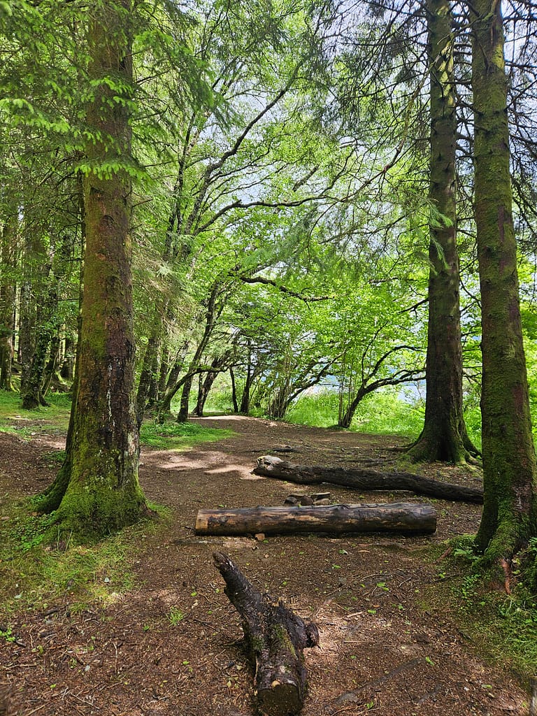
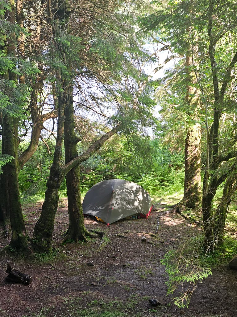
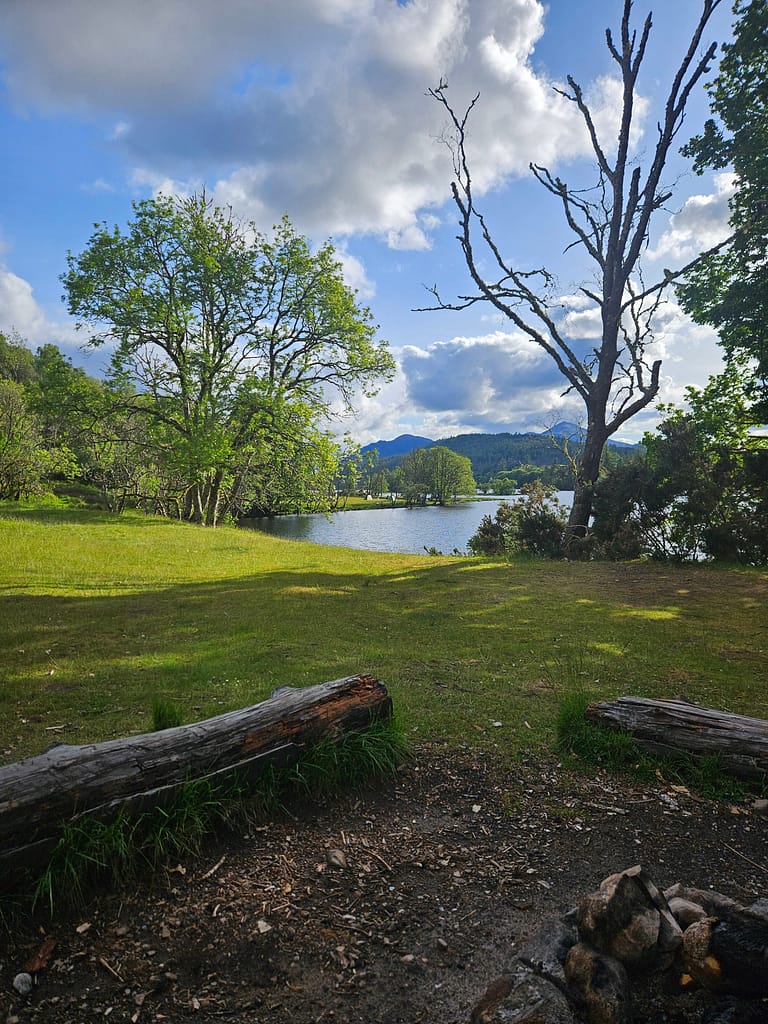
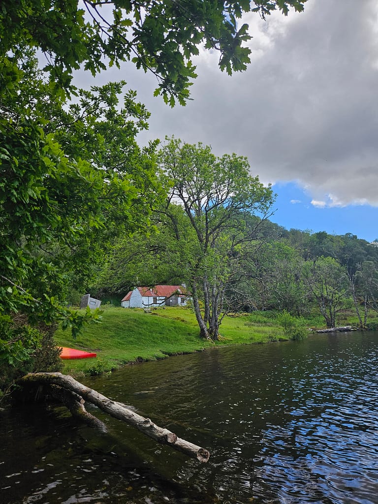
Glas-dhoire was one of the most beautiful places I've ever camped. It was nestled in a forested area right next to Loch Oich. There was no road access; only walkers and canoers were allowed. The site had a composite toilet and a small, semi-open hut to shelter from the rain.
Leiterfearn was a truly beautiful area. It was a bit more open than Glas-dhoire, but it offered a fairly wide flat area with direct views of Loch Lochy. There was a composite toilet here too, but it had collapsed, along with its shed, so it was out of use.
Fort Augustus is a fairly central location, with plenty of B&B options. I pitched my tent on a small grassy area near the canal entrance, not far from the canal. There were also restrooms and showers nearby.
Because I wasn't sure I'd have any water problems, I'd filled all my bottles before setting off and packed extra water. However, I was able to find water at all the campsites, either from the canal system or from natural springs. I also brought a filter. As a result, I had no problems at the end of the day.
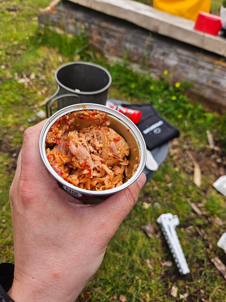
Food & Shopping Status
I normally do all my food shopping before I set off, but due to the UK's meat and dairy restrictions, I shopped in Scotland this time. Luckily, camping-friendly food is readily available in most UK supermarkets. When I arrived in Glasgow, I first stopped at an outdoor store to pick up some camping supplies, then went to a supermarket to stock up on whatever fresh food I might be craving. Since I wasn't carrying it on my back this time, I figured I wouldn't need to pack too much. (Of course, I hadn't really considered the hassle of hauling the kayak out of the water and fitting the gear into the sea kayak.)
Shopping options are available at Fort William, the starting point, and at Fort Augustus, midway along the route. Fort Augustus also offers a pharmacy, restaurants, and other amenities.
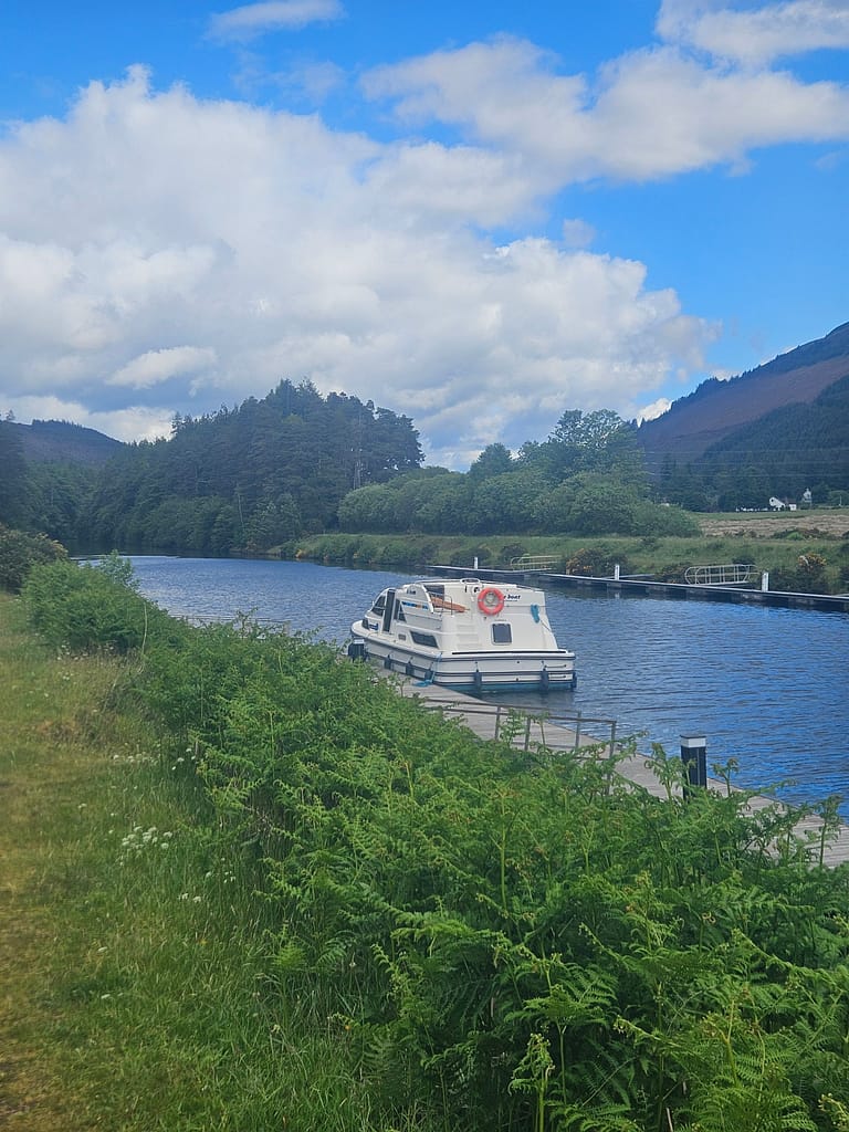
Besides, South Laggan is connected to the canal a floating restaurant/bar There is also a river right at the beginning of Loch Lochy, Well of the Seven Heads There is a place called; which has a small market, snack options and an area where you can drink coffee.
There is also a small shopping shop within the Foyers camping site in Loch Ness.
What to Pack & What to Dress Like?
My biggest concern before going was what to wear. I initially planned to do this trip in a wetsuit, so I bought a canoe-friendly one from Decathlon. However, I learned from blogs that a drysuit would be more appropriate because the water in the lochs is so cold.
A wetsuit works by trapping water between your body and the fabric, warming it up and providing insulation. A drysuit, on the other hand, prevents water from entering, keeping you completely dry even if you fall in. Because the water in Scotland is very cold, a wetsuit isn't ideal for this route. However, I couldn't find an affordable drysuit in Türkiye.
So I thought I'd find a compromise by bringing a wetsuit and wearing my raincoat over it. But when I arrived, the rental company told me I could use their drysuit if I wanted, and that was a real lifesaver. Canoes inevitably take in water in rain or rough weather, and my proposed solution would likely have failed me. Thanks to the drysuit, I didn't take in any water from the outside. I wore merino underwear, trekking pants, and a light fleece jacket underneath, and I didn't use the wetsuit at all.
For footwear, I'd packed both boots and neoprene shoes; I wasn't sure which to use for paddling. I ended up wearing the boots and tucking the drysuit legs into them. That way, even if I got in the water while launching or boarding the sea kayak, I never got wet.
The only thing I had trouble with was that I sweated excessively throughout the day and because the drysuit wasn't breathable, I started to feel cold because of the sweat inside, especially when I stood still and didn't move.
Along the way, depending on the weather, I sometimes used a waterproof hat and sometimes a buff. I also brought neoprene gloves, but I found that they made my hands even colder when wet, so I didn't use them much. I even hung them on a tree while camping and forgot them there.
If I go again, I would definitely choose to take a pair of gloves with cut fingers to reduce friction.
Although it's possible to rent a life jacket, I bought one from Decathlon before I went. I wanted one with a back compartment for a water bladder and zippered compartments. This choice really made things extra comfortable along the way; I had easy access to water and snacks.
Besides clothing, I packed all the camping supplies, including electronics and navigation equipment, and five days' worth of food. My brief list of supplies was as follows:
| Category | Equipment | DESCRIPTION |
| Sea Kayak Equipment | Canoe / Sea Kayak | Own equipment or rented |
| Sea Kayak Equipment | Shovel (spare) | In case of loss |
| Sea Kayak Equipment | Life jacket (PFD) | Compulsory |
| Sea Kayak Equipment | Spraydeck | For Sea Kayaking |
| Sea Kayak Equipment | Sponge | To drain small amounts of water |
| Sea Kayak Equipment | Water pump | To drain large amounts of water |
| Sea Kayak Equipment | Drysuit / Wetsuit | Protection in cold waters |
| Sea Kayak Equipment | Towline/Rope | To tie to the pier |
| Camping & Equipment | Tent | Waterproof and windproof |
| Camping & Equipment | Sleeping bag | Around 0°C is recommended |
| Camping & Equipment | Food | It may be spongy or swollen |
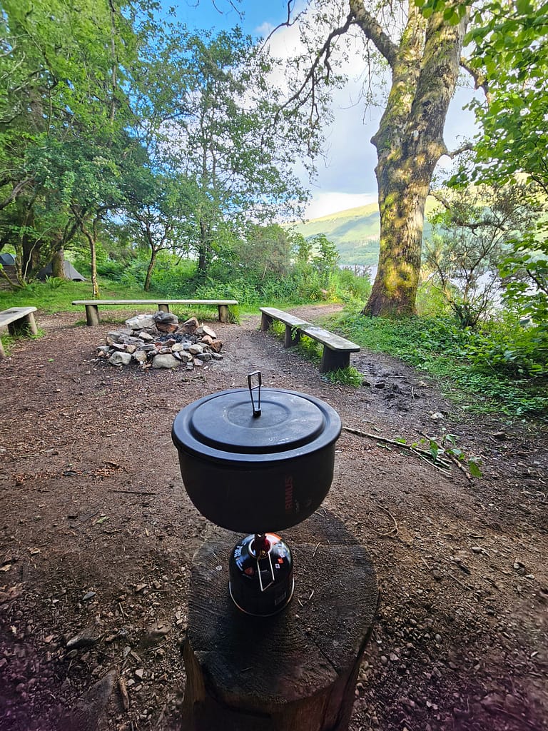
| Camping & Equipment | Camping stove and fuel | It is beneficial to be lightweight |
| Camping & Equipment | Lighter / Match | To light a fire |
| Camping & Equipment | Pots and pans set | It might be best to choose as minimal as possible |
| Camping & Equipment | Cup / fork–spoon | For food and drink |
| Camping & Equipment | Dry Bags | To keep things dry |
| Camping & Equipment | suntan cream | UV protection |
| Camping & Equipment | Garbage bag | To comply with leave no trace rules |
| Camping & Equipment | Phone Water protective case | Ideal to have a strap |
| Clothes | Quick-drying clothes | Merino may be preferred |
| Clothes | Wind and rain jacket | Essential in Scotland; protects against strong winds |
| Clothes | Thermal underwear | For evening and cold weather |
| Clothes | Spare socks | It is necessary because water penetration is guaranteed |
| Clothes | Beret & gloves & buff | Protection against wind chill |
| Clothes | Camping clothes | Dry and clean set for the evening |
| Clothes | Down or softshell jacket | To protect from the cold in the evening |
| Clothes | Boots/Neoprene shoes | For use when sea kayaking |
| Clothes | Neoprene Gloves | For use when sea kayaking |
| Clothes | Sneakers/Sandals | For camping |
| Clothes | Glasses & hats | Against sun and water reflections |
| Food & Water | 4–5 days of food | Freeze-dried and lightweight options |
| Food & Water | Snacks | Bar + nuts; quick energy |
| Food & Water | Water bag/Canteen | 2–3L carrying capacity |
| Food & Water | water treatment | Tablet or filter |
| Navigation & Electronics | Phone + GPS | Garmin vs |
| Navigation & Electronics | Map & compass | It is useful to carry a physical map in case your electronics run out of battery. |
| Navigation & Electronics | Power Bank | 20.000 mAh+ |
| Navigation & Electronics | Camera | Water resistant/impermeable |
| Navigation & Electronics | Headlamp | Overnight camping and security; spare batteries required |
| Emergency | First aid kit | Including personal medications |
| Emergency | multi-tool | For cutting, repair and emergency work |
| Emergency | duct tape | Quick repair for canoes and equipment |
How Should Sea Kayaks Be Positioned?
I've watched many videos online about how to pack equipment on a sea kayak. While there's no single correct method, the basic idea is to concentrate the weight in the middle and lighten toward the ends, thus maintaining balance. Furthermore, different strategic placements are possible depending on the weather, wind, and current.
Before I left, I bought several dry bags of various sizes and took them with me. It was actually possible to rent dry bags, but I didn't want to have to divide and store my belongings at the rental place, so I opted to bring my own. This way, I could organize all my belongings at the hotel and start my route ready. Instead of buying large dry bags, I diversified my options into 5, 10, 20, and 30-liter bags; I ended up with 7-8 in total. This made the setup easier and allowed me to use the space more efficiently.
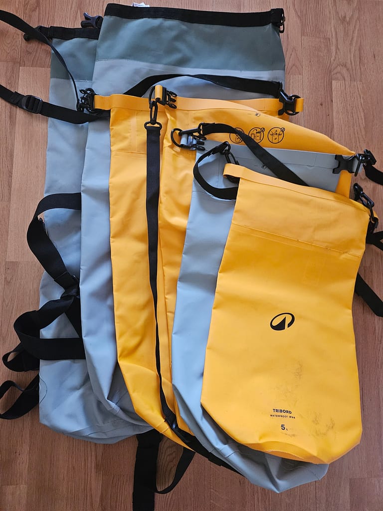
While I had come up with an ideal layout from all the videos I watched, in real life it was a bit of a "what can I fit where?" situation. Because even though I thought I was going light, my materials barely fit. This installation required much more effort than I had anticipated.
I think this was the most tiring part for me every day: In the morning, putting everything in dry bags one by one and carrying it to the sea kayak, then shoving it all together… And in the evening, taking all these bags out one by one and carrying them again.
In the day compartment, I kept snacks, a map, a change of clothes (in case I fell in the water), and extra water. I also placed the extra water I bought at the beginning behind the seat.
Day by Day Route
Getting to the Route
My initial plan was to stay one night in Edinburgh and fly to Fort William, the starting point of the trip, the next day. However, since even hostels were around 10 TL for my travel time, I decided to plan my accommodation differently.
I took a single train from Edinburgh to Glasgow and stayed there for one night. Glasgow offers much more affordable options than Edinburgh. I stayed at the Point A Hotel Glasgow. It was a self-service hotel and generally clean and comfortable. It was Saturday evening when I arrived in Glasgow. After checking into the hotel, I went out for dinner. I actually needed to buy food for the road, but since it was evening, the outdoor shops were closed, so I put it off until the next day. I just stopped by the supermarket to pick up some snacks and fresh food.
I had a train to Fort William at 12:00 the next day, so I had a short time to go to the outdoor store and do some shopping. I went to the store first thing in the morning; even though it was 10:00, it wasn't open yet. After a short wait, it opened, and I was their first customer. I quickly grabbed my essentials, returned to the hotel, and grabbed my suitcase to catch the train.
Before arriving, I'd originally thought a large backpack would be sufficient, but due to the abundance of dry bags and the need to bring a life jacket, I ended up bringing a large duffle with me on a trolley. Running around with a huge suitcase made me incredibly unhappy. At that moment, I realized I missed my trekking trips.
The journey from Glasgow to Fort William was a bit emotional for me, as I was seeing the same sights I'd walked through last year. The train was already packed with walkers, cyclists, and adventurers in general.
Train journeys are such a breather for me amidst all this growing up. I really enjoy admiring the scenery, drinking coffee, and listening to music as I travel. About four hours later, I arrived in Fort William. When I landed, the station was packed with wizards, young and old. 😊 This is also the departure point for the famous Jacobite train—aka the Harry Potter train. We took one during our holiday in Scotland two years ago. Fans usually arrive in costume, wand, hat… in other words, in full regalia.
I booked my hotel right across from the station. It didn't get great reviews, but since I was only staying one night, I didn't care. I stayed at the Alexandra Hotel. It was quite old, but I generally liked the retro vibe. Dinner reservations were required. Since it was quite rainy when I arrived, I didn't go out and ate at the hotel. I went back to my room and started packing dry bags for the next day. As I looked out the window, I saw that the weather was getting quite hot, which naturally made me a bit stressed for the next day.
After finishing the preparations, I fell asleep with a little excitement and a lot of stress.
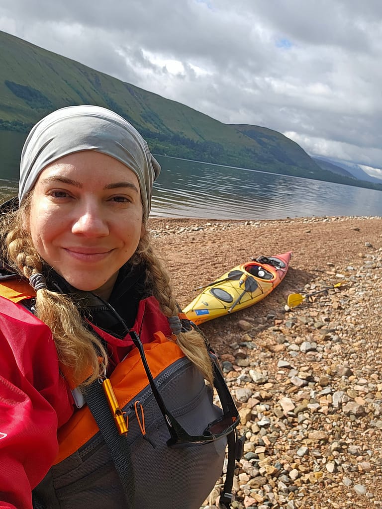
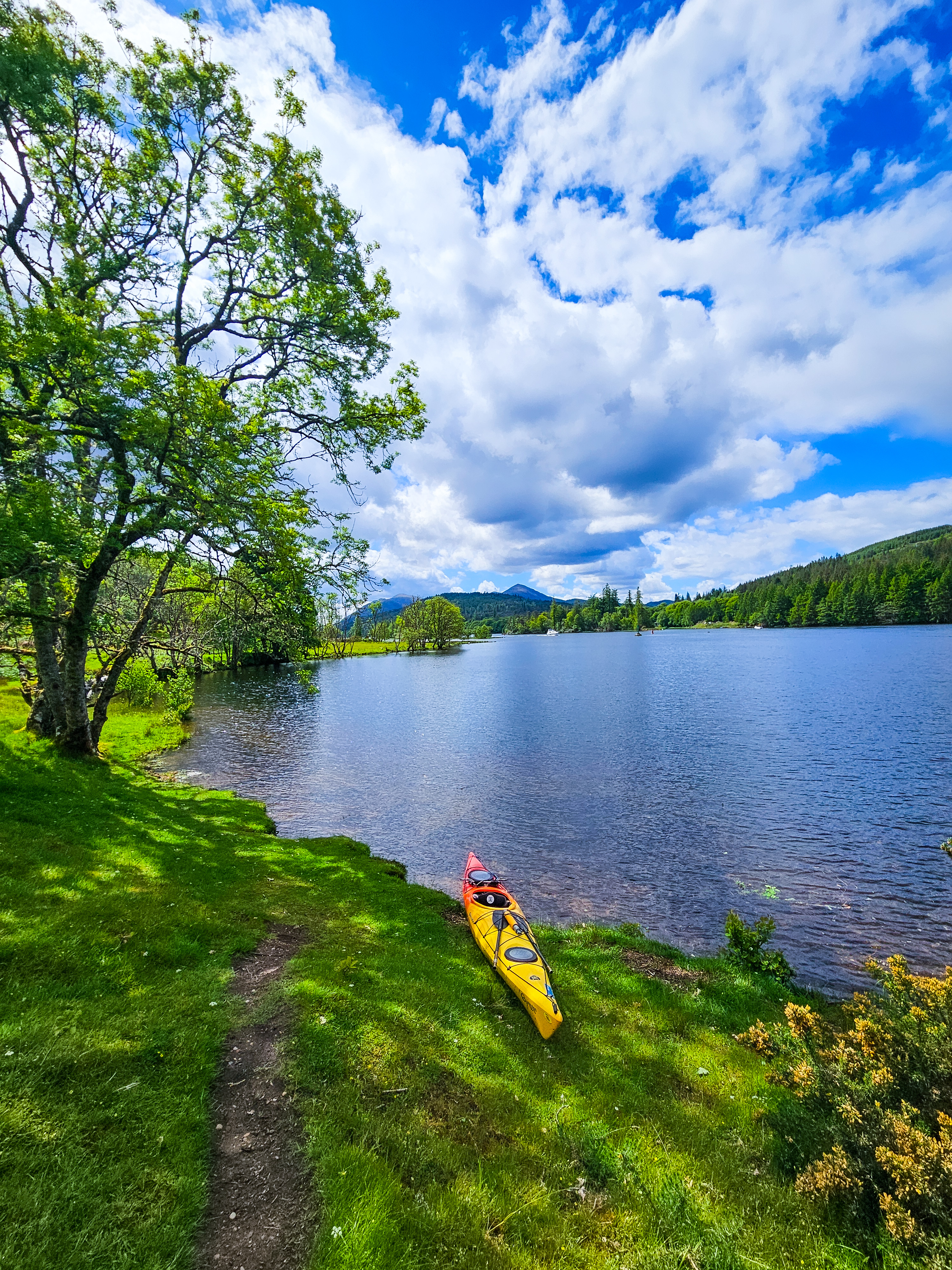
Day 1- (Forth William- Gairlochy)
After breakfast, I asked the hotel to call a taxi. Once inside, I showed them the address, but I didn't have to bother; Fort William is a small town, so taxi drivers are generally familiar with the directions. He dropped me off in front of Rockhopper's warehouse. I arrived about 15 minutes before the agreed-upon time. I'm usually early for these kinds of meetings because I'm afraid of being late. By this time, it had begun to rain lightly. I waited under a tree.
The only thing that crossed my mind was that they might realize I wasn't experienced enough and give up on renting. 😊 I guess I had tried so hard to convince them because I still couldn't believe I was available. Just as I was thinking, "What if they don't rent? I've come all the way here; am I going to have to walk all the way?", one of the employees arrived in his minivan. He greeted me with a friendly smile and invited me in. When I opened the warehouse, I saw that it was quite large; there were over 50 kayaks and canoes.

First, he brought the waiver documents. I signed them. After signing them, I felt a sense of relief, thinking, "Okay, they won't back down now." I shouldn't have been relieved to sign documents waiving responsibility if anything happened to me, but it still gave me peace of mind. While he asked me questions about the materials, I tried to appear confident. Even though I was using most of them for the first time, I think I'd worked everything out on paper; I didn't hesitate at all about what I wanted or didn't want. Moreover, when he saw that I'd arrived with all the dry bags, he said, "You're so prepared!" and was clearly surprised.
Meanwhile, they were chatting and getting their gear out, and I was getting ready. They asked me what other adventures I'd done. I told them about Nepal, climbing, and the West Highland Way. When he saw me plug his Garmin GPS into the PDF, he said, "Oh, okay, you're using this." I think he relaxed a bit and trusted me when he saw all this.
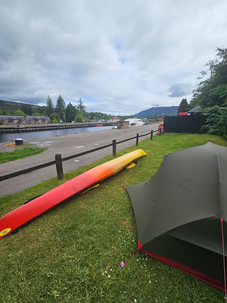
He showed me how to attach the trolley. Trolleys have a mechanism that opens and closes with screws. When not in use, you can close them and put them on the sea kayak. The straps wrap around the sea kayak, then secure them. It seemed pretty easy at the time, but then unfortunately, it became a lot of work. I was wearing my raincoat as planned, but he suggested a dry suit, and I'm so glad he did. The dry suit made me very comfortable. He also gave me waterproof versions of the physical maps and the key to the canal operations. It was the last one they had. He said, "Don't lose it." Once we were all set up, we loaded our belongings into the minibus. I left the duffle and any items I wouldn't use with them; we agreed to bring them when we met.
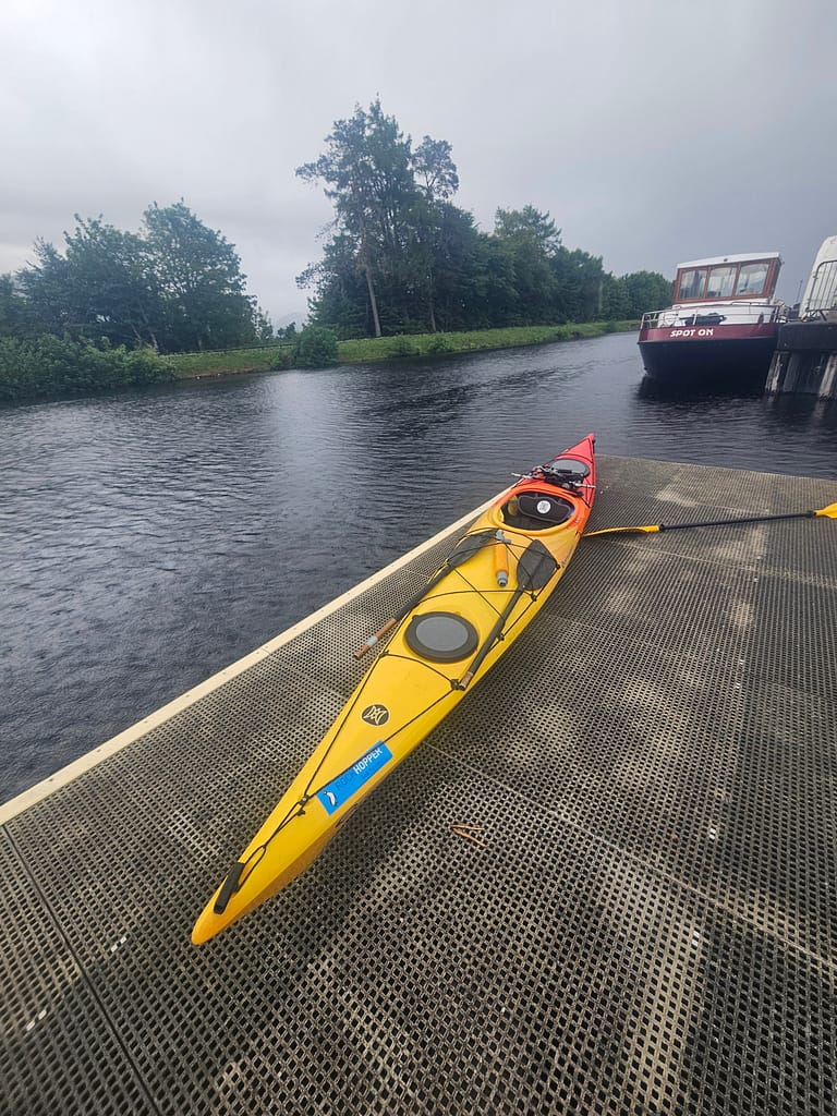
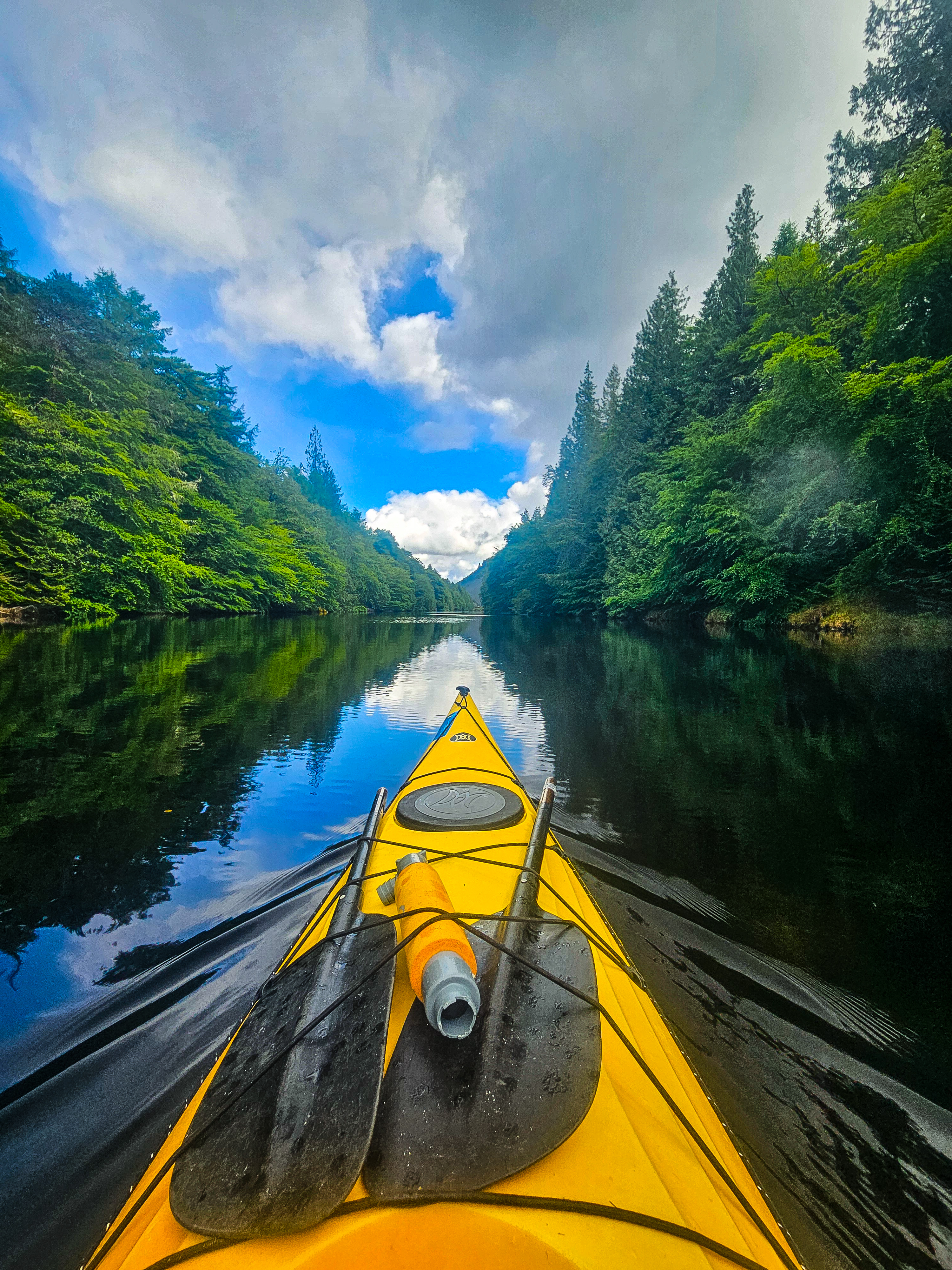
He dropped me off at Banavie, the starting point of the route. The official route actually starts in Corpach, but since it's a very short route with two long portages, most people start in Banavie. Together, we carried the kayak to the dock. Then I carried my dry bags. Once the carrying was done, he left. I started packing. It was a little more difficult than I'd anticipated. Once everything was ready, I took a few photos, but I was quite excited. This would be my first time launching the kayak; I was thinking, "I hope I don't fall off. Please don't embarrass myself, it's still early in the trail." Meanwhile, a few boats were passing through the channel. Luckily, I launched it without any problems and got in. Since it was my first time using a sea kayak skirt, I struggled a bit to put it on, but I finally managed it.
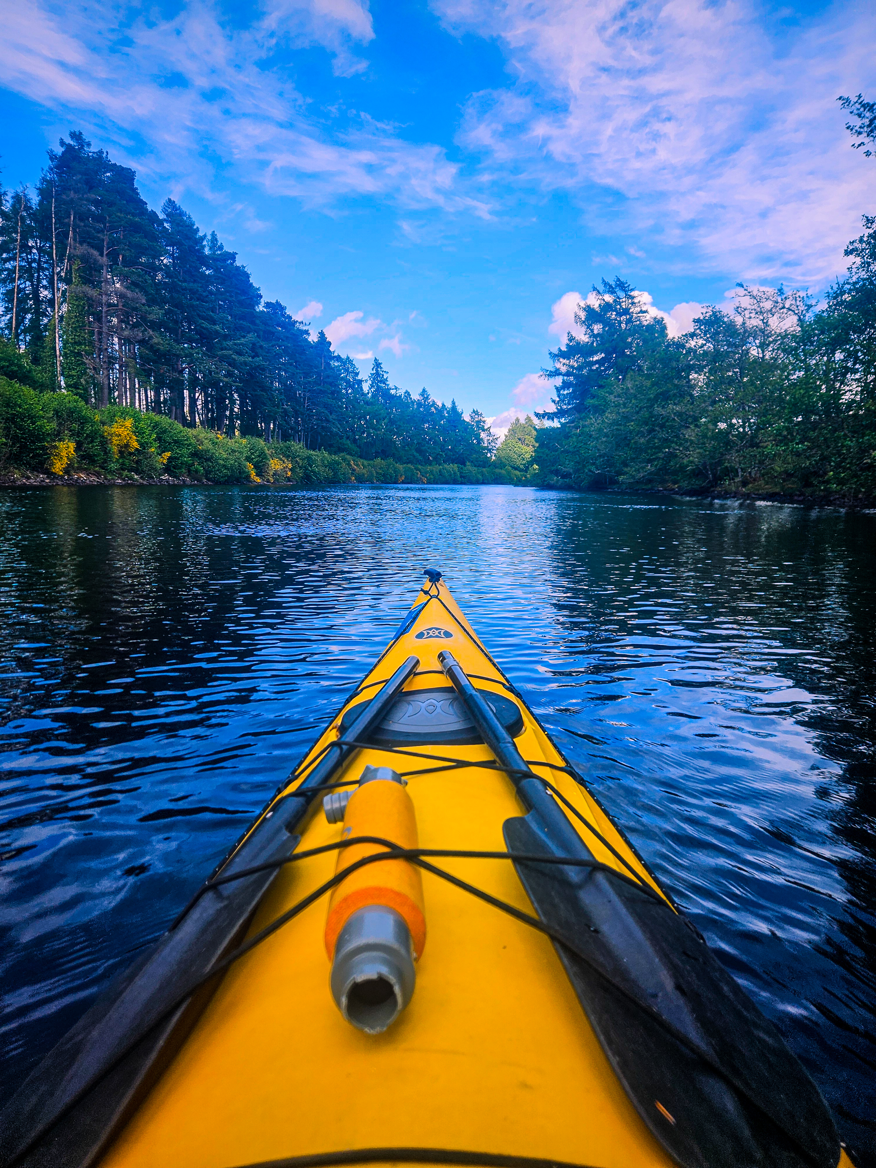
The first day of the route was quite enjoyable. Because you're completely within the channel, there are no waves. There's a gentle current, which, since it runs from south to north, helps you accelerate. It was rainy, but since there was no wind, it didn't bother you too much. People were cycling or walking along the Great Glen footpath, which runs parallel to the road. They waved and said hello from time to time. The surroundings are lush and wooded. You'll occasionally see Highland lambs on Highland farms. It truly feels like a mini-paradise.
The easy route was also good for practicing rowing. I was getting used to sea kayaking. I was tracking the route with my GPS watch. Halfway there, my phone rang. My sister and nephew had video-called me. I hadn't told my sister I was going to Scotland. It was a funny sight; my phone rang while I was rowing in the middle of the channel, and they were surprised when I answered.
Halfway through the route, around the 6th kilometre mark, you'll encounter the aqueduct. A few kilometres beyond that, you'll reach Moy Bridge. Moy Bridge is a retractable bridge, but it's also possible to pass under it when it's closed for kayaks and canoes. When kayaking or canoeing, you should always keep to the right, according to channel regulations. Three kilometres past Moy Bridge, you're nearing the end of the day and approaching the first canal gates. The total distance for today is approximately 10 kilometres, shorter than the previous days.

After hoisting the skis up, it was time to attach the trolley, or wheels. I did as instructed in their warehouse; the wheels fit, and there seemed to be no problem. However, today's portage section was about 600 meters of rocky road.
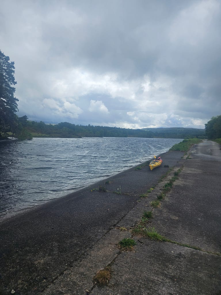
When you arrive in Gairlochy, there's a pier near the canal gates, but because it's a bit high, there's actually a place a little further back where you can exit directly from the shore (marked on the GPS map). However, if you exit from the shore, the portage distance becomes longer. I chose to exit from the shore via the pier. However, I think it wasn't the right choice. Because the pier is elevated, I initially struggled to get out of the sea kayak. Then, pulling the kayak out of the water proved more challenging than I expected. The pier, which weighs nearly 50 kilograms, was lifted up, nearly causing me to fall.
As I started pulling the kayak, the wheels would come off the sea kayak every 15-20 meters due to its weight and the friction from the rocks, and I had to start the entire process over again. Each time, I had to remove the wheel straps, reposition them, then carry the kayak, rewrap the straps, tighten them, and secure them, ready to go. Because the first part of the hike was uphill, both carrying and doing this were quite challenging. By the end of the day, after repeated efforts, I had covered the 600 meters in just 1-1.5 hours and finally managed to get the kayak to the Gairlochy informal campsite.
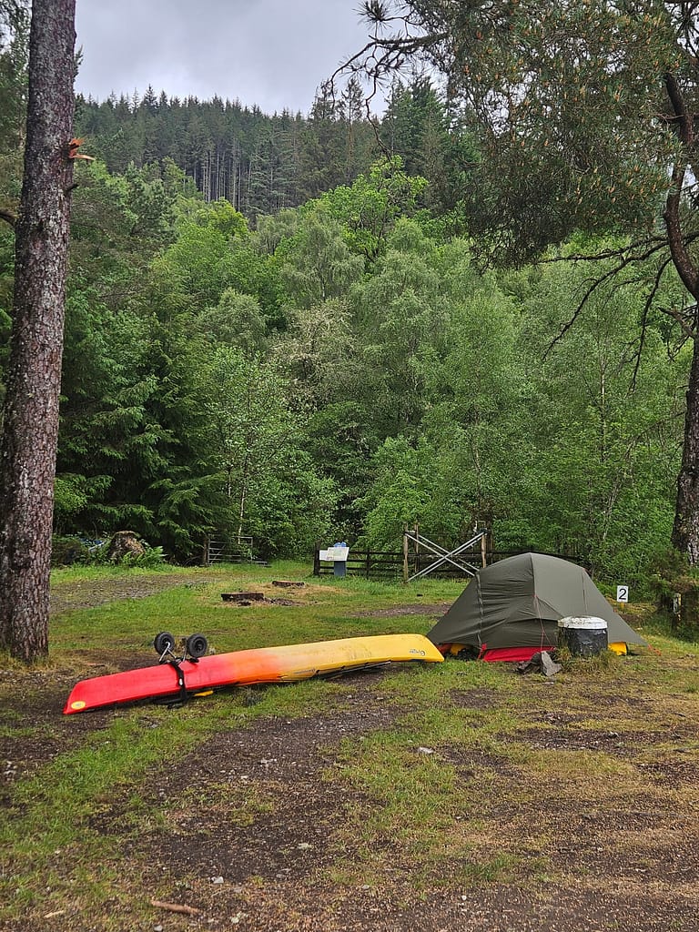
It was quite frustrating that the first part of the day had gone by easier than I expected, and that part of it, which I thought I'd "get it done," had exhausted me so much. Fortunately, it was the end of the day, so I could at least rest. The informal campsite at Gairlochy was a nice spot, right next to the canal gates. There was no one there yet when I arrived. There was a composite toilet nearby, and on the opposite side was a small hut belonging to the canal company, with toilets, showers, and so on. Apart from one or two staff working the canal gates, no one else was there.
I set up the tent, boiled some water, and made some coffee. That's when I realized one of my dry bags was missing. Trying to figure out where I left it, I texted Rockhopper. I'd dropped it in the car. It was the bag containing all my hygiene products, insect repellent, a comb, etc. Luckily, I managed to find a solution for some of the sewer facilities. Not having insect repellent was a challenge. I could have survived without the others. 😊
While I was drinking my coffee, a hiker came and started setting up a tent by the canal. Later, a canoe group came and set up a tent. I was drinking coffee by the canal and admiring the view. Because there was no wind, midges (small flies) started appearing and bothering me. So I went to the tent and rested while watching videos on attaching the trolley, trying to figure out what I was doing wrong.
As it was getting dark, a group of about 10-15 high school-aged boys set up a tent right next to me and stayed up all night drinking and listening to music at full volume. Luckily, I'd brought earplugs, so I was able to sleep, though not very comfortably.
Day 2-(Gairlochy-Glasdhoire)
When I woke up this morning, the high school group was packing up. Their teachers apologized for the noise, but of course, it was too late. By the time I got ready, all the tents were gone. I packed up the tent and put in the dry bags.
I could see the pier from afar, but I still had about 200 meters to walk. I prepared the kayak and attached the wheels; of course, after a short distance, the wheels came off, and then I put them back on, and as I continued on, I noticed a locked, barred gate on the road leading to the pier. I'd taken it to the wrong spot. It was a private pier. You can imagine how angry I was when I realized the right spot was right behind where I'd set up my tent. I'd struggled for half an hour to no avail. There was a direct drop-off point from where I'd set up my tent, but it required a very steep descent. "This can't be it," I thought at first. Then, feeling helpless, I forced my way down the steep slope, using considerable effort, and set off.
After following the canal for a bit in the first section, you emerge into Loch Lochy. Even before leaving the canal, I could already sense the wind was strong today. At the end of the canal, you'll first see a lighthouse on the right. My plan was to stay close to the shore on the left. There's a fish farm on the right; you should be careful when crossing.
As soon as I emerged onto Loch Lochy, I quickly realized the reason for everyone's warnings about lochs. Suddenly, high waves and turbulent waters, along with the wind, greeted me. I felt like I was facing wild waves in the open sea. And that's when I made a poor decision, making matters worse. Normally, Loch Lochy curves inward on the left, making the route longer. I decided to bypass the bend and continue straight ahead, shortening the route. But when I did, I did exactly what I was told not to do: I ended up in the middle of the loch, far offshore.
The waves grew even bigger, rocking me to the point of falling over. At that point, because I hadn't closed the skirt I'd opened at the beginning of the trail to grab my camera, water started to get inside my kayak. At this point, as I was making mistake after mistake, I started to think, "Okay... they were right when they said don't do this alone." 😊
I'd never considered it until then, but facing it made me even more nervous: If the sea kayak, which had begun to fill with water, sank, my money, passport, camera, and all my belongings would also sink to the bottom. This confrontation initially caused panic, but eventually, I pulled myself together. To calm myself down, I began talking to myself, as I always do. Then, I focused entirely on paddling. With difficulty, I managed to free myself and reach the shore.
This time, I realized that the waves crashing against the shore were returning, creating turbulence, and this was throwing me off balance. I didn't know how close to stay in such a situation, what to do—nothing. I didn't know whether to laugh or cry at this. I found a balance somewhere in the middle and continued paddling through the increasing rain. It was as if I were learning to paddle from scratch. Meanwhile, fighting the waves had sapped most of my strength.
As I continued a little further, one of the signs I'd placed on my GPS appeared. This was Clunes. This is the last point on the road for a while. So, if you ever feel like giving up and want to have your rental car picked up, this is the spot. Even though things seemed bad for me, I guess I'm not one to give up, so I didn't stop and continued.
After a while, I regained some composure and first pumped out the water that had filled the boat with the sump pump, then tucked the skirt in properly; at least I'd prevent more water from entering. It was a good thing I did, because the rain intensified. Just then, I spotted a canoe team heading ahead. They'd stopped somewhere. I waved to them—calmly, as if I hadn't spent the last hour in a panic. By this time, I was about halfway through my planned route for today.
My original plan was to take a lunch break at Glas-dhoire and continue on. Glas-dhoire is a trailblazer, an informal campsite for kayakers and canoers. It's accessible only from the loch or on foot. As I approached, the rain and wind were at their peak. As soon as I approached the shore, the waves crashed against me, forcing my kayak to land. Even getting out of the kayak was difficult in those waves. When I went to the campsite and looked around, it felt like an oasis in the midst of the storm. It was sheltered by trees and hills, making it quite peaceful. A group of kayakers who had arrived the night before were sitting in a semi-open hut. They hadn't left because of the bad weather; they were planning to move on when the weather calmed down around 5 p.m. By this time, it was nearly 1 p.m.
I kept thinking about waiting for the weather to calm down a bit. Despite waiting an hour or an hour and a half, the weather didn't change. Besides, having been in my sweatsuit all day without any fresh air, I was starting to feel incredibly cold. I was shivering intermittently. When the weather didn't improve, I decided to set up the tent and change clothes. On the other hand, Glasgow was so beautiful that I wanted to spend a night there. But abandoning the trip midway would, of course, have consequences for my plan.
I felt relieved after setting up the tent and changing into dry clothes. Meanwhile, the team actually left around 5:00. I was left alone in the area. I cooked and ate. Two more canoes arrived as it was getting darker. They had set out from Banavie today. I think combining the short first day with today's half-day leg and staying here would have been a better plan.
After dinner, I searched for and watched videos on proper rowing techniques and what to do on waves. I guess this is what learning something on the road truly means.
Day 3-(Glasdhoire-Leiterfearn)
I'd checked the weather forecast on my GPS the night before. It showed quite windy and rainy. It was raining when I woke up in the morning. But when I got out of my tent and looked out onto the loch, I saw that the water was crystal clear and there were barely any waves. Given the volatility of Scottish weather, even GPS forecasts are inaccurate. Seeing no wind, I quickly started packing. The kayakers had left.
Of course, with no wind, the midges started attacking. Unfortunately, I forgot my midge spray in my bag, but luckily I had my head shield with me. I put it on and gathered my belongings. However, the packing and packing part was still quite tiring.
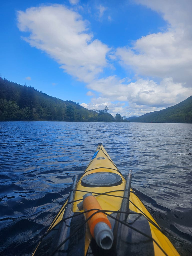
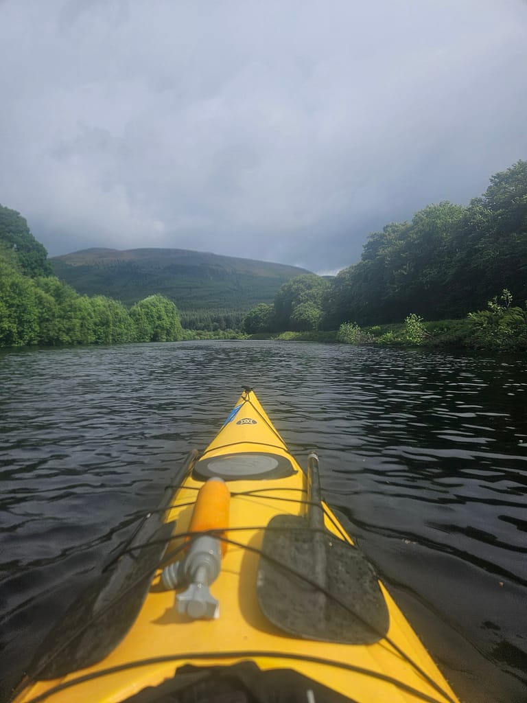
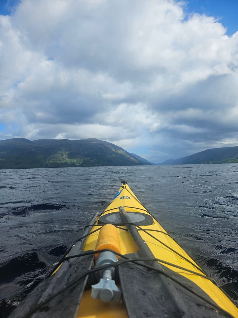
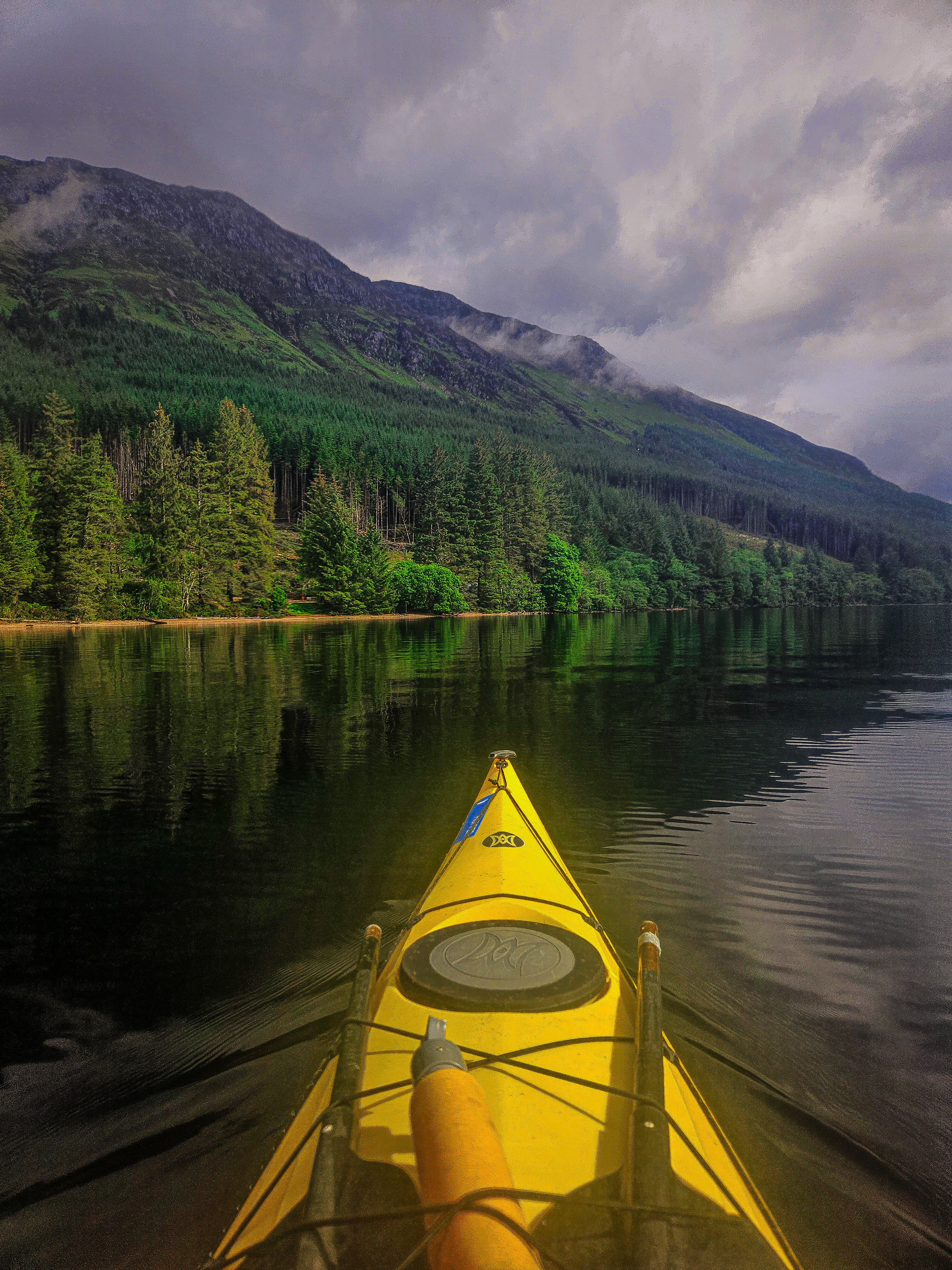
But once I got out on the water, I could say I had realized the dream I'd had before arriving. Without the waves to contend with, I was able to appreciate the beauty of the Highland landscapes and lush forests around me. I took plenty of photos.
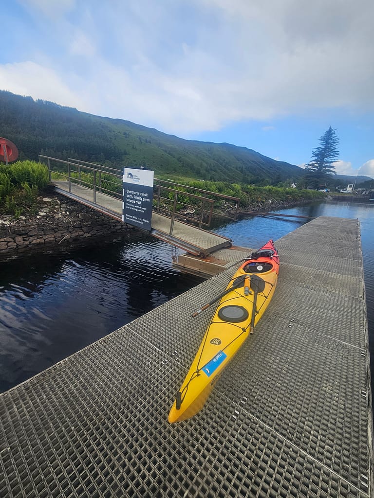
Towards the end of Loch Lochy, you enter the channel, which curves to the right. You're approaching South Laggan, the first portage of the day. The pier here was much higher than I'd expected, almost 50 cm above the water. Since I'd had a hard time climbing up the pier the first day, I created a system with the ropes I'd brought and tied myself to the pier first. This way, the kayak wouldn't drift away while I was trying to climb up. Once on the pier, I pulled the kayak out of the water a short distance away, using the ropes. This eliminated the possibility of falling into the water.
Actually, if you proceed to the left of the pier and pass the moored yachts, there is an area where you can get off the shore, but I only realised this much later.
For the portage section, I started trying other binding techniques I'd seen in videos. It was still a long stretch. While it was much better than the first day, the wheels were still coming off occasionally. Towards the end of this trip, I developed a method of securing the skis by wrapping them around the carrying straps, and it worked. I was able to keep them on for a long time.
South Laggan hosts The Eagle Barge, a floating restaurant and bar. I had planned to visit, but since it was still early in the day, I wasn't hungry, so I passed. After passing the South Laggan canal gates, you enter a beautiful canal section. It's quite pleasant, lush, and easy. As the canal ends and Loch Oich begins, the Well of Seven Heavens is on the left. You can stop here, cross the road, and grab a coffee. There's also a small shop where you can shop.
Loch Oich is a smaller loch than Loch Lochy. Today was the best day of the previous two days. While it rained occasionally, the wind was less and the water was less choppy. I hadn't covered as much ground as I had the day before, so I was behind schedule. At one point, I needed to hurry, but the beauty of the weather and the stunning scenery around me made it impossible to rush. I kept stopping to take photos.
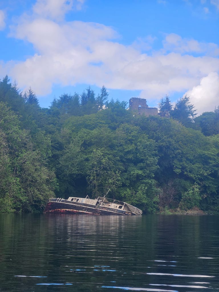
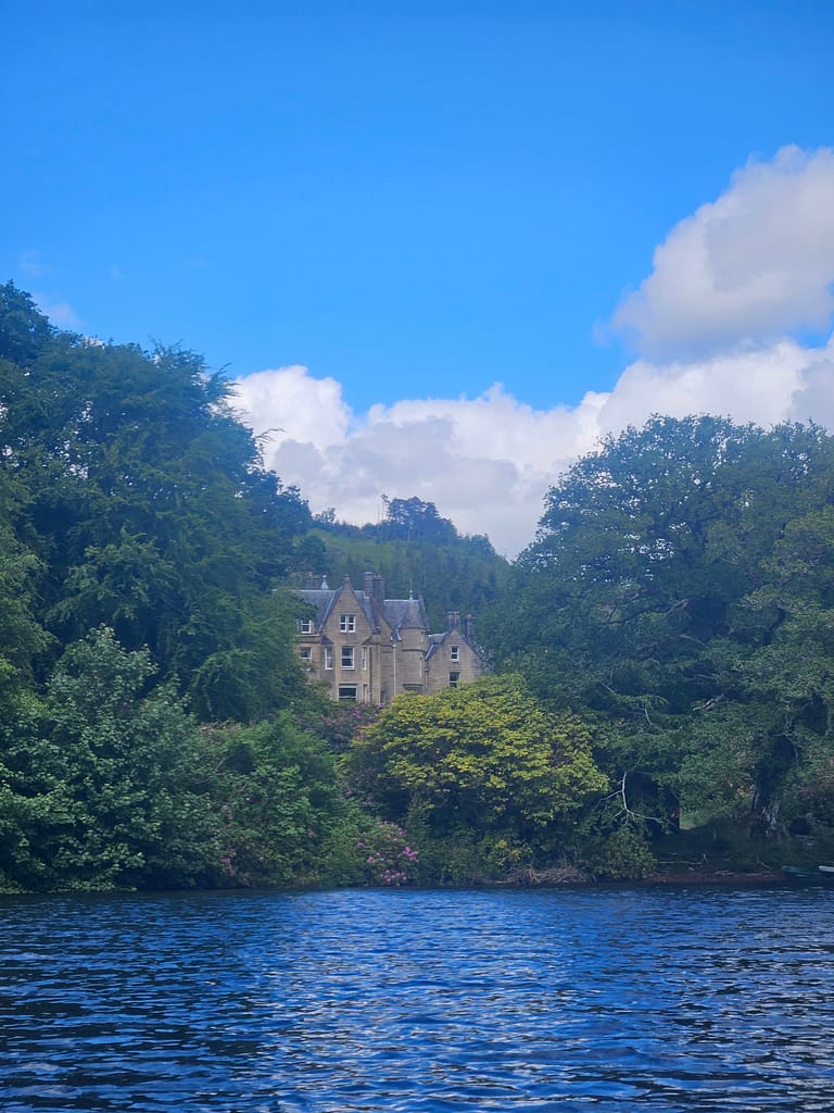
As you continue along Loch Oich, you'll come across a boat wreck and Invergarry Castle on your left, followed by an old manor house. This is the Glengarry Castle Hotel. As you continue, the water in Loch Oich becomes shallower in places. There are signs specifically for yachts, but it's fine for sea kayaks. As I passed one of these signs, I encountered the largest tour boat I'd seen along the way, and I quickly maneuvered into the shallows and pulled myself to safety.
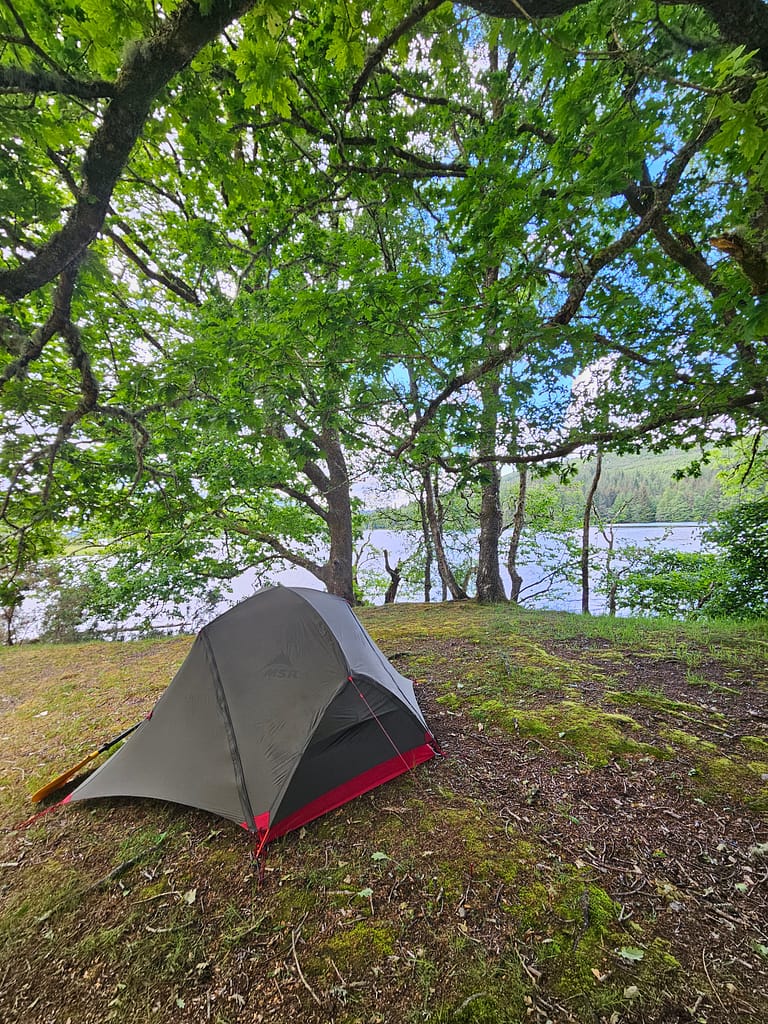
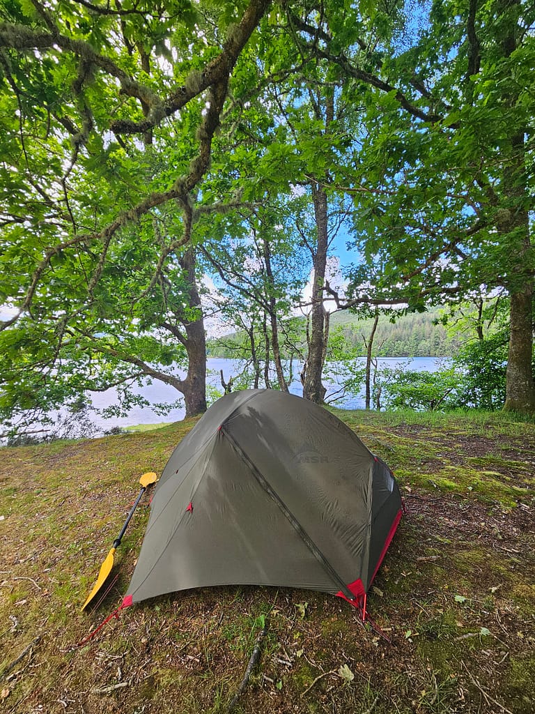
After leaving the cruise boat, I arrived at the informal campsite of Leiterfearn, which I'd originally planned to reach at the end of the previous day. It was around 3:00 PM. I could have gone further to make up for the lost distance, but when I saw it, I decided to spend the night there. It was a beautiful spot, nestled under lush green trees, right next to Loch Oich.
Of course, there was a part of me that ate away at this point: staying here meant not completing the journey. But I think, at the end of the day, I needed to remind myself why I embarked on these journeys. I never do it to complete a journey, reach a finish line, or win a title or medal. I go those distances to be there, to gaze up at the sky in those landscapes, to experience them. I had proven what I wanted to prove to myself, and the rest was just about enjoying the journey. Looking back now, I know I made the right decision.
The only way to get here by land is by foot. There was no one there when I arrived. After setting up my tent and resting, I set off to enjoy the views of Loch Oich. I prepared and ate my lunch outside. Meanwhile, a lone female hiker in her 70s arrived to camp. We chatted a bit. She had bought new shoes, but her feet were hurting. She explained that if she couldn't find a solution, she'd have to abandon the trail and return. She said she was considering cutting off her shoes (the part that hurts at the back). I suggested it might work. She cut off the upper ankle, and the problem was solved. I was very pleased.
During our conversation, when he saw me arriving on a kayak, he said, "You must have very strong arms." I think whenever people hear that I've done such trips and say I'm strong, I can't quite believe it. Because for me, what keeps me going is something far more than the strength of my arms or legs. Of course, I exercise, and that gets me to a certain level, but I haven't been as strong as people have long implied. I think it's more of a kind of strength that comes with a strong determination and a genuine desire to do something.
After dinner, I listened to music by the lake until dark. Then I read a little in the tent. I'd given up on how-to videos for today. I fell asleep relatively early.
Day 4-(Leiterfearn – Forth Augustus)
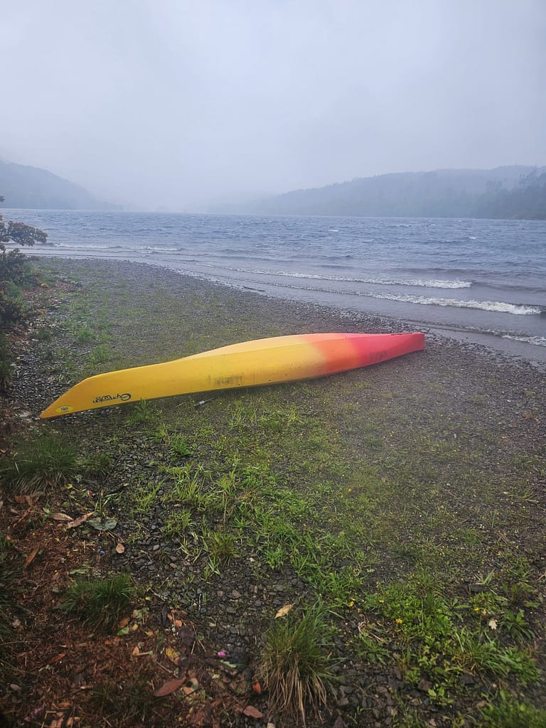
I think I woke up to the worst weather today. I got up early, but the rain was pouring down with incredible force, so I had to wait in my tent for a long time. It poured down continuously until almost 10:00. At some point, the rain eased a bit, and I quickly got down to work packing up the tent and stowing the skis.
When I landed, the water was quite choppy due to the waves. As I neared the end of Loch Oich, the turbulence caused by the rivers connecting in several places unbalanced my sea kayak, and I was almost capsized when I pulled myself together at the last minute. Meanwhile, the rain intensified, making things even more difficult. As I approached the junction with the channel at the end of Loch Oich, I was left too far to the right. The recent wind made it nearly impossible to turn left. I was swept along the curving bank and stopped. When I turned to turn left, the waves came perpendicular to the sea kayak, and I lost my balance, and it stopped.
At this point, I decided to stop and wait for the weather to improve. I waited for about an hour and a half, but when nothing improved, I decided, "I might as well capsize now; I'm close to shore anyway," and I made my way out. With a lot of paddling, I managed to get into the channel without capsizing. When you enter the channel, you have to stay to the right; otherwise, you might accidentally enter the river flowing to the left. It ties into the same spot, but the current is strong, making it less suitable for sea kayaks.
Cullochy portage is a short distance away. Then, you enter a section of the channel that continues back to the shore, offering easy and beautiful views. Kytra portage has a pull-in area directly from the shore. As I arrived here, removed the kayak, and was about to attach the trolley, I realized I'd lost one of the screws securing the trolley wheels. Without the screw, the wheel would immediately fall off.
While trying several methods, the trolley came loose and the kayak landed on my hand; my watch "detected an accident" and started a countdown to call for emergency help. Luckily, I turned it off at the last minute. Although it hurt and bled a little, my hand wasn't in too bad a condition. After much effort, I managed to tie the wheel to the wheel with a rope using my injured hand and keep it from coming off. I lost count of how many solutions I came up with along the way.
After the Kytra canal gates, you continue along the canal to Fort Augustus, following an easy but enjoyable route. It was around 4:00 when I arrived in Fort Augustus, which is a late hour to start the Loch Ness leg. There aren't many options for dividing the distance in Loch Ness. There's only one suitable camping spot in the middle. There aren't many places to get off the shore, and there's no road access either. So, once you start, you have to finish the journey. So, considering all this, I decided to stay in Fort Augustus. The wind had changed the next day, and if I had continued, it would have been impossible.
Fort Augustus is located exactly halfway along the route. There are plenty of restaurants, shops, and pharmacies. It's an ideal place to catch up on supplies. I set up camp in the small green area just to the right of the first canal gate in Fort Augustus. The canal works restroom and shower were located nearby.
I called Rockhopper and asked them to pick me up the next day. I was too lazy to cook dinner and decided to eat out, but I had to turn back at about three restaurants in this small town because I didn't have a reservation and they were out of seats. It's a popular stop on Highland tours, so we stopped here on our tour two years ago.
After dinner, I had a drink outside and wandered around. I even looked at Loch Ness from afar and thought, "It didn't happen this time, but I'll definitely come back." 😊
Way back
The next day, around noon, a member of the Rockhopper team picked me up and dropped me off in Inverness. Inverness is a small city; a half-day tour was sufficient. As usual, I browsed a few secondhand bookstores and explored some Gothic cemeteries (two of my favorite things to do in Scotland). The next day, I took the train to Edinburgh and returned to Istanbul on a direct flight.
Finally;
If I had the chance to plan again today, I think I would put a few buffers in case the weather was bad, take more minimal supplies, and manage the planning differently, based on my own limits rather than the guidebook sections.
Although I didn't complete the route, I'm thrilled to have completed my long-dreamed-of long-distance solo sea kayaking camp on the Great Glen Canoe Trail. However, this journey, from beginning to end, was a test of determination, fraught with uncertainty and challenging. Along the way, I had to repeatedly develop solutions, adapt to unexpected situations, and manage my own limitations. In this process, I've learned that I can remain calm, make sound decisions, and develop practical solutions in the face of challenging situations in nature.
I hope to return to Scotland for more sea kayaking/canoeing adventures. Who knows, maybe even to complete the unfinished story with Loch Ness…
Publication
Updated
Estimated reading time: 188 minute
FAQ
Answer: The Great Glen Canoe Trail is a 62-mile (100 km) canoe/sea kayak + camping route from Fort William to Inverness, Scotland, via the Caledonian Canal and several lochs. The route includes both canal and loch crossings.
The route can generally be completed in 4–5 days. However, this time may be longer depending on variables such as wind, weather, and camping conditions.
I've done solo sailing, but frankly, most companies aren't very keen on solo charters. There are risks in the waterways, and the wind can change quickly. However, with the right preparation and understanding your own limitations, it's possible.
Both can be used — a canoe is more stable and can carry more gear, but is slower; a sea kayak has a better advantage against the wind and can be more practical for soloing.
Especially during channel crossings, there may be a need to carry the canoe/kayak overland, a process called a "portage"—this can be challenging with heavy equipment. Loch crossings should take into account factors such as wind, waves, and water temperature; there is a risk of capsizing and hypothermia.
While the water temperature and weather may seem more suitable during the summer months, there are some drawbacks (such as the problem of midges). Spring, such as May, is generally preferable because it has less rain and occurs before the fly season begins—but the water and weather can still be risky.
Wild camping is possible on some days; some accommodation options include camping sites, B&Bs or hostels.
Yes. Everyone I encountered along the way was incredibly helpful and supportive. I didn't experience any discomfort. The ethos of the route is one of calm and flow.
I would definitely go more minimal. I would also add a few buffer days in case of bad weather. I would plan according to my own limits, not the guidebook's plan.
Write a Reply